Masontown, Pennsylvania
Masontown, Pennsylvania | |
|---|---|
| Etymology: John and Abigail Mason | |
 Location of Masontown in Fayette County, Pennsylvania. | |
 Masontown Location in Pennsylvania | |
| Coordinates: 39°50′46″N 79°54′13″W / 39.84611°N 79.90361°WCoordinates: 39°50′46″N 79°54′13″W / 39.84611°N 79.90361°W | |
| Country | United States |
| State | Pennsylvania |
| County | Fayette |
| Established | 1798 |
| Government | |
| • Mayor | Toni Scarton Petrus |
| Area | |
| • Total | 1.53 sq mi (3.95 km2) |
| • Land | 1.50 sq mi (3.87 km2) |
| • Water | 0.03 sq mi (0.08 km2) |
| Elevation | 1,020 ft (310 m) |
| Population (2010) | |
| • Total | 3,450 |
| • Estimate (2019)[2] | 3,277 |
| • Density | 2,191.97/sq mi (846.31/km2) |
| Time zone | UTC-4 (EST) |
| • Summer (DST) | UTC-5 (EDT) |
| ZIP code | 15461 |
| Area code(s) | 724 |
| Website | masontownpa |


Masontown is a borough in Fayette County, Pennsylvania, United States. It is part of the Pittsburgh Metro Area. The population of the borough was 3,450 at the 2010 census.[3] It is served by the Albert Gallatin Area School District. Masontown is a small crossroads for the rural portions of western Fayette County, and it contains a small shopping center and a grocery store within its business district.
History[]
Fort Mason was built as a blockhouse from 1774 to 1778 by John Mason, also known as Johannes Phillip Maurer (1730-1812). Masontown became a town in 1798. He later moved to Ohio and is buried on a family farm in Columbiana County.
Geography[]
Masontown is located in southwestern Fayette County at 39°50′46″N 79°54′13″W / 39.84611°N 79.90361°W (39.846228, -79.903492).[4] The borough's western border is the Monongahela River, which forms the Green County line, but the main settled part of the borough is 1 mile (1.6 km) east of and 200 feet (60 m) higher than the river.
Pennsylvania Route 21 passes through the northern and western part of the borough, leading east 12 miles (19 km) to Uniontown, the Fayette county seat, and west across the Monongahela 16 miles (26 km) to Waynesburg. Pennsylvania Route 166 passes through the center of Masontown as Main Street and leads south 10 miles (16 km) to Point Marion at the confluence of the Monongahela and Cheat rivers.
According to the United States Census Bureau, Masontown has a total area of 1.54 square miles (4.00 km2), of which 1.51 square miles (3.91 km2) is land and 0.03 square miles (0.08 km2), or 2.10%, is water.[3]
Demographics[]
| Historical population | |||
|---|---|---|---|
| Census | Pop. | %± | |
| 1880 | 376 | — | |
| 1890 | 391 | 4.0% | |
| 1900 | 466 | 19.2% | |
| 1910 | 890 | 91.0% | |
| 1920 | 1,525 | 71.3% | |
| 1930 | 3,873 | 154.0% | |
| 1940 | 3,721 | −3.9% | |
| 1950 | 4,550 | 22.3% | |
| 1960 | 4,730 | 4.0% | |
| 1970 | 4,226 | −10.7% | |
| 1980 | 4,909 | 16.2% | |
| 1990 | 3,759 | −23.4% | |
| 2000 | 3,611 | −3.9% | |
| 2010 | 3,450 | −4.5% | |
| 2019 (est.) | 3,277 | [2] | −5.0% |
| Sources:[5][6][7] | |||
As of the census[6] of 2000, there were 3,611 people, 1,536 households, and 984 families residing in the borough. The population density was 2,376.6 people per square mile (917.2/km2). There were 1,701 housing units at an average density of 1,119.5 per square mile (432.1/km2). The racial makeup of the borough was 93.27% White, 5.59% African American, 0.22% Native American, 0.03% Asian, 0.30% from other races, and 0.58% from two or more races. Hispanic or Latino of any race were 0.22% of the population.
There were 1,536 households, out of which 27.6% had children under the age of 18 living with them, 44.5% were married couples living together, 15.8% had a female householder with no husband present, and 35.9% were non-families. 33.1% of all households were made up of individuals, and 20.4% had someone living alone who was 65 years of age or older. The average household size was 2.32 and the average family size was 2.90.
In the borough the population was spread out, with 23.0% under the age of 18, 7.8% from 18 to 24, 23.2% from 25 to 44, 23.1% from 45 to 64, and 22.9% who were 65 years of age or older. The median age was 42 years. For every 100 females, there were 83.1 males. For every 100 females age 18 and over, there were 77.2 males.
The median income for a household in the borough was $24,049, and the median income for a family was $27,609. Males had a median income of $35,948 versus $18,194 for females. The per capita income for the borough was $13,875. About 19.7% of families and 25.2% of the population were below the poverty line, including 37.2% of those under age 18 and 16.6% of those age 65 or over.
Notable people[]
- Frank L. Bowman, congressman from West Virginia
- Mike Nixon, longtime Pittsburgh Steelers coach and scout
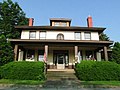
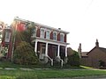
Gallery[]

References[]
- ^ "2019 U.S. Gazetteer Files". United States Census Bureau. Retrieved July 28, 2020.
- ^ Jump up to: a b "Population and Housing Unit Estimates". United States Census Bureau. May 24, 2020. Retrieved May 27, 2020.
- ^ Jump up to: a b "Geographic Identifiers: 2010 Census Summary File 1 (G001), Masontown borough, Pennsylvania". American FactFinder. U.S. Census Bureau. Archived from the original on February 13, 2020. Retrieved July 7, 2016.
- ^ "US Gazetteer files: 2010, 2000, and 1990". United States Census Bureau. 2011-02-12. Retrieved 2011-04-23.
- ^ "Census of Population and Housing". U.S. Census Bureau. Retrieved 11 December 2013.
- ^ Jump up to: a b "U.S. Census website". United States Census Bureau. Retrieved 2008-01-31.
- ^ "Incorporated Places and Minor Civil Divisions Datasets: Subcounty Resident Population Estimates: April 1, 2010 to July 1, 2012". Population Estimates. U.S. Census Bureau. Archived from the original on 11 June 2013. Retrieved 11 December 2013.
| Wikimedia Commons has media related to Masontown, Pennsylvania. |
External links[]

| show Municipalities and communities of Fayette County, Pennsylvania, United States |
|---|

| show Authority control |
|---|
- Populated places established in 1798
- Pittsburgh metropolitan area
- Boroughs in Fayette County, Pennsylvania
- 1798 establishments in Pennsylvania