Massiges
Massiges | |
|---|---|
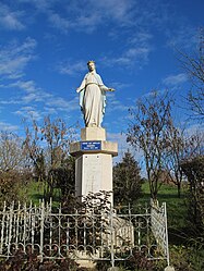 A statue of the Virgin in Massiges | |
show Location of Massiges | |
 Massiges | |
| Coordinates: 49°11′16″N 4°45′03″E / 49.1878°N 4.7508°ECoordinates: 49°11′16″N 4°45′03″E / 49.1878°N 4.7508°E | |
| Country | France |
| Region | Grand Est |
| Department | Marne |
| Arrondissement | Châlons-en-Champagne |
| Canton | Argonne Suippe et Vesle |
| Intercommunality | Argonne Champenoise |
| Government | |
| • Mayor (2020–2026) | Pierre Labat[1] |
| Area 1 | 8.19 km2 (3.16 sq mi) |
| Population (Jan. 2018)[2] | 50 |
| • Density | 6.1/km2 (16/sq mi) |
| Time zone | UTC+01:00 (CET) |
| • Summer (DST) | UTC+02:00 (CEST) |
| INSEE/Postal code | 51355 /51800 |
| Elevation | 124–198 m (407–650 ft) (avg. 133 m or 436 ft) |
| 1 French Land Register data, which excludes lakes, ponds, glaciers > 1 km2 (0.386 sq mi or 247 acres) and river estuaries. | |


Massiges (French pronunciation: [masiʒ]) is a commune in the Marne department in north-eastern France.
The neighbouring Main de Massiges, an elevated geographical feature shaped like a left hand, was the site of considerable fighting during the First World War.[3]
See also[]
References[]
- ^ Maires au 17-06-2020, data.gouv.fr, accessed 1 December 2020
- ^ "Populations légales 2018". INSEE. 28 December 2020.
- ^ http://www.lamaindemassiges.com
| Wikimedia Commons has media related to Massiges. |
This Marne geographical article is a stub. You can help Wikipedia by . |
Categories:
- Communes of Marne (department)
- Marne (department) geography stubs