Medical Lake, Washington
Medical Lake | |
|---|---|
City | |
 Location of Medical Lake, Washington | |
| Coordinates: 47°34′17″N 117°41′00″W / 47.57139°N 117.68333°W | |
| Country | United States |
| State | Washington |
| County | Spokane |
| Government | |
| • Type | Mayor–council |
| • Mayor | Shirley Maike[1] |
| Area | |
| • Total | 3.58 sq mi (9.28 km2) |
| • Land | 3.37 sq mi (8.73 km2) |
| • Water | 0.21 sq mi (0.55 km2) |
| Elevation | 2,425 ft (739 m) |
| Population | |
| • Total | 5,060 |
| • Estimate (2019)[3] | 4,966 |
| • Density | 1,473.15/sq mi (568.84/km2) |
| Time zone | UTC-8 (Pacific (PST)) |
| • Summer (DST) | UTC-7 (PDT) |
| ZIP code | 99022 |
| Area code | 509 |
| FIPS code | 53-44690 |
| GNIS feature ID | 1512452[5] |
| Website | medical-lake.org |


Medical Lake is a city in Spokane County, eastern Washington, United States. At the 2010 census, the population was 5,060. The city is the site of a psychiatric hospital, Eastern State Hospital, and of Fairchild Air Force Base, two major employers.
History[]
The city of Medical Lake was incorporated in 1890.[6] The city took its name from the nearby eponymous lake.
The Spokane people, a Native American tribe which had long inhabited the area, believed the water and mud of the lake to possess curative properties.
White settlers such as Andrew Lefevre and Stanley Hallett, who moved to the area in the 1870s, promoted this belief and marketed the lake salts for medicinal uses. A salt and soap industry developed here, followed by the construction of commercial bath houses in the 1880s. This was a period when springs and spas were popular developments across the country.
Several resort hotels were constructed along the lake shore. In 1891, the state constructed Eastern State Hospital, and this further stimulated economic growth in the city. Such growth continued until the 1920s, when the lake declined in popularity as a tourist destination.
A period of stagnation was interrupted in the 1940s with the construction of nearby Fairchild Air Force Base to support the US effort in World War II. This brought a surge of population to the city. Medical Lake's economy continues to depend upon the institutional presence of Eastern State Hospital and Fairchild AFB. Many residents of the city commute to work in nearby Spokane, which has a more varied economy.[7]
Geography[]
Medical Lake is located at 47°34′17″N 117°41′00″W / 47.571384°N 117.683333°WCoordinates: 47°34′17″N 117°41′00″W / 47.571384°N 117.683333°W (47.571384, -117.683333).[8]
According to the United States Census Bureau, the city has a total area of 3.64 square miles (9.43 km2), of which, 3.40 square miles (8.81 km2) is land and 0.24 square miles (0.62 km2) is water.[9]
The city lies to the east of the lake of the same name. There are many other lakes within a few miles of the city, including West Medical Lake, Silver Lake, Clear Lake, and numerous smaller lakes and ponds south of the city. Driving distance from downtown Spokane is 16 miles via Interstate 90 and Washington State Route 902, the latter of which runs through the city. Eastern State Hospital is situated across the lake to the west. Fairchild Air Force Base is located immediately north of the city.[10]
Geologically, the city lies on basalt flows that were heavily eroded by catastrophic flooding at the end of the last Ice Age, making the city and its environs a part of the Channeled Scablands terrain.[11]
Demographics[]
| Historical population | |||
|---|---|---|---|
| Census | Pop. | %± | |
| 1890 | 617 | — | |
| 1900 | 516 | −16.4% | |
| 1910 | 1,730 | 235.3% | |
| 1920 | 1,254 | −27.5% | |
| 1930 | 1,671 | 33.3% | |
| 1940 | 2,114 | 26.5% | |
| 1950 | 4,488 | 112.3% | |
| 1960 | 4,765 | 6.2% | |
| 1970 | 3,529 | −25.9% | |
| 1980 | 3,600 | 2.0% | |
| 1990 | 3,664 | 1.8% | |
| 2000 | 3,758 | 2.6% | |
| 2010 | 5,060 | 34.6% | |
| 2019 (est.) | 4,966 | [3] | −1.9% |
| U.S. Decennial Census[12] 2015 Estimate[13] | |||
2010 census[]
As of the census[4] of 2010, there were 5,060 people, 1,707 households, and 1,169 families living in the city. The population density was 1,488.2 inhabitants per square mile (574.6/km2). There were 1,835 housing units at an average density of 539.7 per square mile (208.4/km2). The racial makeup of the city was 88.0% White, 2.3% African American, 1.6% Native American, 2.0% Asian, 0.3% Pacific Islander, 1.5% from other races, and 4.3% from two or more races. Hispanic or Latino of any race were 5.7% of the population.
There were 1,707 households, of which 37.7% had children under the age of 18 living with them, 51.0% were married couples living together, 12.2% had a female householder with no husband present, 5.3% had a male householder with no wife present, and 31.5% were non-families. 25.5% of all households were made up of individuals, and 7.1% had someone living alone who was 65 years of age or older. The average household size was 2.55 and the average family size was 3.05.
The median age in the city was 36.8 years. 23.5% of residents were under the age of 18; 10.3% were between the ages of 18 and 24; 28.9% were from 25 to 44; 27.4% were from 45 to 64; and 10% were 65 years of age or older. The gender makeup of the city was 50.0% male and 50.0% female.
2000 census[]
As of the census of 2000, there were 3,758 people, 1,090 households, and 767 families living in the city. The population density was 1,090.8 people per square mile (420.6/km2). There were 1,197 housing units at an average density of 347.4 per square mile (134.0/km2). The racial makeup of the city was 88.88% White, 4.60% African American, 1.41% Native American, 1.57% Asian, 0.21% Pacific Islander, 1.01% from other races, and 2.32% from two or more races. Hispanic or Latino of any race were 4.12% of the population.
There were 1,090 households, out of which 40.8% had children under the age of 18 living with them, 50.4% were married couples living together, 15.1% had a female householder with no husband present, and 29.6% were non-families. 25.1% of all households were made up of individuals, and 7.2% had someone living alone who was 65 years of age or older. The average household size was 2.58 and the average family size was 3.07.
In the city, the age distribution of the population shows 24.3% under the age of 18, 9.1% from 18 to 24, 35.5% from 25 to 44, 22.9% from 45 to 64, and 8.2% who were 65 years of age or older. The median age was 36 years. For every 100 females, there were 108.2 males. For every 100 females age 18 and over, there were 104.2 males.
The median income for a household in the city was $42,159, and the median income for a family was $47,357. Males had a median income of $35,543 versus $23,971 for females. The per capita income for the city was $14,874. About 9.4% of families and 14.8% of the population were below the poverty line, including 12.3% of those under age 18 and 13.7% of those age 65 or over.
Gallery[]

Sign at the Medical Lake waterfront park

Medical Lake Access Trail
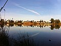
Overlooking the lake (taken from the Access Trail)


References[]
- ^ "City Government". City of Medical Lake. Retrieved May 27, 2021.
- ^ "2019 U.S. Gazetteer Files". United States Census Bureau. Retrieved August 7, 2020.
- ^ Jump up to: a b "Annual Estimates of the Resident Population for Incorporated Places in Washington: April 1, 2010 to July 1, 2019". United States Census Bureau. May 2020. Retrieved May 27, 2020.
- ^ Jump up to: a b "U.S. Census website". United States Census Bureau. Retrieved 2012-12-19.
- ^ "US Board on Geographic Names". United States Geological Survey. 2007-10-25. Retrieved 2008-01-31.
- ^ "City Government - The City of Medical Lake". City of Medical Lake. Retrieved 9 May 2017.
- ^ Kershner, Jim. "Medical Lake -- Thumbnail History". History Link. Retrieved 9 May 2017.
- ^ "US Gazetteer files: 2010, 2000, and 1990". United States Census Bureau. 2011-02-12. Retrieved 2011-04-23.
- ^ "US Gazetteer files 2010". United States Census Bureau. Archived from the original on 2012-01-25. Retrieved 2012-12-19.
- ^ "Medical Lake Topo Map, Spokane County WA (Medical Lake Area)". Topozone. Retrieved 9 May 2017.
- ^ "The channeled scablands of eastern Washington : the geologic story of the Spokane flood". USGS. Retrieved 9 May 2017.
- ^ United States Census Bureau. "Census of Population and Housing". Retrieved August 3, 2013.
- ^ "Population Estimates". United States Census Bureau. Archived from the original on October 19, 2016. Retrieved June 19, 2016.
External links[]
| show Municipalities and communities of Spokane County, Washington, United States |
|---|

| show Authority control |
|---|
- Cities in Washington (state)
- Cities in Spokane County, Washington
- 1890 establishments in Washington (state)