Mela, Corse-du-Sud
show This article may be expanded with text translated from the corresponding article in French. (January 2009) Click [show] for important translation instructions. |
Mela | |
|---|---|
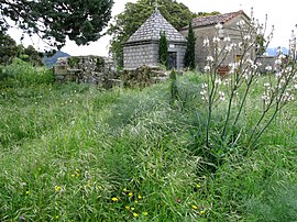 Ruins of the church of Santa Maria Assunta | |
show Location of Mela | |
 Mela | |
| Coordinates: 41°41′48″N 9°05′41″E / 41.6967°N 9.0947°ECoordinates: 41°41′48″N 9°05′41″E / 41.6967°N 9.0947°E | |
| Country | France |
| Region | Corsica |
| Department | Corse-du-Sud |
| Arrondissement | Sartène |
| Canton | Sartenais-Valinco |
| Intercommunality | l'Alta Rocca |
| Government | |
| • Mayor (2020–2026) | Albert Mondoloni[1] |
| Area 1 | 4.63 km2 (1.79 sq mi) |
| Population (Jan. 2018)[2] | 28 |
| • Density | 6.0/km2 (16/sq mi) |
| Time zone | UTC+01:00 (CET) |
| • Summer (DST) | UTC+02:00 (CEST) |
| INSEE/Postal code | 2A158 /20112 |
| Elevation | 137–908 m (449–2,979 ft) (avg. 800 m or 2,600 ft) |
| 1 French Land Register data, which excludes lakes, ponds, glaciers > 1 km2 (0.386 sq mi or 247 acres) and river estuaries. | |


Mela is a commune in the Corse-du-Sud department of France on the island of Corsica.
Population[]
| Year | Pop. | ±% |
|---|---|---|
| 1962 | 53 | — |
| 1968 | 56 | +5.7% |
| 1975 | 51 | −8.9% |
| 1982 | 48 | −5.9% |
| 1990 | 30 | −37.5% |
| 1999 | 40 | +33.3% |
| 2008 | 31 | −22.5% |
See also[]
References[]
- ^ "Répertoire national des élus: les maires". data.gouv.fr, Plateforme ouverte des données publiques françaises (in French). 2 December 2020.
- ^ "Populations légales 2018". INSEE. 28 December 2020.
| Wikimedia Commons has media related to Mela (Corse-du-Sud). |
This Corse-du-Sud geographical article is a stub. You can help Wikipedia by . |
Categories:
- Communes of Corse-du-Sud
- Corse-du-Sud geography stubs