Metropolitan Branch Trail
| Metropolitan Branch Trail | |
|---|---|
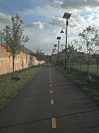 The Metropolitan Branch Trail | |
| Length | 8 miles (13 km) |
| Location | Washington, D.C. |
| Trailheads | South: Union Station, North: Silver Spring |
| Use | Hiking, Biking |
| Hiking details | |
| Website | www |
The Metropolitan Branch Trail (informally, the Met Branch Trail) is a rail trail that, when completed, will run eight miles (13 km) from the transit center in Silver Spring, Maryland, to Union Station in the District of Columbia. It serves to extend the Capital Crescent Trail where it merges with the active WMATA and CSX railroad tracks into the National Capital. At Fort Totten, a connector trail to the Northwest Branch Trail of the Anacostia Tributary Trail System at Hyattsville, Maryland, will be constructed; and an on-street connection to the National Mall will be constructed from Union Station. When completed, the Metropolitan Branch Trail will serve as part of the East Coast Greenway.
Seven miles of the trail are within Washington, D.C., and one mile (1.6 km) is in Maryland. The trail gets its name from the Metropolitan Subdivision of the Baltimore and Ohio Railroad (B&O), which the trail parallels. The remainder of the trail closely parallels the current WMATA and CSX tracks into Maryland. It is anchored by two railroad landmarks: Washington Union Station and the old B&O Railroad Station in Silver Spring.
History[]
The Metropolitan Branch Trail was first conceived in 1988, by Patrick Hare of the Brookland neighborhood. Working with the (WABA) and Rails-to-Trails Conservancy in 1989, Hare organized a group of 11 area cyclists to conduct an exploratory walk/ride.[1] Soon after, motivated by CSX's plans to develop the Eckington Rail Yard needed for the trail,[2] the Coalition for the Metropolitan Branch Trail was formed to explore and promote the potential for a multi-use trail. Before that, the trail was sometimes called the "Dome to Dome Trail" because it would connect the Capitol Dome and the Catholic University dome. The Metropolitan Branch Trail entered the DC Comprehensive Plan in the early 1990s and in 1997, the DC Department of Public Works (DPW) completed an engineering feasibility study that determined that it would be possible. In 1991, Congress gave the District $1.5 million to secure access, rights-of-way, easements or title to lands needed for the trail.[3]
Planning of the trail began in 1998 after Congress allocated $8.5 million in demonstration-project funding to the District for the trail through the Transportation Equity Act for the 21st Century (TEA-21), the six-year federal transportation funding bill; this was celebrated with a ground-breaking ceremony.[1] In 1999, WABA published a concept plan for the trail that envisioned a large urban park and greenway along the abandoned, and as yet undeveloped, CSX Transportation property. In April 2001, WABA published a study describing the necessary acquisitions for the trail. In 2002,[4] when the city and the Washington Metropolitan Area Transit Authority (WMATA) agreed to construct a new Metro station at New York and Florida Avenues, trail advocates and city staff negotiated for WMATA to build a portion of the trail as a part of the project. Around the same time the Maryland-National Capital Park and Planning Commission (M-NCPPC) completed a Feasibility Study and Concept Plan for one mile of the MBT between DC and Silver Spring. In 2003, the District Department of Transportation (DDOT) hired a special project manager for the trail, prepared a Takoma Alignment Study, and began development of the comprehensive concept plan, which was completed in 2005.[5]
Even as the planning was ongoing, work was underway in the District. After a groundbreaking ceremony on May 29, 1998, the District Department of Transportation built a nearly one-mile segment along John McCormack Road near Catholic University as part of routine road maintenance.[6] It was built with $1.9 million of federal Congestion Mitigation and Air Quality (CMAQ) funding and was completed in November 1998.[7] On October 21, 1999, the trail was named one of 50 Millennium Legacy Trails at a White House ceremony featuring First Lady Hillary Rodham Clinton and Secretary of Transportation Rodney Slater.[8][9] Five days later, a formal ribbon-cutting ceremony was held at the Brookland-Catholic University Metro station to celebrate its designation as a Millennium Legacy Trail.[10] It was attended by Slater; eight members of Congress; and representatives of NHTSA, FHWA, and the DC government.[11] Another short, on-road trail section was built along First Street NE from Union Station in 2000. When the New York Ave–Florida Ave–Gallaudet University Metro station opened in November 2004,[12] it included about 2,000 feet (610 m) of trail on a raised structure, but that section was inaccesible until 2010. Stairs from the New York Avenue Metro Station section to L Street NE, a trail under the tracks along L Street NE and a one block portion along 2nd Street NE were completed in the spring of 2008. The core of the trail, a 1.5-mile segment from New York Avenue to Franklin Street opened in May 2010, following a June 2009 start, making the whole DC section usable.[13] On July 9, 2013, a 500-foot-long section between Monroe Street and the CUA Metro station opened as part of the Monroe Street Market development. [14] On May 30, 2014, a roughly 2,000-foot section of the trail opened as a curb-protected, two-way bike lane along 1st Street NE from G Street NE to M Street NE.[15] This was connected to the existing trail in November 2014 by a 572-foot protected bike lane on M Street,[16] and then extended 812 feet south along 1st Street from G Street NE to the stub at Columbus Circle NE on August 12, 2015.[17] The Rhode Island Avenue Pedestrian Bridge, which connects the trail on the west side of the extant railroad tracks with the Rhode Island Avenue Metro Station on the east side, opened on December 31, 2014, after more than 15 months of work.[18]
On October 31, 2017, DDOT issued a Notice to Proceed for the design-build construction of the next phase of the Metropolitan Branch Trail from John McCormack Drive in Brookland to the Fort Totten Metro Station. That work is to be completed in 2020.[19][20] The first completed section, opened on June 17, 2020, was an 800-foot replacement of the connector between Gallatin St, NE and 1st Place, NE.[21]
On December 7, 2019, the section between Q and R Streets NE, closed since August 2019, reopened as part of construction of Alethia Tanner Park. The trail in that block had always hugged the outside of the parcel, but the new design allowed it to cut across the parcel, removing two very sharp turns.[22] On March 18, 2020, NoMa Parks Foundation completed a Henry Thomas Way Drive connector as part of the same project.[23] On June 25th Alethia Tanner Park, the park through which both ran, opened.[24]
From April to June of 2021, DC built a 450 foot section of the trail along Eastern Avenue from the Maryland boundary, where it connected to an existing section built by Montgomery County, to Piney Branch Road.[25]
Work was going on in Maryland too. A section in Montgomery County will connect the trail from DC to the Silver Spring Metro Center. The Montgomery County Planning Board approved a CCT/MetBranch Trail Facility Plan in 2001, but formal planning for the trail wasn't completed until 2017.[26] Nonetheless, some work was rolled in to other projects and proceeded.[27] In 2003, Montgomery College realigned Fenton street to make room for their Takoma campus expansion and this work included a half mile of mostly-paved trail from the District line to Montgomery College. It was mostly paved because there was a short section made of water permeable stone-dust surface due to fear of tree-root damage.[28][29] The campus expansion also included a bridge from the Takoma Park section over the railroad tracks to Jessup Blair Park in Silver Spring that opened on July 28, 2004.[30] After further evaluation indicated the trees would not be significantly impacted the unpaved section along Fenton was paved in January 2006.[31] Sections built as part of larger projects include a 100-foot section of a trail south of Ripley Street that was part of the 2012 Solaire building construction,[32] a section from Colesville Road to Ripley Street in Silver Spring that opened in January and February of 2013 as part of the Silver Spring Transit Center,[33] and a 0.05-mile section of the trail alongside the Progress Place development that was completed in late 2016, but will not be opened to the public until the county finishes its trail construction work.[34] The first piece built by Montgomery County, not as part of some other project, was a two-block section along Fenton and King Streets that was completed in June 2018.[35] The remainder of the trail in Montgomery County is to be completed in 2023.[26]
Meanwhile, work on the first piece of the Maryland section of the Prince George's County Connector Trail, from Eastern Avenue in DC to Russell Avenue in Maryland, began in 2009 and was completed in 2010.[36]
Right-of-way[]
A substantial segment of the original Metropolitan Branch right-of-way south of Franklin Street NE (in some places, 200 feet wide) was originally marked as an extension of Delaware Avenue under the L'Enfant Plan. It was converted into railroad sidings for industrial uses on Capitol Hill in the late 19th-early 20th century, parallel to B&O railroad.
The Metropolitan Branch sidings became disused as industrial applications left the city, and the owner, CSX, which had already sold the active B&O railroad tracks within the District to the Washington Metro under a joint use agreement, made plans to redevelop many of the properties along the right-of-way, leaving it as a staging ground for temporary construction uses. During this period, the wide, grassy strip became a popular short-cut for pedestrians and cyclists trying to access the new Red Line which runs along the corridor.
Initially, WMATA engineered the Red Line to accommodate existing railroad uses in the corridor, bisecting the existing rail line and preserving many of the Metropolitan Branch sidings. In 1988, a decade after WMATA purchased and widened the active tracks, Montgomery County, Maryland purchased the Georgetown Branch of the B&O, a single track spur feeding into the Metropolitan Branch from the north, for transportation use including an extension of the Capital Crescent Trail.[37] The remaining disused portions of the Metropolitan Branch spanned the distance parallel to the Red Line between the Georgetown Branch and Union Station, including sizable gaps north of Franklin Street, where the railroad had been widened by WMATA; the only available right-of-way for a trail in these areas was on adjacent parkland, or streets parallel to the railroad tracks.
Subsequent alterations to the Metropolitan Branch Trail route have reduced the amount of right-of-way acquisition by placing substantial portions of the proposed trail on-street, while retaining a continuous off-street trail between Franklin Street and the New York Ave–Florida Ave–Gallaudet University Metro station.
See also[]
References[]
- ^ Jump up to: a b Metropolitan Branch Trail Concept Plan (PDF). 1999. Retrieved 31 July 2017.
- ^ Bell, Thomas (23 November 1989). "CYCLISTS RACING TO GET RAILBED FOR NE TRAIL". The Washington Post. Retrieved 9 September 2015.
- ^ "District of Columbia Appropriations Act of 1992". Retrieved 29 October 2020.
- ^ "$6M to WMATA for Bike Access to NY Avenue Station" (Press release). District Department of Transportation. 7 March 2002. Archived from the original on 12 May 2009. Retrieved 30 June 2008.
- ^ District Department of Transportation (2005). "Metropolitan Branch Trail Draft Comprehensive Plan". Archived from the original (PDF) on 2005-04-08. Retrieved 2009-05-28. Cite journal requires
|journal=(help) - ^ "Bike Path Groundbreaking Today". The Washington Post. May 29, 1998. Archived from the original on July 24, 2018. Retrieved 24 July 2018.
- ^ Lenhart, Jennifer (23 November 1998). "Part of Bike Beltway Open in the District". The Washington Post. Retrieved 15 September 2015.
- ^ "U.S. Transportation Secretary Slater Announces $3.6 Million in Funding for Millennium Trails". 6 January 2000. Retrieved 21 October 2020.
- ^ "MILLENNIUM LEGACY TRAILS". Retrieved 21 October 2020.
- ^ Levey, Bob (4 November 1999). "A Bicycle Beltway Within the Beltway". The Washington Post. Retrieved 16 September 2015.
- ^ Pearson, Marietta (24 January 2000). "Completion of First Part of Metropolitan Branch Trail Opens as Part of Millennium Trails" (PDF). NHTSA Now. 6 (1). Retrieved 27 August 2016.
- ^ "Metro's New York Ave-Florida Ave-Gallaudet U Metrorail station opens today on the Red Line". 20 November 2004. Archived from the original on 10 July 2013. Retrieved 6 July 2020.
- ^ District Department of Transportation (2010). "Metropolitan Branch Trail Opening Press Release" (PDF). Retrieved 2010-08-28. Cite journal requires
|journal=(help)[dead link] - ^ Shani (2013-07-08). "Monroe Street Market (Catholic U) Development To Open Pedestrian And MBT Areas Today". The Brookland Bridge. Retrieved 2013-11-01.
- ^ Billing, Greg. "FIRST ST. NE CYCLE TRACK RIBBON CUTTING TOMORROW". waba.org. Retrieved 12 August 2015.
- ^ Dan Emerine [@DJEinDC] (12 November 2014). "2-way cycle track on M St between MBT/NoMa Metro & 1st St NE opened yesterday" (Tweet) – via Twitter.
- ^ Cranor, David. "1st Street NE Protected Bike Lane extension now open". Retrieved 12 August 2015.
- ^ Russell, Edward. "A long-awaited bridge opens to Rhode Island Avenue Metro". Greater Greater Washington. Retrieved 31 December 2014.
- ^ Cranor, David. "Say Goodbye to the "Big Stinky": DDOT to Begin Metropolitan Branch Trail Extension". The WashCycle. Retrieved 2 November 2017.
- ^ "METROPOLITAN BRANCH TRAIL FORT TOTTEN". Retrieved 18 March 2020.
- ^ @@gregbilling (17 June 2020). "The Fort Totten neighborhood connection to the Met Branch Trail is open" (Tweet) – via Twitter.
- ^ @NoMaParksDC (7 December 2019). "#MBT #TannerPark" (Tweet) – via Twitter.
- ^ @NoMaParksDC (18 March 2020). "We are opening the MBT Connector in Tanner Park today!" (Tweet) – via Twitter.
- ^ "ALETHIA TANNER PARK IS NOW OPEN!!". Retrieved 17 July 2020.
- ^ @DDOTDC (April 20, 2021). "Metropolitan Branch Trail Eastern Ave project update: new curb extensions, bioretention, streetlights, ramps and flexipave are in" (Tweet) – via Twitter.
- ^ Jump up to: a b "Metropolitan Branch Trail". Retrieved 21 July 2020.
- ^ "Metropolitan Branch Trail". Archived from the original on 30 March 2010. Retrieved 21 July 2020.
- ^ "Takoma Park Expansion Plan" (PDF). Retrieved 21 July 2020.
- ^ "Metropolitan Branch Trail". Silver Spring Trails. Archived from the original on 5 March 2005. Retrieved 21 July 2020.
- ^ "Public Project: Jesup Blair Park Renovation". Retrieved 20 July 2020.
- ^ "The Metropolitan Branch Trail". Silver Spring Trails. Archived from the original on 2 September 2006. Retrieved 21 July 2020.
- ^ Reed, Dan. "Silver Spring's Ripley District becoming a neighborhood". Greater Greater Washington. Retrieved 19 July 2017.
- ^ "Ripley Street Portion of Metropolitan Branch Trail Opened in Silver Spring; Will Enhance Accessibility Around Transit Center". montgomerycountymd.gov. Archived from the original on 26 February 2013. Retrieved 22 July 2020.
- ^ Diegel, Mike. "PROGRESS PLACE'S NEW LOCATION TO OPEN THIS WEEK IN DOWNTOWN SILVER SPRING". Source of the Spring. Retrieved 19 July 2017.
- ^ Cranor, David. "Groundbreaking ceremony for the Met Branch Trail's Ft. Totten Section will happen Saturday at 10am, also a very small section completed in MD". TheWashCycle. Retrieved 24 July 2018.
- ^ Cranor, David. "Trees going in soon on the Met Branch Trail". TheWashcycle. Retrieved 18 July 2017.
- ^ Coalition for the Capital Crescent Trail. "A Brief History of the Georgetown Branch." Archived 2007-02-03 at the Wayback Machine Accessed 2009-11-14.
| Wikimedia Commons has media related to Metropolitan Branch Trail. |
External links[]
- Metropolitan Branch Trail - official site (DC Department of Transportation)
- Northwest Branch Trail - Montgomery County Department of Parks
- Silver Spring Trails
Coordinates: 38°54′23.7″N 77°0′12.4″W / 38.906583°N 77.003444°W

- Rail trails in Washington, D.C.
- Rail trails in Maryland
- Baltimore and Ohio Railroad
- Protected areas of Montgomery County, Maryland
- Transportation in Montgomery County, Maryland
- Hyattsville, Maryland