Meyronne, Saskatchewan
Meyronne | |
|---|---|
Special service area[1] | |
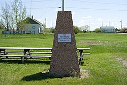 Memorial commemorating Meyronne's 75th anniversary in 1988 | |
 Meyronne | |
| Coordinates: 49°39′58″N 106°50′49″W / 49.666°N 106.847°W | |
| Country | Canada |
| Province | Saskatchewan |
| Region | Saskatchewan |
| Census division | 3 |
| Rural Municipality | Pinto Creek |
| Post office founded | June 1, 1909 |
| Incorporated (village) | N/A |
| Restructured (special service area) | September 5, 2006 |
| Government | |
| • Governing body | R.M. Pinto Creek No. 75 |
| Area | |
| • Total | 0.53 km2 (0.20 sq mi) |
| Population (2001) | |
| • Total | 35 |
| • Density | 65.5/km2 (170/sq mi) |
| Time zone | CST |
| Area code(s) | 306 |
| Highways | Highway 13 Highway 611 |
| [2][3][4][5] | |


Meyronne is a special service area in the Canadian province of Saskatchewan.
History[]
Known history of the Wood Mountain area goes back to the trek by the NWMP in 1874 and the founding of the Wood Mountain Post that same year. Land in the area was opened for homesteading in 1908. When the railway went through in 1913, the settlement moved to its present site. [6]
It was reorganised from a village into a special service area on September 5, 2006.

Demographics[]
| Canada census – Meyronne, Saskatchewan community profile | |||
|---|---|---|---|
| Population: | |||
| Land area: | |||
| Population density: | |||
| Median age: | |||
| Total private dwellings: | |||
| Median household income: | |||
| References: earlier[7] | |||
Infrastructure[]
Saskatchewan Transportation Company provides intercity bus service to Meyronne.[8]
See also[]
References[]
- ^ "Search for Municipal Information". Government of Saskatchewan. Archived from the original on March 10, 2014. Retrieved April 7, 2014.
- ^ National Archives, Archivia Net, Post Offices and Postmasters, archived from the original on 2006-10-06
- ^ Government of Saskatchewan, MRD Home, Municipal Directory System, archived from the original (– Scholar search) on November 21, 2008
- ^ Canadian Textiles Institute. (2005), CTI Determine your provincial constituency, archived from the original on 2007-09-11
- ^ Commissioner of Canada Elections, Chief Electoral Officer of Canada (2005), Elections Canada On-line, archived from the original on 2007-04-21
- ^ Meyronne Memories, 1908-1967, p. 4, 10
- ^ "2001 Community Profiles". 2001 Canadian Census. Statistics Canada. February 17, 2012.
- ^ STC Route Map Archived 2013-10-04 at the Wayback Machine
| Towns |  | ||||||
|---|---|---|---|---|---|---|---|
| Villages | |||||||
| Rural municipalities | |||||||
| First Nations |
| ||||||
| Indian reserves | |||||||
| Unincorporated communities |
| ||||||
Coordinates: 49°39′58″N 106°50′49″W / 49.666°N 106.847°W
This article about a location in the Census Division No. 3 of Saskatchewan is a stub. You can help Wikipedia by . |
Categories:
- Designated places in Saskatchewan
- Former villages in Saskatchewan
- Pinto Creek No. 75, Saskatchewan
- Special service areas in Saskatchewan
- Populated places disestablished in 2006
- Division No. 3, Saskatchewan
- Saskatchewan Division No. 3 geography stubs