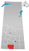
Wood Mountain, Saskatchewan
Wood Mountain | |
|---|---|
Village | |
 Saskatchewan Wheat Pool elevator | |
 Wood Mountain | |
| Coordinates: 49°22′15″N 106°23′01″W / 49.37083°N 106.38361°WCoordinates: 49°22′15″N 106°23′01″W / 49.37083°N 106.38361°W | |
| Country | Canada |
| Province | Saskatchewan |
| Region | South-central |
| Rural Municipality | Old Post |
| Incorporated (village) | 1930 |
| Government | |
| • Governing body | Wood Mountain Village Council |
| • Mayor | Edward McIvor |
| • Clerk | Sherry Mielke |
| • MLA | Dave Marit |
| • MP | Jeremy Patzer |
| Area | |
| • Total | 0.61 km2 (0.24 sq mi) |
| Population (2006) | |
| • Total | 20 |
| • Density | 32.6/km2 (84/sq mi) |
| Time zone | CST |
| Postal code | S0H 4L0 |
| Area code(s) | 306 |
| Highways | Highway 18 Highway 358 |
| Railways | Canadian Pacific Railway (Defunct) |
| Website | Village of Wood Mountain[1] |
| [2][3][4][5] | |
Wood Mountain (2016 population: 20) is a village in the Canadian province of Saskatchewan within the Rural Municipality of Old Post No. 43 and Census Division No. 3. Its name is derived from the Red River Métis words "montagne de bois" (meaning mountain of wood in French), due to the abundance of poplar trees in the otherwise barren region. Highway 18 and Highway 358 intersect south of the community.
Wood Mountain is known for its annual stampede that has been held every year for more than 120 years.
This village is home to the First Nations administrative office for the band government of the Wood Mountain Lakota First Nation.[6]
History[]
Wood Mountain was the terminus of the Fort Ellice-Wood Mountain Trail that was used from 1757 to the 1850s to haul provisions such as pemmican by the Metis and First Nations. The trail was over 400 kilometres long.[7] It was incorporated as a village on March 4, 1930.[8]
Demographics[]

In the 2016 Census of Population conducted by Statistics Canada, the Village of Wood Mountain recorded a population of 20 living in 9 of its 10 total private dwellings, a -25% change from its 2011 population of 25. With a land area of 0.61 km2 (0.24 sq mi), it had a population density of 32.8/km2 (84.9/sq mi) in 2016.[11]
In the 2011 Census of Population, the Village of Wood Mountain recorded a population of 25, a 25% change from its 2006 population of 20. With a land area of 0.61 km2 (0.24 sq mi), it had a population density of 41.0/km2 (106.1/sq mi) in 2011.[12]
Economy and tourism[]
Historically, Wood Mountain's economy has relied mainly on agriculture as a main industry. The community still has strong roots to farming and ranching, but with its location and rich history, tourism has become a main industry. The community has a variety of businesses, recreation sites, and many accommodations such as bed and breakfasts, a cafe restaurant, a pool, a library, a community hall, and a wide variety of churches, museums, campgrounds, and regional parks.[citation needed]
Local attractions[]
- Wood Mountain Community Pool
- Wood Mountain Regional Park
Events[]
- , oldest continuous annual Rodeo in Canada. It has run since 1890.[13]
- Wood Mountain Farmers Market
- Redneck Rumble
Regional attractions/accommodations[]
- Grasslands National Park
- Crossing Resort
- Glentworth Bar and Hotel
- Limerick Bar and Hotel
Notable residents[]
- Andrew Suknaski, poet
- Kacy & Clayton, folk-rock group
See also[]
- List of communities in Saskatchewan
References[]
- ^ Village of Wood Mountain
- ^ National Archives, Archivia Net. "Post Offices and Postmasters".
- ^ Government of Saskatchewan, MRD Home. "Municipal Directory System". Archived from the original on November 21, 2008.
- ^ Canadian Textiles Institute. (2005). "CTI Determine your provincial constituency".
- ^ Commissioner of Canada Elections, Chief Electoral Officer of Canada (2005). "Elections Canada On-line".
- ^ http://www.sicc.sk.ca/archive/bands/bwoodm.html
- ^ https://esask.uregina.ca/entry/fort_ellice-wood_mountain_trail.jsp
- ^ "Urban Municipality Incorporations". Saskatchewan Ministry of Government Relations. Archived from the original on October 15, 2014. Retrieved June 1, 2020.
- ^ "Saskatchewan Census Population" (PDF). Saskatchewan Bureau of Statistics. Archived from the original (PDF) on September 24, 2015. Retrieved May 31, 2020.
- ^ "Saskatchewan Census Population". Saskatchewan Bureau of Statistics. Retrieved May 31, 2020.
- ^ "Population and dwelling counts, for Canada, provinces and territories, and census subdivisions (municipalities), 2016 and 2011 censuses – 100% data (Saskatchewan)". Statistics Canada. February 8, 2017. Retrieved May 30, 2020.
- ^ "Population and dwelling counts, for Canada, provinces and territories, and census subdivisions (municipalities), 2011 and 2006 censuses (Saskatchewan)". Statistics Canada. June 3, 2019. Retrieved May 30, 2020.
- ^ http://www.woodmountain.ca/Stampd.html
External links[]
| Wikimedia Commons has media related to Wood Mountain, Saskatchewan. |
- Villages in Saskatchewan
- Old Post No. 43, Saskatchewan
- Division No. 3, Saskatchewan
- Romanian-Canadian history
- Royal Canadian Mounted Police
- Sitting Bull


