Minmi, New South Wales
| Minmi Newcastle, New South Wales | |
|---|---|
| Population | 743 (2016 census)[1] |
| • Density | 413/km2 (1,069/sq mi) |
| Postcode(s) | 2287 |
| Area | 1.8 km2 (0.7 sq mi) |
| Location | 19 km (12 mi) WNW of Newcastle |
| LGA(s) | City of Newcastle |
| Parish | Hexham |
| State electorate(s) | Cessnock |
| Federal division(s) | Newcastle |
Minmi /ˈmɪnˌmaɪ/[2] is an outer western suburb of Newcastle, New South Wales, Australia, located 19 kilometres (12 mi) from Newcastle's central business district. It is part of the City of Newcastle local government area.
Minmi was an important coal mining centre in the second half of the nineteenth century, particularly under the ownership and management of J & A Brown.
Minmi's mines were connected by a private railway line across the Hexham Swamp to J & A Brown's loading facilities on the Hunter River at Hexham. J & A Brown's engineering workshops were also located at Hexham.
History[]
Pre-European Colonisation[]
Prior to white settlement, the area of present-day Minmi was home to the Pambalong people for approximately 40,000 years. The Pambalong people were thought to be a sub-tribe of the Lake Macquarie Awabakal nation. Pambalong territory extended from the south bank of the Hunter River, west to Tarro and the foothills of the Sugarloaf Range and south to Lake Macquarie. By 1893 there was no trace of the Pambalong people in the Minmi district.[3][4]
Timeline[]
The following information is largely taken from a sign in Minmi Park (see photo in image gallery below).
1835 – Coal discovered by Harry Styles.
1848 – First coal mines opened by William Robson and the Turner Brothers.
1850s – Coal mining by Eales and Brown Brothers.
1860s – J & A Brown acquire all land and mining rights in Minmi.
1861 – Public education begins. The first miners' union formed.
1877 – Back Creek tunnel opened. First Minmi race day.
1878 – New school opens with 300 students. Police station established.
1882 – John Brown – Manager of J & A Brown.
1884 – First soccer game in Newcastle – Minmi Rangers versus Lambton.
1890s – Progress Association established.
1895 – Post office and courthouse built.
1900s – Minmi's population at its height with 6,000 residents.
1909 – Maitland coal fields opened, prompting many Minmi mining families to leave for Cessnock and Kurri Kurri for the better pay offered at the Maitland coalfields.
1924 – John Brown closes Back Creek mines.
1929 – Coal strike and lockout.
1930 – John Brown dies.
1949 – Seven week strike. Army in open cut mine.
1951 – Open cut mining ceased. Back Creek despoiled.
1961 – Centenary of public education. New school opens.
1980 – Residents win land titles.
1990s – Minmi land rezoned. Bonnie Doon Estate established.
1992 – Freeway opened.
1995 – Fire station commissioned.
Minmi Cemetery[]
It is located on 20 Minmi Road.[5] It has a total of 598 graves and the oldest known grave is Eliza Chapman who died on 21 January 1863.[6] Some graves could be older than that but are too deteriorated to read the inscription and many of the graves are without markers.[7] The cemetery was originally established on the private property of J & A Brown, who operated a number of coal mines in the area, and was made available by them for public use.[7] On 9 August 2002 the Minmi Heritage Garden was established next to the cemetery paid for by Coal & Allied Industries.[7]
Image gallery[]

History sign

J & A Brown's brake wagon

Minmi bushland
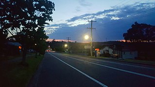
Woodford Street, Minmi


References[]
- ^ Australian Bureau of Statistics (27 June 2017). "Minmi (State Suburb)". 2016 Census QuickStats. Retrieved 18 March 2018.

- ^ "Search By Letter - ABC PRONOUNCE". Australian Broadcasting Corporation. Archived from the original on 11 February 2017. Retrieved 10 February 2017.
- ^ Newcastle and Hunter District Historical Society Inc. Minmi: The Place of the Giant Lily. Newcastle and Hunter District Historical Society Inc. p. 5.
- ^ "Aboriginal Culture". City of Newcastle. Retrieved 8 September 2020.
- ^ "Minmi Cemetery in Minmi, New South Wales - Find A Grave Cemetery". findagrave.com. Retrieved 28 October 2020.
- ^ "Minmi Cemetery - Hunter & Central Coast Region - New South Wales, Australia". interment.net. Retrieved 28 October 2020.
- ^ a b c "Australian Cemeteries Index - Cemetery 169 - Minmi". austcemindex.com. Retrieved 28 October 2020.

- Suburbs of Newcastle, New South Wales