Mizen Head
| Mizen Head | |
|---|---|
| Carn Uí Néid | |
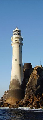
 Mizen Head, the most southwesterly point of Ireland | |
| Highest point | |
| Elevation | 101.63 m (333.4 ft)[1] |
| Coordinates | 51°27′1″N 9°49′10″W / 51.45028°N 9.81944°WCoordinates: 51°27′1″N 9°49′10″W / 51.45028°N 9.81944°W |
| Naming | |
| Language of name | Irish |
| Geography | |
 Location in Ireland | |
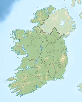
| Location | County Cork, Ireland |
| OSI/OSNI grid | D180438 |
| Geology | |
| Mountain type | Dolerite sill |

Mizen Head (Irish: Carn Uí Néid; anciently Notium or Notion Ancient Greek: Νότιον ἄκρον, romanized: Notion akron,[2][3]) is located at the extremity of the in the district of Carbery in County Cork, southwest Ireland.
Geography[]
Mizen Head is one of the extreme points of the island of Ireland and is a major tourist attraction, noted for its dramatic cliff scenery. One of the main transatlantic shipping routes passes close by to the south, and Mizen Head was, for many seafarers, the first (or last) sight of Europe. The tip of the peninsula is almost an island, cut off by a deep chasm, now spanned by a bridge; this gives access to an old signal station, a weather station, and a lighthouse. The signal station, once permanently staffed, is now a museum housing displays relating to the site's strategic significance for transatlantic shipping and communications, including the pioneering efforts of Guglielmo Marconi. The "99 steps" which formed part of the original access route have been supplemented by a series of paths and viewing platforms, and a full range of visitor facilities is available at the entrance to the site. The villages of Ballydehob, Crookhaven, Goleen, and Schull are located on the peninsula to the east.

Mizen Head is not the most southerly point on the mainland of Ireland; nearby Brow Head holds that title, being several metres further south. Nevertheless, geography books have long measured the length of Ireland, diagonally northeast-to-southwest, as "from Fair Head to Mizen Head"[4] or north-to-south "from Malin Head to Mizen Head".[5]
See also[]
- Carbery's Hundred Isles
- Malin to Mizen
- Wild Atlantic Way
References[]
- ^ "Mizen Head Elevation (101.63 M)". Distancesto.com. 2017.
elevation 101.63 m
- ^ Ptolemy. The Geography. 2.2.5.
- ^
 Smith, William, ed. (1854–1857). "Notium". Dictionary of Greek and Roman Geography. London: John Murray.
- ^ Robert Johnson. The Competitive Geography (1877). p. 170.
- ^ William Hughes and John Williams. A Class-book of Modern Geography (1885). p. 78.
Sources[]
- Mizen Journal, Archaeology Paddy O'Leary, No 11, 2003 ISSN 1649-203X
- Archaeological Inventory of County Cork, Vol 1 West Cork, Office of Public Works, 1992 ISBN 0-7076-0175-4
- BHAS Journal vol 2 p.106-119, Townlands Donal Fitzgerald ISSN 0791-6612
- Northside of the Mizen, General reading, Patrick McCarthy & Richard Hawkes
External links[]
| show Peninsulas of Ireland |
|---|
| show Places in County Cork |
|---|

| show Lighthouses in Ireland |
|---|
- Headlands of County Cork
- Tourist attractions in County Cork