Mocanaqua, Pennsylvania
Mocanaqua, Pennsylvania | |
|---|---|
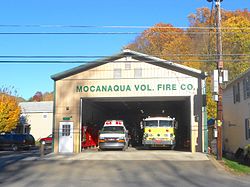 Volunteer Fire Department | |
| Nickname(s): "Little Bear" (Ma-con-na-quah)[citation needed] | |
 Mocanaqua Location in Pennsylvania | |
| Coordinates: 41°8′28″N 76°8′20″W / 41.14111°N 76.13889°WCoordinates: 41°8′28″N 76°8′20″W / 41.14111°N 76.13889°W | |
| Country | United States |
| State | Pennsylvania |
| County | Luzerne |
| Township | Conyngham |
| Government | |
| • Type | 2nd Class Township |
| Area | |
| • Total | 0.5 sq mi (1.4 km2) |
| • Land | 0.5 sq mi (1.3 km2) |
| • Water | 0.04 sq mi (0.1 km2) |
| Population (2010) | |
| • Total | 646 |
| • Density | 1,200/sq mi (460/km2) |
| Time zone | UTC-5 (Eastern (EST)) |
| • Summer (DST) | UTC-4 (EDT) |
| Area code(s) | 570 |
| GNIS feature ID | 1181387,[1] 2630027[2] |


Mocanaqua is an unincorporated community and census-designated place (CDP) in Conyngham Township, Luzerne County, Pennsylvania, United States. The population was 646 at the 2010 census.[3]
Geography[]
According to the United States Census Bureau, the CDP has a total area of 0.54 square miles (1.4 km2), of which 0.50 square miles (1.3 km2) is land and 0.04 square miles (0.1 km2), or 9.55%, is water.[4] It is located on the east bank of the Susquehanna River along PA 239, which crosses the river and links Mocanaqua to the borough of Shickshinny.
School District[]
Students attend the Greater Nanticoke Area School District.
Gallery[]
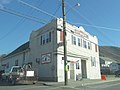
Polish Falcons Hall in Mocanaqua

Main Street

Houses in Mocanaqua

Church in Mocanaqua


References[]
| Wikimedia Commons has media related to Mocanaqua, Pennsylvania. |
- ^ U.S. Geological Survey Geographic Names Information System: Mocanaqua
- ^ U.S. Geological Survey Geographic Names Information System: Mocanaqua Census Designated Place
- ^ "Profile of General Population and Housing Characteristics: 2010 Demographic Profile Data (DP-1): Mocanaqua CDP, Pennsylvania". United States Census Bureau. Retrieved April 27, 2012.
- ^ "Geographic Identifiers: 2010 Demographic Profile Data (G001): Mocanaqua CDP, Pennsylvania". United States Census Bureau. Retrieved April 27, 2012.
| show Municipalities and communities of Luzerne County, Pennsylvania, United States |
|---|

| show Authority control |
|---|
Categories:
- Census-designated places in Luzerne County, Pennsylvania
- Census-designated places in Pennsylvania