Swoyersville, Pennsylvania
Swoyersville, Pennsylvania | |
|---|---|
Borough | |
 Location of Swoyersville in Luzerne County, Pennsylvania. | |
 Swoyersville Location of Swoyersville in Luzerne County, Pennsylvania. | |
| Coordinates: 41°17′41″N 75°52′36″W / 41.29472°N 75.87667°WCoordinates: 41°17′41″N 75°52′36″W / 41.29472°N 75.87667°W | |
| Country | United States |
| State | Pennsylvania |
| County | Luzerne |
| Incorporated | 1888 |
| Government | |
| • Type | Borough Council |
| • Mayor | Christopher Concert |
| Area | |
| • Total | 2.16 sq mi (5.59 km2) |
| • Land | 2.16 sq mi (5.59 km2) |
| • Water | 0.00 sq mi (0.00 km2) |
| Elevation | 560 ft (170 m) |
| Population (2010) | |
| • Total | 5,062 |
| • Estimate (2019)[3] | 5,009 |
| • Density | 2,318.98/sq mi (895.35/km2) |
| Time zone | UTC−5 (Eastern (EST)) |
| • Summer (DST) | UTC−4 (EDT) |
| ZIP code | 18704 |
| Area code | 570 |
| FIPS code | 42-75832 |
| Website | www |


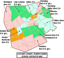
Swoyersville is a borough in Luzerne County, Pennsylvania, United States. The population was 5,062 at the 2010 census.[4] Swoyersville is located within the Wyoming Valley West School District.
History[]
The community was originally called Swoyerville; it was incorporated as a borough in 1888. The community was named after mine owner John Henry Swoyer. In the 1950s, the town held a special vote on whether to add an "s" to the borough's name. The measure passed and the borough became Swoyersville.
Coal mining was the chief industry in and around Swoyersville for most of the 19th and 20th centuries. The mines ceased production in the 1950s (after the Knox Mine Disaster). However, work continued at the colliery on Main Street (in Swoyersville) well into the 1960s. In 1972, the town was severely flooded by the Susquehanna River as a result of Hurricane Agnes. At the time, there was great concern that many of the flooded abandoned mine tunnels — running underneath Swoyersville — would cave-in. However, the cave-ins never occurred.
Geography[]
Swoyersville is located at 41°17′41″N 75°52′36″W / 41.294602°N 75.876684°W.[5] According to the United States Census Bureau, the borough has a total area of 2.1 square miles (5.5 km2), all of it land.
Swoyersville's terrain is flat in the south, with the northern part of the borough being hilly. The majority of the borough's land is urban, with some forest in the north.[6]
Demographics[]
| Historical population | |||
|---|---|---|---|
| Census | Pop. | %± | |
| 1900 | 2,264 | — | |
| 1910 | 5,396 | 138.3% | |
| 1920 | 6,876 | 27.4% | |
| 1930 | 9,133 | 32.8% | |
| 1940 | 9,234 | 1.1% | |
| 1950 | 7,795 | −15.6% | |
| 1960 | 6,751 | −13.4% | |
| 1970 | 6,786 | 0.5% | |
| 1980 | 5,795 | −14.6% | |
| 1990 | 5,630 | −2.8% | |
| 2000 | 5,157 | −8.4% | |
| 2010 | 5,062 | −1.8% | |
| 2019 (est.) | 5,009 | [3] | −1.0% |
| Sources:[7][8][9] | |||
As of the census[8] of 2000, there were 5,157 people, 2,243 households, and 1,484 families residing in the borough. The population density was 2,386.4 people per square mile (921.8/km2). There were 2,356 housing units at an average density of 1,090.3 per square mile (421.1/km2). The racial makeup of the borough was 99.22% White, 0.10% African American, 0.06% Native American, 0.16% Asian, 0.08% from other races, and 0.39% from two or more races. Hispanic or Latino of any race were 0.16% of the population.
There were 2,243 households, out of which 24.0% had children under the age of 18 living with them, 51.5% were married couples living together, 11.1% had a female householder with no husband present, and 33.8% were non-families. 31.0% of all households were made up of individuals, and 17.5% had someone living alone who was 65 years of age or older. The average household size was 2.30 and the average family size was 2.88.
In the borough the age distribution of the population shows 18.5% under the age of 18, 6.6% from 18 to 24, 26.7% from 25 to 44, 24.7% from 45 to 64, and 23.4% who were 65 years of age or older. The median age was 44 years. For every 100 females there were 89.4 males. For every 100 females age 18 and over, there were 86.4 males.
The median income for a household in the borough was $30,434, and the median income for a family was $39,188. Males had a median income of $29,101 versus $26,304 for females. The per capita income for the borough was $16,449. About 10.4% of families and 10.8% of the population were below the poverty line, including 19.3% of those under age 18 and 6.5% of those age 65 or over.
Notable people[]
- Adam Comorosky, Pittsburgh Pirates and Cincinnati Reds outfielder
- Harry Dorish, MLB pitcher with the Boston Red Sox, St. Louis Browns, Baltimore Orioles and Chicago White Sox
- Jim Hettes, UFC fighter
- Joe Holup, forward for the NBA's Syracuse Nationals and Detroit Pistons
- Lou Michaels, former kicker for the Baltimore Colts
- Walt Michaels, former head coach of the New York Jets
- Dick Mulligan, former Major League Baseball pitcher
- John Paluck, former DE with the Washington Redskins
- Packy Rogers, infielder with the Brooklyn Dodgers
- Steve Shemo, former Major League Baseball second baseman
- Fred Shupnik, former Democratic member of the Pennsylvania House of Representatives
- Chuck Sieminski, former American football player
References[]
- ^ "2019 U.S. Gazetteer Files". United States Census Bureau. Retrieved July 28, 2020.
- ^ "Swoyersville, Pennsylvania (PA 18704) profile: Population, maps, real estate, averages, homes, statistics, relocation, travel, jobs, hospitals, schools, crime, moving, houses, news, sex offenders".
- ^ Jump up to: a b "Population and Housing Unit Estimates". United States Census Bureau. May 24, 2020. Retrieved May 27, 2020.
- ^ "Profile of General Population and Housing Characteristics: 2010 Demographic Profile Data (DP-1): Swoyersville borough, Pennsylvania". United States Census Bureau. Retrieved April 13, 2012.
- ^ "US Gazetteer files: 2010, 2000, and 1990". United States Census Bureau. 2011-02-12. Retrieved 2011-04-23.
- ^ "Google Maps".
- ^ "Census of Population and Housing". U.S. Census Bureau. Retrieved 11 December 2013.
- ^ Jump up to: a b "U.S. Census website". United States Census Bureau. Retrieved 2008-01-31.
- ^ "Incorporated Places and Minor Civil Divisions Datasets: Subcounty Resident Population Estimates: April 1, 2010 to July 1, 2012". Population Estimates. U.S. Census Bureau. Archived from the original on 11 June 2013. Retrieved 11 December 2013.
External links[]
| show Municipalities and communities of Luzerne County, Pennsylvania, United States |
|---|

| show Authority control |
|---|
- Populated places established in 1888
- Boroughs in Luzerne County, Pennsylvania