Mogadore, Ohio
Mogadore, Ohio | |
|---|---|
 | |
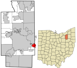 Location in Summit County and the state of Ohio. | |
| Coordinates: 41°3′8″N 81°23′50″W / 41.05222°N 81.39722°WCoordinates: 41°3′8″N 81°23′50″W / 41.05222°N 81.39722°W | |
| Country | United States |
| State | Ohio |
| Counties | Summit, Portage |
| Government | |
| • Mayor | Mike Rick |
| Area | |
| • Total | 2.16 sq mi (5.60 km2) |
| • Land | 2.14 sq mi (5.55 km2) |
| • Water | 0.02 sq mi (0.05 km2) |
| Elevation | 1,148 ft (350 m) |
| Population | |
| • Total | 3,853 |
| • Estimate (2019)[5] | 3,821 |
| • Density | 1,782.18/sq mi (688.25/km2) |
| Time zone | UTC-5 (Eastern (EST)) |
| • Summer (DST) | UTC-4 (EDT) |
| ZIP code | 44260 |
| Area code(s) | 330, 234 |
| FIPS code | 39-51058[4] |
| GNIS feature ID | 1077531[3] |


Mogadore (/ˈmɒɡədɔːr/ MOG-ə-dor) is a village in Portage and Summit counties in the U.S. state of Ohio. It is a suburb of Akron and is part of the Akron Metropolitan Statistical Area. The population was 3,853 at the 2010 census.
Geography[]
Mogadore is located at 41°3′8″N 81°23′50″W / 41.05222°N 81.39722°W (41.052256, -81.397241).[6]
According to the United States Census Bureau, the village has a total area of 2.11 square miles (5.46 km2), of which 2.09 square miles (5.41 km2) is land and 0.02 square miles (0.05 km2) is water.[7]
Demographics[]
| Historical population | |||
|---|---|---|---|
| Census | Pop. | %± | |
| 1910 | 438 | — | |
| 1920 | 751 | 71.5% | |
| 1930 | 1,502 | 100.0% | |
| 1940 | 1,616 | 7.6% | |
| 1950 | 1,818 | 12.5% | |
| 1960 | 3,851 | 111.8% | |
| 1970 | 4,825 | 25.3% | |
| 1980 | 4,190 | −13.2% | |
| 1990 | 4,008 | −4.3% | |
| 2000 | 3,893 | −2.9% | |
| 2010 | 3,853 | −1.0% | |
| 2019 (est.) | 3,821 | [5] | −0.8% |
| U.S. Decennial Census[8] | |||
2010 census[]
As of the census[2] of 2010, there were 3,853 people, 1,481 households, and 1,087 families living in the village. The population density was 1,843.5 inhabitants per square mile (711.8/km2). There were 1,565 housing units at an average density of 748.8 per square mile (289.1/km2). The racial makeup of the village was 97.6% White, 0.3% African American, 0.2% Native American, 0.3% Asian, 0.1% from other races, and 1.5% from two or more races. Hispanic or Latino of any race were 0.9% of the population.
There were 1,481 households, of which 33.2% had children under the age of 18 living with them, 55.9% were married couples living together, 13.1% had a female householder with no husband present, 4.4% had a male householder with no wife present, and 26.6% were non-families. 22.0% of all households were made up of individuals, and 10.7% had someone living alone who was 65 years of age or older. The average household size was 2.60 and the average family size was 3.00. The median age in the village was 41 years. 23% of residents were under the age of 18; 8.5% were between the ages of 18 and 24; 24.1% were from 25 to 44; 27.6% were from 45 to 64; and 16.9% were 65 years of age or older. The gender makeup of the village was 48.5% male and 51.5% female.
2000 census[]
As of the census[4] of 2000, there were 3,893 people, 1,485 households, and 1,125 families living in the village. The population density was 1,860.8 people per square mile (719.2/km2). There were 1,521 housing units at an average density of 727.0 per square mile (281.0/km2). The racial makeup of the village was 98.69% White, 0.18% African American, 0.05% Native American, 0.15% Asian, and 0.92% from two or more races. Hispanic or Latino of any race were 0.26% of the population.
There were 1,485 households, out of which 31.9% had children under the age of 18 living with them, 63.0% were married couples living together, 8.6% had a female householder with no husband present, and 24.2% were non-families. 21.0% of all households were made up of individuals, and 11.2% had someone living alone who was 65 years of age or older. The average household size was 2.61 and the average family size was 3.01.
In the village, the population umbrella was spread out, with 24.7% under the age of 18, 7.4% from 18 to 24, 28.2% from 25 to 44, 23.1% from 45 to 64, and 16.6% who were 65 years of age or older. The median age was 39 years. For every 100 females, there were 97.2 males. For every 100 females age 18 and over, there were 93.7 males.
The median income for a household in the village was $48,255, and the median income for a family was $53,393. Males had a median income of $36,513 versus $26,557 for females. The per capita income for the village was $20,965. About 2.6% of families and 3.6% of the population were below the poverty line, including 6.8% of those under age 18 and none of those age 65 or over.
Government[]
Mogadore is governed by a mayor and a 7-member council, all of whom are elected at-large to four-year terms.[9] The village also elects a clerk-treasurer to handle the finances of the village. All the elections are nonpartisan.[10]
Education[]
Mogadore Local School District operates one elementary school, one middle school, and Mogadore High School.[11]
Mogadore has a public library, a branch of the Akron-Summit County Public Library.[12]
See also[]
- List of U.S. cities in multiple counties
References[]
- ^ "2019 U.S. Gazetteer Files". United States Census Bureau. Retrieved July 28, 2020.
- ^ Jump up to: a b "U.S. Census website". United States Census Bureau. Retrieved 2013-01-06.
- ^ Jump up to: a b "US Board on Geographic Names". United States Geological Survey. 2007-10-25. Retrieved 2008-01-31.
- ^ Jump up to: a b "U.S. Census website". United States Census Bureau. Retrieved 2008-01-31.
- ^ Jump up to: a b "Population and Housing Unit Estimates". United States Census Bureau. May 24, 2020. Retrieved May 27, 2020.
- ^ "US Gazetteer files: 2010, 2000, and 1990". United States Census Bureau. 2011-02-12. Retrieved 2011-04-23.
- ^ "US Gazetteer files 2010". United States Census Bureau. Archived from the original on 2012-01-25. Retrieved 2013-01-06.
- ^ "Census of Population and Housing". Census.gov. Retrieved June 4, 2015.
- ^ http://www.mogadorevillage.org/index.php/council
- ^ http://summitcountyboe.com/WebApps/cnm.aspx
- ^ "Mogadore Local School District". GreatSchools. Retrieved 3 March 2018.
- ^ "Locations". Akron-Summit County Public Library. Retrieved 3 March 2018.
| show Municipalities and communities of Portage County, Ohio, United States |
|---|

| show Municipalities and communities of Summit County, Ohio, United States |
|---|

| show Authority control |
|---|
- Villages in Portage County, Ohio
- Villages in Ohio
- Villages in Summit County, Ohio
- Populated places on the Underground Railroad
- Populated places established in 1807