Mogwadi
Mogwadi
Dendron | |
|---|---|
 Mogwadi | |
| Coordinates: 23°22′05″S 29°19′23″E / 23.368°S 29.323°ECoordinates: 23°22′05″S 29°19′23″E / 23.368°S 29.323°E | |
| Country | South Africa |
| Province | Limpopo |
| District | Capricorn |
| Municipality | Molemole |
| Area | |
| • Total | 4.73 km2 (1.83 sq mi) |
| Population (2011)[1] | |
| • Total | 4,045 |
| • Density | 860/km2 (2,200/sq mi) |
| Racial makeup (2011) | |
| • Black African | 94.4% |
| • Coloured | 1.0% |
| • Indian/Asian | 0.4% |
| • White | 3.5% |
| • Other | 0.7% |
| First languages (2011) | |
| • Northern Sotho | 83.5% |
| • Afrikaans | 3.5% |
| • English | 2.9% |
| • Zulu | 2.1% |
| • Other | 8.1% |
| Time zone | UTC+2 (SAST) |
| Area code | 015 |


Mogwadi (formerly called Dendron) is a small town on the R521 road in the Capricorn District Municipality in the Limpopo province of South Africa.
Located about 61 km northwest of Polokwane. It was laid out on the farm Duitsland and then managed by a health committee. The former name is derived from the Greek word for ‘tree’ and refers to the abundance of indigenous trees in the area.[2]
References[]
- ^ a b c d "Main Place Mogwadi". Census 2011.
- ^ "Dictionary of Southern African Place Names (Public Domain)". Human Science Research Council. p. 134.
This Limpopo location article is a stub. You can help Wikipedia by . |
Municipalities and communities of Capricorn District Municipality, Limpopo | ||
|---|---|---|
District seat: Polokwane | ||
| Blouberg | 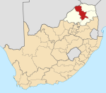 | |
| Molemole | ||
| Polokwane | ||
| Lepelle-Nkumpi | ||
Categories:
- Limpopo geography stubs
- Populated places in the Molemole Local Municipality