Setumong
Setumong | |
|---|---|
 Setumong | |
| Coordinates: 23°44′56″S 29°02′53″E / 23.749°S 29.048°ECoordinates: 23°44′56″S 29°02′53″E / 23.749°S 29.048°E | |
| Country | South Africa |
| Province | Limpopo |
| District | Capricorn |
| Municipality | Polokwane |
| Area | |
| • Total | 5.25 km2 (2.03 sq mi) |
| Elevation | 1,089 m (3,573 ft) |
| Population (2011)[1] | |
| • Total | 2,551 |
| • Density | 490/km2 (1,300/sq mi) |
| Racial makeup (2011) | |
| • Black African | 99.9% |
| First languages (2011) | |
| • Northern Sotho | 96.6% |
| • Tsonga | 1.5% |
| • Other | 1.9% |
| Time zone | UTC+2 (SAST) |
| Postal code (street) | 0748 |
| Area code | +27 (0)15 |


Setumong is a large village in the Polokwane Local Municipality of the Capricorn District Municipality in the Limpopo province of South Africa. It is the capital of the Ga-Matlala tribal chieftaincy and headquarters the Bakone Traditional Council. It located about 48 km northwest of the city of Polokwane on the Matlala Road.
Tradition[]
Setumong is an important center of tradition and culture in Ga-Matlala and the Aganang Local Municipality. The majority of the villages in the municipality belong to the Bakone Traditional Council; which, along with the traditional councils of Moletši and Ga-Mašašane, make up the municipal body of traditional affairs.[2]
Education[]
Notable people[]
- Kgoši - Chief Minister of the Bantustan of Lebowa from 1972-1973.
- Kgošigadi - Anti-Apartheid Chieftainess of Ga-Matlala.
References[]
- ^ a b c d "Main Place Setumong". Census 2011.
- ^ "Contents" (PDF). Aganang.gov.za. Retrieved 2016-05-21.
- ^ "Sekgwari Primary School in Setumong, Aganang Rural, Limpopo". Pathfinda.com. Retrieved 20 May 2016.
- ^ "Bakone Primary School in Setumong, Aganang Rural, Limpopo". Pathfinda.com. Retrieved 20 May 2016.
- ^ "BK Matlala Commercial High School". Schoolguide.co.za. Retrieved 20 May 2016.
Municipalities and communities of Capricorn District Municipality, Limpopo | ||
|---|---|---|
District seat: Polokwane | ||
| Blouberg | 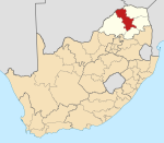 | |
| Molemole | ||
| Polokwane | ||
| Lepelle-Nkumpi | ||
Categories:
- Populated places in the Polokwane Local Municipality