Sebayeng
Sebayeng
Solomondale | |
|---|---|
 Sebayeng | |
| Coordinates: 23°53′06″S 29°43′05″E / 23.885°S 29.718°ECoordinates: 23°53′06″S 29°43′05″E / 23.885°S 29.718°E | |
| Country | South Africa |
| Province | Limpopo |
| District | Capricorn |
| Municipality | Polokwane |
| Area | |
| • Total | 6.92 km2 (2.67 sq mi) |
| Elevation | 1,086 m (3,563 ft) |
| Population (2011)[1] | |
| • Total | 13,826 |
| • Density | 2,000/km2 (5,200/sq mi) |
| Racial makeup (2011) | |
| • Black African | 99.6% |
| • Indian/Asian | 0.1% |
| • Other | 0.2% |
| First languages (2011) | |
| • Northern Sotho | 92.6% |
| • Tsonga | 3.0% |
| • Other | 4.4% |
| Time zone | UTC+2 (SAST) |
| Postal code (street) | 0964 |
| PO box | 0752 |
| Area code | +27 (0)15 |


Sebayeng is a township in the Polokwane Local Municipality of the Capricorn District Municipality of the Limpopo province of South Africa. It is located about 37 km east of the city of Polokwane on the R81 road.
Education[]
- Sebayeng Primary School.
- Mafolofolo High School.
References[]
- ^ a b c d "Main Place Sebayeng". Census 2011.
Municipalities and communities of Capricorn District Municipality, Limpopo | ||
|---|---|---|
District seat: Polokwane | ||
| Blouberg | 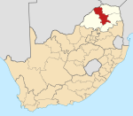 | |
| Molemole | ||
| Polokwane | ||
| Lepelle-Nkumpi | ||
Categories:
- Populated places in the Polokwane Local Municipality