Montcléra
Montcléra | |
|---|---|
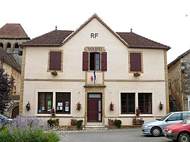 The town hall in Montcléra | |
show Location of Montcléra | |
 Montcléra | |
| Coordinates: 44°37′16″N 1°12′40″E / 44.6211°N 1.2111°ECoordinates: 44°37′16″N 1°12′40″E / 44.6211°N 1.2111°E | |
| Country | France |
| Region | Occitanie |
| Department | Lot |
| Arrondissement | Gourdon |
| Canton | Puy-l'Évêque |
| Intercommunality | Cazals-Salviac |
| Government | |
| • Mayor (2020–2026) | Guy Theulet |
| Area 1 | 20.91 km2 (8.07 sq mi) |
| Population (Jan. 2018)[1] | 267 |
| • Density | 13/km2 (33/sq mi) |
| Time zone | UTC+01:00 (CET) |
| • Summer (DST) | UTC+02:00 (CEST) |
| INSEE/Postal code | 46200 /46250 |
| Elevation | 154–311 m (505–1,020 ft) (avg. 239 m or 784 ft) |
| 1 French Land Register data, which excludes lakes, ponds, glaciers > 1 km2 (0.386 sq mi or 247 acres) and river estuaries. | |


Montcléra (French pronunciation: [mɔ̃kleʁa]) is a commune in the Lot department in south-western France.
See also[]
- Communes of the Lot department
References[]
- ^ "Populations légales 2018". INSEE. 28 December 2020.
| Wikimedia Commons has media related to Montcléra. |
| show Communes of the Lot department |
|---|
| show Authority control |
|---|
This Lot geographical article is a stub. You can help Wikipedia by . |
Categories:
- Communes of Lot (department)
- Lot (department) geography stubs