Municipality of Lovrenc na Pohorju
Municipality of Lovrenc na Pohorju
Občina Lovrenc na Pohorju | |
|---|---|
 | |
 Coat of arms | |
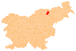 Location of the Municipality of Lovrenc na Pohorju in Slovenia | |
| Coordinates: 46°32′17″N 15°23′3″E / 46.53806°N 15.38417°ECoordinates: 46°32′17″N 15°23′3″E / 46.53806°N 15.38417°E | |
| Country | |
| Government | |
| • Mayor | Joško Manfreda |
| Area | |
| • Total | 84.4 km2 (32.6 sq mi) |
| Population (2013)[1] | |
| • Total | 3,096 |
| • Density | 37/km2 (95/sq mi) |
| Time zone | UTC+01 (CET) |
| • Summer (DST) | UTC+02 (CEST) |
| Website | www |

The Municipality of Lovrenc na Pohorju is a municipality in northeastern Slovenia. It lies in the Pohorje Hills to the west of Maribor. The area is part of the traditional region of Styria. It is now included in the Drava Statistical Region.[2] The settlement of Lovrenc na Pohorju is the seat of the municipality.
Settlements[]
In addition to the municipal seat of Lovrenc na Pohorju, the municipality also includes the following settlements:
- Činžat
- Kumen
- Puščava
- Rdeči Breg
- Recenjak
- Ruta
References[]
External links[]
 Media related to Municipality of Lovrenc na Pohorju at Wikimedia Commons
- Lovrenc na Pohorju municipal site
| show Places adjacent to Municipality of Lovrenc na Pohorju |
|---|

| Authority control |
|---|
This article about the Municipality of Lovrenc na Pohorju in Slovenia is a stub. You can help Wikipedia by . |
Categories:
- Municipalities of Slovenia
- Podravska statistical region geography stubs