Murdock Township, Douglas County, Illinois
Murdock Township | |
|---|---|
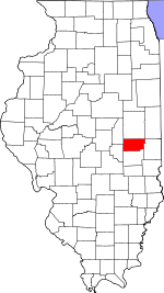
 Location in Douglas County | |
 Douglas County's location in Illinois | |
| Coordinates: 39°49′12″N 88°04′53″W / 39.82000°N 88.08139°WCoordinates: 39°49′12″N 88°04′53″W / 39.82000°N 88.08139°W | |
| Country | |
| State | |
| County | Douglas |
| Established | December 7, 1882 |
| Area | |
| • Total | 30.88 sq mi (80.0 km2) |
| • Land | 30.84 sq mi (79.9 km2) |
| • Water | 0.04 sq mi (0.1 km2) 0.13% |
| Elevation | 669 ft (204 m) |
| Population (2010) | |
| • Estimate (2016)[1] | 221 |
| • Density | 7.3/sq mi (2.8/km2) |
| Time zone | UTC-6 (CST) |
| • Summer (DST) | UTC-5 (CDT) |
| ZIP codes | 61852, 61919, 61941, 61942, 61956 |
| FIPS code | 17-041-51427 |

Murdock Township is one of nine townships in Douglas County, in the U.S. state of Illinois. As of the 2010 census, its population was 225 and it contained 126 housing units.[2] It was formed from Camargo and Newman townships on December 7, 1882.
Geography[]
According to the 2010 census, the township has a total area of 30.88 square miles (80.0 km2), of which 30.84 square miles (79.9 km2) (or 99.87%) is land and 0.04 square miles (0.10 km2) (or 0.13%) is water.[2]
Unincorporated towns[]
- Fairland at 39°52′35″N 88°06′06″W / 39.876422°N 88.101707°W
- Murdock at 39°48′03″N 88°04′42″W / 39.800867°N 88.078372°W
Cemeteries[]
The township contains these two cemeteries: Jordan and Murdock.
Major highways[]
Airports and landing strips[]
- Mayhall Airport
Demographics[]
| Historical population | |||
|---|---|---|---|
| Census | Pop. | %± | |
| 2016 (est.) | 221 | [1] | |
| U.S. Decennial Census[3] | |||
School districts[]
- Heritage Community Unit School District 8
- Shiloh Community Unit School District 1
- Villa Grove Community Unit School District 302
Political districts[]
- State House District 110
- State Senate District 55
References[]
- "Murdock Township, Douglas County, Illinois". Geographic Names Information System. United States Geological Survey. Retrieved 2010-01-17.
- United States Census Bureau 2009 TIGER/Line Shapefiles
- United States National Atlas
- ^ a b "Population and Housing Unit Estimates". Retrieved June 9, 2017.
- ^ a b "Population, Housing Units, Area, and Density: 2010 - County -- County Subdivision and Place -- 2010 Census Summary File 1". United States Census. Archived from the original on 2020-02-12. Retrieved 2013-05-28.
- ^ "Census of Population and Housing". Census.gov. Retrieved June 4, 2016.
External links[]
Places adjacent to Murdock Township, Douglas County, Illinois | |
|---|---|
Municipalities and communities of Douglas County, Illinois, United States | ||
|---|---|---|
| Cities | ||
| Villages | ||
| Townships | ||
| Unincorporated communities | ||
| Ghost town | ||
| Footnotes | ‡This populated place also has portions in an adjacent county or counties | |
| ||
Categories:
- Townships in Douglas County, Illinois
- Townships in Illinois