Tuscola Township, Douglas County, Illinois
Tuscola Township | |
|---|---|
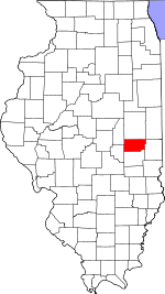
 Location in Douglas County | |
 Douglas County's location in Illinois | |
| Coordinates: 39°49′01″N 88°17′11″W / 39.81694°N 88.28639°WCoordinates: 39°49′01″N 88°17′11″W / 39.81694°N 88.28639°W | |
| Country | |
| State | |
| County | Douglas |
| Established | November 5, 1867 |
| Area | |
| • Total | 62.65 sq mi (162.3 km2) |
| • Land | 62.57 sq mi (162.1 km2) |
| • Water | 0.08 sq mi (0.2 km2) 0.13% |
| Elevation | 659 ft (201 m) |
| Population (2010) | |
| • Estimate (2016)[1] | 5,159 |
| • Density | 84.1/sq mi (32.5/km2) |
| Time zone | UTC-6 (CST) |
| • Summer (DST) | UTC-5 (CDT) |
| ZIP codes | 61910, 61919, 61953 |
| FIPS code | 17-041-76420 |

Tuscola Township is one of nine townships in Douglas County, Illinois, USA. As of the 2010 census, its population was 5,259 and it contained 2,459 housing units.[2]
Geography[]
According to the 2010 census, the township has a total area of 62.65 square miles (162.3 km2), of which 62.57 square miles (162.1 km2) (or 99.87%) is land and 0.08 square miles (0.21 km2) (or 0.13%) is water.[2]
Cities, towns, villages[]
Unincorporated towns[]
- Hayes at 39°51′45″N 88°16′52″W / 39.862532°N 88.281160°W
- Hillcrest at 39°47′08″N 88°16′47″W / 39.785588°N 88.279770°W
- at 39°47′24″N 88°16′31″W / 39.790032°N 88.275326°W
- North Prairie Acres at 39°48′40″N 88°16′20″W / 39.811143°N 88.272270°W
- at 39°48′25″N 88°16′38″W / 39.806976°N 88.277270°W
- at 39°48′32″N 88°17′07″W / 39.808921°N 88.285326°W
- at 39°47′22″N 88°17′05″W / 39.789476°N 88.284770°W
- at 39°49′33″N 88°13′01″W / 39.825865°N 88.21699°W
- at 39°48′21″N 88°16′35″W / 39.805865°N 88.276437°W
Cemeteries[]
The township contains these three cemeteries: Mount Zion, Nelson and Tuscola Township.
Major highways[]
Airports and landing strips[]
- Cooper Landing Field (historical)
- Tuscola Airport
Demographics[]
| Historical population | |||
|---|---|---|---|
| Census | Pop. | %± | |
| 2016 (est.) | 5,159 | [1] | |
| U.S. Decennial Census[3] | |||
School districts[]
- Tuscola Community Unit School District 301
- Villa Grove Community Unit School District 302
Political districts[]
- State House District 110
- State Senate District 55
References[]
- "Tuscola Township, Douglas County, Illinois". Geographic Names Information System. United States Geological Survey. Retrieved 2010-01-17.
- United States Census Bureau 2009 TIGER/Line Shapefiles
- United States National Atlas
- ^ a b "Population and Housing Unit Estimates". Retrieved June 9, 2017.
- ^ a b "Population, Housing Units, Area, and Density: 2010 - County -- County Subdivision and Place -- 2010 Census Summary File 1". United States Census. Archived from the original on 2020-02-12. Retrieved 2013-05-28.
- ^ "Census of Population and Housing". Census.gov. Retrieved June 4, 2016.
External links[]
Places adjacent to Tuscola Township, Douglas County, Illinois | |
|---|---|
Municipalities and communities of Douglas County, Illinois, United States | ||
|---|---|---|
| Cities | ||
| Villages | ||
| Townships | ||
| Unincorporated communities | ||
| Ghost town | ||
| Footnotes | ‡This populated place also has portions in an adjacent county or counties | |
| ||
Categories:
- Townships in Douglas County, Illinois
- Townships in Illinois