Garrett, Illinois
Garrett | |
|---|---|
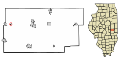 Location of Garrett in Douglas County, Illinois. | |
 Location of Illinois in the United States | |
| Coordinates: 39°47′52″N 88°25′31″W / 39.79778°N 88.42528°WCoordinates: 39°47′52″N 88°25′31″W / 39.79778°N 88.42528°W | |
| Country | |
| State | |
| County | Douglas |
| Township | Garrett |
| Area | |
| • Total | 0.11 sq mi (0.28 km2) |
| • Land | 0.11 sq mi (0.28 km2) |
| • Water | 0.00 sq mi (0.00 km2) |
| Elevation | 667 ft (203 m) |
| Population (2010) | |
| • Total | 162 |
| • Estimate (2019)[2] | 158 |
| • Density | 1,462.96/sq mi (566.94/km2) |
| Time zone | UTC-6 (CST) |
| • Summer (DST) | UTC-5 (CDT) |
| ZIP Code(s) | 61913 |
| Area code(s) | 217 |
| FIPS code | 17-28742 |
| Wikimedia Commons | Garrett, Illinois |

Garrett is a village in Douglas County, Illinois, United States. The population was 162 at the 2010 census.
Geography[]
Garrett is located at 39°47′52″N 88°25′31″W / 39.79778°N 88.42528°W (39.797915, -88.425360).[3]
According to the 2010 census, Garrett has a total area of 0.13 square miles (0.34 km2), all land.[4]
Demographics[]
| Historical population | |||
|---|---|---|---|
| Census | Pop. | %± | |
| 1910 | 290 | — | |
| 1920 | 270 | −6.9% | |
| 1930 | 236 | −12.6% | |
| 1940 | 252 | 6.8% | |
| 1950 | 213 | −15.5% | |
| 1960 | 249 | 16.9% | |
| 1970 | 224 | −10.0% | |
| 1980 | 205 | −8.5% | |
| 1990 | 169 | −17.6% | |
| 2000 | 198 | 17.2% | |
| 2010 | 162 | −18.2% | |
| 2019 (est.) | 158 | [2] | −2.5% |
| U.S. Decennial Census[5] | |||
As of the census[6] of 2000, there were 198 people, 76 households, and 52 families residing in the village. The population density was 1,422.9 people per square mile (546.1/km2). There were 81 housing units at an average density of 582.1 per square mile (223.4/km2). The racial makeup of the village was 98.48% White, and 1.52% from two or more races. Hispanic or Latino of any race were 2.53% of the population.
There were 76 households, out of which 40.8% had children under the age of 18 living with them, 43.4% were married couples living together, 13.2% had a female householder with no husband present, and 30.3% were non-families. 27.6% of all households were made up of individuals, and 14.5% had someone living alone who was 65 years of age or older. The average household size was 2.61 and the average family size was 3.02.
In the village, the population was spread out, with 34.8% under the age of 18, 5.1% from 18 to 24, 32.8% from 25 to 44, 15.2% from 45 to 64, and 12.1% who were 65 years of age or older. The median age was 35 years. For every 100 females, there were 104.1 males. For every 100 females age 18 and over, there were 104.8 males.
The median income for a household in the village was $29,375, and the median income for a family was $29,500. Males had a median income of $29,063 versus $20,096 for females. The per capita income for the village was $10,920. About 4.0% of families and 14.0% of the population were below the poverty line, including 17.5% of those under the age of eighteen and 23.5% of those 65 or over.
References[]
- ^ "2019 U.S. Gazetteer Files". United States Census Bureau. Retrieved July 14, 2020.
- ^ a b "Population and Housing Unit Estimates". United States Census Bureau. May 24, 2020. Retrieved May 27, 2020.
- ^ "US Gazetteer files: 2010, 2000, and 1990". United States Census Bureau. 2011-02-12. Retrieved 2011-04-23.
- ^ "G001 - Geographic Identifiers - 2010 Census Summary File 1". United States Census Bureau. Archived from the original on 2020-02-13. Retrieved 2015-08-03.
- ^ "Census of Population and Housing". Census.gov. Retrieved June 4, 2015.
- ^ "U.S. Census website". United States Census Bureau. Retrieved 2008-01-31.
Municipalities and communities of Douglas County, Illinois, United States | ||
|---|---|---|
| Cities | ||
| Villages | ||
| Townships | ||
| Unincorporated communities | ||
| Ghost town | ||
| Footnotes | ‡This populated place also has portions in an adjacent county or counties | |
| ||
- Villages in Douglas County, Illinois
- Villages in Illinois