Nelson, Victoria
| Nelson Victoria | |||||||||||||||
|---|---|---|---|---|---|---|---|---|---|---|---|---|---|---|---|
 The town's hotel | |||||||||||||||
 Nelson | |||||||||||||||
| Coordinates | 38°03′0″S 141°01′0″E / 38.05000°S 141.01667°ECoordinates: 38°03′0″S 141°01′0″E / 38.05000°S 141.01667°E | ||||||||||||||
| Population | 190 (2016 census)[1] | ||||||||||||||
| Postcode(s) | 3292 | ||||||||||||||
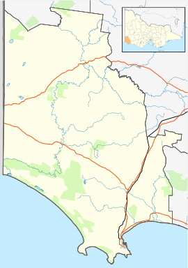
| Location |
| ||||||||||||||
| LGA(s) | Shire of Glenelg | ||||||||||||||
| State electorate(s) | South-West Coast | ||||||||||||||
| Federal division(s) | Wannon | ||||||||||||||
| |||||||||||||||
| Footnotes | Adjoining localities[2] | ||||||||||||||

Nelson is a small fishing town in Victoria, Australia on the lands of the Gunditjmara people. It is located at the mouth of the Glenelg River and Discovery Bay, a few kilometres from the South Australian border, and 422 kilometres (262 mi) west of Melbourne. At the 2016 census, Nelson and the surrounding area had a population of 190.[1]
In January 1852 the name of Nelson was adopted for the settlement, after the ship Lady Nelson, [3] [4] which was used by Lieutenant James Grant in explorations of the area in the early nineteenth century.
A punt was built across the river in 1848 by Henry Kellett. A summerhouse was also built in 1848, which later became the town's current hotel. The town site was surveyed and named in 1852 by Lindsay Clarke, and sheep grazing began soon after. Settlement of the township came much later, a Post Office being opened on 17 March 1876.[5]
The Portland-Nelson Road is the only main road in and out of Nelson and crosses the Glenelg at Nelson and is the only crossing for over 25 km. The first crossing over the Glenelg was constructed out of wood in 1893. It was replaced by a steel cantilever bridge in 1963. A second concrete cantilever bridge was added in 1997 on the north side of the steel bridge to cater for the demands of road freight travelling through the town.
Traditional ownership[]
The formally recognised traditional owners for the area in which Nelson sits are the Gunditjmara People[6] who are represented by the Gunditj Mirring Traditional Owners Aboriginal Corporation.[7]
Notes[]
- ^ a b Australian Bureau of Statistics (27 June 2017). "Nelson (State Suburb)". 2016 Census QuickStats. Retrieved 5 August 2007.

- ^ "Glenelg Shire town and rural districts names and boundaries" (PDF). Department of Environment, Land, Water and Planning, State Government of Victoria, Australia. Archived from the original (PDF) on 22 December 2016. Retrieved 3 September 2016.
- ^ Blake, Les (1977). Place names of Victoria. Adelaide: Rigby. p. 294. ISBN 0-7270-0250-3., cited in Bird (2006)
- ^ Bird, Eric (12 October 2006). "Place Names on the Coast of Victoria" (PDF). The Australian National Placename Survey (ANPS). Archived from the original (PDF) on 10 February 2011.
- ^ Premier Postal History. "Post Office List". Retrieved 11 April 2008.
- ^ "Map of formally recognised traditional owners". Aboriginal Victoria. Retrieved 2 June 2020.
- ^ "Gunditj Mirring Traditional Owners Aboriginal". Gunditj Mirring Traditional Owners Aboriginal Corporation. Retrieved 2 June 2020.
References[]
- Learmonth, Noel F. (1970). Four Towns and a Survey. Hawthorn Press: Melbourne
External links[]
![]() Media related to Nelson, Victoria at Wikimedia Commons
Media related to Nelson, Victoria at Wikimedia Commons
This article about a location in Barwon South West (region) is a stub. You can help Wikipedia by . |
- Towns in Victoria (Australia)
- Coastal towns in Victoria (Australia)
- Western District (Victoria)
- Fishing communities in Australia
- Barwon South West geography stubs