Nevado El Cisne
| Nevado El Cisne | |
|---|---|
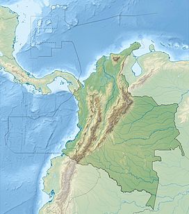 Nevado El Cisne Location of Nevado El Cisne in Colombia | |
| Highest point | |
| Elevation | 4,636 m (15,210 ft)[1] |
| Parent peak | Nevado del Ruiz |
| Listing | Los Nevados National Natural Park |
| Coordinates | 4°50′35″N 75°21′08″W / 4.84306°N 75.35222°WCoordinates: 4°50′35″N 75°21′08″W / 4.84306°N 75.35222°W[2] |
| Geography | |
| Location | Caldas & Tolima |
| Parent range | Central Ranges Andes |
| Geology | |
| Mountain type | Basaltic lava dome |
| Volcanic belt | North Volcanic Zone Andean Volcanic Belt |

The Nevado El Cisne (English: The Snowy Swan) is a volcano in the Central Ranges of the Andes in Colombia. Its summit is at an altitude of 4,636 metres (15,210 ft).[1] The mountain is one of the five lava domes of the Nevado del Ruiz volcano complex.[2] Despite the nevado part of the name, indicating a permanently snow-capped mountain, the summit of El Cisne is now below the permanent snow line as a result of global warming, and it is no longer considered a true nevado.[3] The volcano is located over the Palestina Fault, that crosscuts the underlying of Eocene age, dated at 49.1 ± 1.7 Ma.[4][5]
See also[]
References[]
- ^ a b Pollard, Peter (2000). Colombia Handbook (2nd ed.). Bath: Footprint Handbooks Limited. p. 297. ISBN 1-900949-71-7.
- ^ a b "Nevado del Ruiz: Synonyms and Subfeatures", Global Volcanism Program, Smithsonian Institution
- ^ "Ruiz-Tolima Volcanic Massif", US Geological Survey
- ^ Plancha 225, 1998
- ^ González, 2001, p.50
Bibliography[]
- . 2001. Geología de las planchas 206 Manizales y 225 Nevado del Ruiz - 1:100,000 - Memoria explicativa, 1–93. INGEOMINAS. Accessed 2017-06-09.
- ; ; , and . 1998. Plancha 225 - Nevado del Ruiz - 1:100,000, 1. INGEOMINAS. Accessed 2017-06-06.
| Western Ranges |  | |
|---|---|---|
| Central Ranges | ||
| Eastern Ranges | ||
| Other |
| |
| Source | ||
This Colombian location article is a stub. You can help Wikipedia by . |
Categories:
- Mountains of Colombia
- Volcanoes of Colombia
- Andean Volcanic Belt
- Quaternary Colombia
- Geography of Caldas Department
- Geography of Tolima Department
- Four-thousanders of the Andes
- Colombia geography stubs