Paipa-Iza volcanic complex
| Paipa–Iza volcanic complex | |
|---|---|
 View of Iza volcano from the east | |
| Highest point | |
| Elevation | 2,500–2,770 m (8,200–9,090 ft) |
| Parent peak | Altiplano Cundiboyacense |
| Coordinates | 5°36′25.7″N 72°59′40.4″W / 5.607139°N 72.994556°WCoordinates: 5°36′25.7″N 72°59′40.4″W / 5.607139°N 72.994556°W |
| Naming | |
| Native name | Complejo volcánico de Paipa–Iza (Spanish) |
| English translation | "cacique Paipa & place of healing" |
| Geography | |
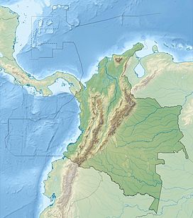 Paipa–Iza volcanic complex Location in Colombia | |
| Location | Paipa & Iza, Boyacá |
| Parent range | Eastern Ranges, Andes |
| Geology | |
| Age of rock | Plio-Pleistocene |
| Mountain type | Volcanic field |
| Type of rock | Porphyritic plagioclase and sanidine-rich rhyolites |
| Volcanic belt | Andean Volcanic Belt Northern Volcanic Zone |
| Last eruption | Early Pleistocene |
| Climbing | |
| First ascent | Precolumbian |
| Easiest route | Drive to Paipa or Iza |
| Access | Partially restricted (quarries) Thermal baths touristic attraction |

The Paipa–Iza volcanic complex is a volcanic field of Late Pliocene to Early Pleistocene age on the Altiplano Cundiboyacense in the Eastern Ranges of the Colombian Andes. It is the northernmost volcanic complex of the Andean Volcanic Belt with Fueguino in Tierra del Fuego, Chile, at the opposite end of the Andean mountain belt.
The complex, comprising mainly felsic extrusive volcanic rocks as rhyolites, also is the only confirmed volcanic province in the Eastern Ranges, with traces of probably contemporaneous explosive volcanic activity in the vicinity of Guatavita, Cundinamarca.
The Paipa-Iza volcanic field is important as a touristic site with thermal baths in both Paipa and Iza and is being studied for the potential of geothermal energy production and for the extraction of uranium in the area.
Etymology[]
The names Paipa and Iza originate in Muysccubun, the language of the indigenous Muisca, who inhabited the Altiplano Cundiboyacense before the Spanish conquest. Paipa was the name of a cacique who served under cacique Tundama of Duitama and Iza means "place of healing".[1]
Geography[]

The Paipa–Iza volcanic complex is located in the northern part of the Altiplano Cundiboyacense at altitudes between 2,500 and 2,770 metres (8,200 and 9,090 ft). The northwestern part of the complex is situated in the municipality Paipa and the southeastern part in Iza, both belonging to the department of Boyacá.
Climate[]
| | ||||||||||||||||||||||||||||||||||||||||||||||||||||||||||||
|---|---|---|---|---|---|---|---|---|---|---|---|---|---|---|---|---|---|---|---|---|---|---|---|---|---|---|---|---|---|---|---|---|---|---|---|---|---|---|---|---|---|---|---|---|---|---|---|---|---|---|---|---|---|---|---|---|---|---|---|---|
| Climate chart (explanation) | ||||||||||||||||||||||||||||||||||||||||||||||||||||||||||||
| ||||||||||||||||||||||||||||||||||||||||||||||||||||||||||||
| ||||||||||||||||||||||||||||||||||||||||||||||||||||||||||||
Paipa–Iza volcanic complex[]

The complex was active from the late Pliocene, around 2.7 Ma, until the earliest Pleistocene, around 2.3 Ma.[2][3][4][5]
The complex at Iza consists of two domes; Domo Holcim with 0.67 square kilometres (7,200,000 sq ft) and Domo Los Sauces 0.12 square kilometres (30 acres) in size. They consist of porphyritic rhyolites with sanidine and plagioclase as dominant mineral groups and abundant xenoliths of sedimentary rock and in minor quantities volcanic or metamorphic fragments. The overall rock composition is very felsic and comprises biotites and amphiboles as opaque minerals.[6]
Geothermal energy[]
The complex is studied for the potential of geothermal energy production.[7][8][9]
Resources[]
The complex is studied for the potential of uranium mining.[10][11]
Regional geology[]
Cretaceous[]
| Age | Paleomap | VMM | Guaduas-Vélez | W Emerald Belt | Villeta anticlinal | Chiquinquirá- Arcabuco |
Tunja- Duitama |
Altiplano Cundiboyacense | El Cocuy | ||||
|---|---|---|---|---|---|---|---|---|---|---|---|---|---|
| Maastrichtian |  |
eroded | Guaduas | ||||||||||
| Guadalupe | |||||||||||||
| Campanian | |||||||||||||
| Oliní | |||||||||||||
| Santonian | - | ||||||||||||
| Coniacian | Oliní | Conejo | Chipaque | ||||||||||
| Loma Gorda | undefined | La Frontera | |||||||||||
| Turonian |  |
Hondita | La Frontera | ||||||||||
| Cenomanian | hiatus | Simijaca | |||||||||||
| Pacho Fm. | Hiló - Pacho | Une | |||||||||||
| Albian |  |
Hiló | Une | ||||||||||
| Capotes - - | |||||||||||||
| Aptian | Capotes | Socotá - El Peñón | Paja | Fómeque | |||||||||
| Paja | Paja | El Peñón | Trincheras | ||||||||||
| La Naveta | |||||||||||||
| Barremian | 
| ||||||||||||
| Hauterivian | Las Juntas | ||||||||||||
| Rosablanca | Ritoque | ||||||||||||
| Valanginian | Ritoque | - Murca | Rosablanca | hiatus | Macanal | ||||||||
| Rosablanca | |||||||||||||
| Berriasian |  |
Guavio | |||||||||||
| Arcabuco | |||||||||||||
| Sources | |||||||||||||
See also[]
References[]
Bibliography[]
Geology[]
- ; , and . 2005. Pliocene volcanism in the Cordillera Oriental of Colombia, 411-412. 6th International Symposium on Andean Geodynamics (ISAG 2005, Barcelona). Accessed 2017-02-25.
- ; ; ; , and . 2011. Caracterización geológica del cuerpo volcánico de Iza, Boyacá - Colombia. Boletín de Geología 33. 117-130. Accessed 2017-02-25.
- , and . 1990. Características Petrográficas y Geoquímicas de las Rocas Volcánicas de Iza (Departamento de Boyacá, Colombia). 17. 159-168. Accessed 2017-02-25.
- , and . 2009. Geoquímica del domo volcánico en el municipio de Iza, Departamento de Boyacá; interpretación geodinámica y comparación con el vulcanismo neógeno de la Cordillera Oriental. Boletín de Geología 31. 97-108. Accessed 2017-02-25.
Geothermal[]
- ; ; , and . 2010. Preliminary Conceptual Model of the Paipa Geothermal System, Colombia, 1-7. Proceedings World Geothermal Congress 2010 Bali, Indonesia, 25-29 April 2010. Accessed 2017-02-25.
- ; ; , and . 2014. Geothermal development in Colombia, 1-7. Short Course VI on Utilization of Low- and Medium-Enthalpy Geothermal Resources and Financial Aspects of Utilization. Accessed 2017-02-25.
- , and . 2015. Contribution to the Knowledge of the Paipa Geothermal System by the Application of the Magnetotelluric Method, 1-6. Proceedings World Geothermal Congress 2015 Melbourne, Australia, 19-25 April 2015. Accessed 2017-02-25.
Resources[]
- . 2009a. Uranium exploration in Paipa and Iza area (Colombia), preliminary report of new contributions, 96-106. Uranium Raw Material for the Nuclear Fuel Cycle: Exploration, Mining, Production, Supply and Demand, Economics and Environmental Issues (URAM-2009). Proceedings of an International Symposium. Accessed 2017-02-25.
- . 2009b. Uranium exploration in Paipa and Iza area (Colombia), new contributions (preliminary report), 1-36. INGEOMINAS. Accessed 2017-02-25.
Maps[]
- , and . 2009. Plancha 171 - Duitama - 1:100,000, 1. INGEOMINAS. Accessed 2017-06-06.
- ; , and . 1998. Plancha 191 - Tunja - 1:100,000, 1. INGEOMINAS. Accessed 2017-06-06.
- , and . 2005. Planchas 171 & 191 - Geología sector del sur del municipio de Paipa (Boyacá) - 1:25,000. INGEOMINAS.
External links[]
- Volcanoes in the Eastern Ranges - Masmuisca.com
| Western Ranges |  | |
|---|---|---|
| Central Ranges | ||
| Eastern Ranges | ||
| Other |
| |
| Source | ||
- Volcanic fields
- Volcanoes of Colombia
- Andean Volcanic Belt
- Pliocene volcanoes
- Pliocene South America
- Neogene Colombia
- Pleistocene volcanoes
- Pleistocene Colombia
- Altiplano Cundiboyacense
- Geography of Boyacá Department
- Muysccubun