Cumbal Volcano
| Cumbal | |
|---|---|
| Volcán Cumbal | |
 Cumbal in 2011 | |
| Highest point | |
| Elevation | 4,764 m (15,630 ft) |
| Prominence | 1,575 m (5,167 ft) |
| Listing | Ultra |
| Coordinates | 0°56′56″N 77°53′17″W / 0.949°N 77.888°WCoordinates: 0°56′56″N 77°53′17″W / 0.949°N 77.888°W |
| Geography | |
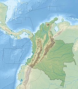 Cumbal Location of Cumbal in Colombia | |
| Location | Colombia |
| Parent range | Nudo de los Pastos, Western Ranges Andes |
| Geology | |
| Mountain type | Andesitic stratovolcano |
| Last eruption | December 1926 |

Cumbal is a stratovolcano of the Caribe Terrane, located at the Nudo de los Pastos in Nariño, Colombia. It is the southernmost historically active volcano of Colombia and is together with Chiles and Azufral one of the few volcanoes of the Western Ranges. The volcano is dominated by andesites.[1]
Plane crash[]
The volcano was the crash site of TAME Flight 120, which struck one of its sides while in a go-around approach to Tulcán on January 28, 2002. There were no survivors among the 94 occupants.
Gallery[]

1989

2007

Nudo de los Pastos


See also[]
References[]
| Wikimedia Commons has media related to Cumbal Volcano. |
- ^ Plancha 447-447bis, 2003
Bibliography[]
- , and . 2003. Plancha 447 Ipiales & 447bis Tallambí - 1:100,000, 1. INGEOMINAS. Accessed 2017-06-06.
External links[]
| show Treasures of Colombia |
|---|
| hide | ||
|---|---|---|
| Western Ranges |  | |
| Central Ranges | ||
| Eastern Ranges | ||
| Other |
| |
| Source | ||
This Colombian location article is a stub. You can help Wikipedia by . |
Categories:
- Andean Volcanic Belt
- Mountains of Colombia
- Stratovolcanoes of Colombia
- Quaternary South America
- Quaternary volcanoes
- 20th-century volcanic events
- Active volcanoes
- Geography of Nariño Department
- Four-thousanders of the Andes
- Colombia geography stubs