New Florence, Pennsylvania
New Florence, Pennsylvania | |
|---|---|
Borough | |
 Ligonier Street | |
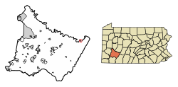 Location of New Florence in Westmoreland County, Pennsylvania. | |
 New Florence, Pennsylvania Location of New Florence in Westmoreland County, Pennsylvania. | |
| Coordinates: 40°22′47″N 79°04′29″W / 40.37972°N 79.07472°WCoordinates: 40°22′47″N 79°04′29″W / 40.37972°N 79.07472°W | |
| Country | United States |
| State | Pennsylvania |
| County | Westmoreland |
| Incorporated | May 27, 1865 |
| Government | |
| • Type | Borough Council |
| Area | |
| • Total | 0.33 sq mi (0.85 km2) |
| • Land | 0.33 sq mi (0.85 km2) |
| • Water | 0.00 sq mi (0.00 km2) |
| Elevation | 1,079 ft (329 m) |
| Population (2010) | |
| • Total | 689 |
| • Estimate (2019)[2] | 647 |
| • Density | 1,972.56/sq mi (762.38/km2) |
| Time zone | UTC-5 (Eastern (EST)) |
| • Summer (DST) | UTC-4 (EDT) |
| Zip code | 15944 |
| Area code(s) | 724, 814 |
| FIPS code | 42-53544 |

New Florence is a borough in Westmoreland County, Pennsylvania, United States. It was named for the city of Florence in Italy. The population was 689 as of the 2010 census, which is a decrease from 784 recorded by 2000 census. It is also one of three communities within the county to utilise the 814 area code, alongside St. Clair and Seward.
Geography[]
New Florence is located at 40°22′47″N 79°4′29″W / 40.37972°N 79.07472°W (40.379707, -79.074841).[3]
According to the United States Census Bureau, the borough has a total area of 0.4 square miles (1.0 km2), of which, 0.3 square miles (0.78 km2) of it is land and 0.04 square miles (0.10 km2) of it (5.56%) is water.
Surrounding and adjacent neighborhoods[]

New Florence is bordered by St. Clair Township to the east, south and west. Across the Conemaugh River in Indiana County to the north, New Florence runs adjacent with West Wheatfield Township and has a direct connector via 9th Street Bridge.
Demographics[]
| Historical population | |||
|---|---|---|---|
| Census | Pop. | %± | |
| 1870 | 333 | — | |
| 1880 | 531 | 59.5% | |
| 1890 | 683 | 28.6% | |
| 1900 | 800 | 17.1% | |
| 1910 | 717 | −10.4% | |
| 1920 | 730 | 1.8% | |
| 1930 | 796 | 9.0% | |
| 1940 | 864 | 8.5% | |
| 1950 | 924 | 6.9% | |
| 1960 | 958 | 3.7% | |
| 1970 | 929 | −3.0% | |
| 1980 | 855 | −8.0% | |
| 1990 | 854 | −0.1% | |
| 2000 | 784 | −8.2% | |
| 2010 | 689 | −12.1% | |
| 2019 (est.) | 647 | [2] | −6.1% |
| Sources:[4][5][6] | |||
As of the census[5] of 2000, there were 784 people, 331 households, and 225 families living in the borough. The population density was 2,242.4 people per square mile (864.9/km2). There were 365 housing units at an average density of 1,044.0 per square mile (402.6/km2). The racial makeup of the borough was 99.11% White, 0.13% Native American, 0.13% from other races, and 0.64% from two or more races. Hispanic or Latino of any race were 0.13% of the population.
There were 331 households, out of which 27.2% had children under the age of 18 living with them, 50.8% were married couples living together, 14.2% had a female householder with no husband present, and 32.0% were non-families. 29.9% of all households were made up of individuals, and 16.9% had someone living alone who was 65 years of age or older. The average household size was 2.37 and the average family size was 2.91.
In the borough the population was spread out, with 23.3% under the age of 18, 6.9% from 18 to 24, 24.5% from 25 to 44, 24.4% from 45 to 64, and 20.9% who were 65 years of age or older. The median age was 42 years. For every 100 females, there were 93.6 males. For every 100 females age 18 and over, there were 79.4 males.
The median income for a household in the borough was $24,688, and the median income for a family was $28,750. Males had a median income of $31,667 versus $19,792 for females. The per capita income for the borough was $13,449. About 19.3% of families and 21.6% of the population were below the poverty line, including 42.9% of those under age 18 and 7.2% of those age 65 or over.
References[]
| Wikimedia Commons has media related to New Florence, Pennsylvania. |
- ^ "2019 U.S. Gazetteer Files". United States Census Bureau. Retrieved July 28, 2020.
- ^ a b "Population and Housing Unit Estimates". United States Census Bureau. May 24, 2020. Retrieved May 27, 2020.
- ^ "US Gazetteer files: 2010, 2000, and 1990". United States Census Bureau. 2011-02-12. Retrieved 2011-04-23.
- ^ "Census of Population and Housing". U.S. Census Bureau. Retrieved 11 December 2013.
- ^ a b "U.S. Census website". United States Census Bureau. Retrieved 2008-01-31.
- ^ "Incorporated Places and Minor Civil Divisions Datasets: Subcounty Resident Population Estimates: April 1, 2010 to July 1, 2012". Population Estimates. U.S. Census Bureau. Archived from the original on 11 June 2013. Retrieved 11 December 2013.

Greater Pittsburgh Region | ||
|---|---|---|
| Counties |
|  Map of the Pittsburgh Tri-State with green counties in the metropolitan area and yellow counties in the combined area |
| Major cities |
| |
| Cities and towns 15k–50k (in 2010) |
| |
| Airports | ||
| Topics |
| |
| ||
- Boroughs in Westmoreland County, Pennsylvania
- Populated places established in 1865
- Pittsburgh metropolitan area
- 1865 establishments in Pennsylvania