Smithton, Pennsylvania
Smithton, Pennsylvania | |
|---|---|
Borough | |
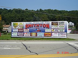 Smithton welcome sign | |
 Location of Smithton in Westmoreland County, Pennsylvania. | |
 Smithton Location of Smithton in Westmoreland County, Pennsylvania. | |
| Coordinates: 40°09′14″N 79°44′26″W / 40.15389°N 79.74056°WCoordinates: 40°09′14″N 79°44′26″W / 40.15389°N 79.74056°W | |
| Country | United States |
| State | Pennsylvania |
| County | Westmoreland |
| Incorporated | February 2, 1901 |
| Government | |
| • Type | Borough Council |
| • Mayor | [1] |
| Area | |
| • Total | 0.12 sq mi (0.30 km2) |
| • Land | 0.10 sq mi (0.26 km2) |
| • Water | 0.01 sq mi (0.04 km2) |
| Elevation | 810 ft (250 m) |
| Population (2010) | |
| • Total | 399 |
| • Estimate (2019)[3] | 373 |
| • Density | 3,656.86/sq mi (1,409.32/km2) |
| Time zone | UTC-5 (Eastern (EST)) |
| • Summer (DST) | UTC-4 (EDT) |
| Zip code | 15479 |
| FIPS code | 42-71424 |

Smithton is a borough in Westmoreland County, Pennsylvania, United States. The population was 399 at the 2010 census. As of 2018, the population was listed at 378.[4] Smithton has its own post office, with zip code 15479,[5] and is serviced by Yough School District.
History[]
Around 1801 a mill, known as Smith's Mill, was built at the location which became Smithton Borough.[6] The town was incorporated as a borough in 1901. Smithton's early industry was in coal mining, coke ovens, and the transportation of goods produced in the valley of Jacobs Creek.[7]
By 1906, four schools were located at Smithton, with 4 teachers serving 144 students.[8] William B. Jones (grandfather of actress Shirley Jones) founded The Jones Brewing Company at Smithton in 1907.[9] The company brewed Stoney's Beer in Smithton until 2002, when the brewing operation was moved to Latrobe, Pennsylvania.[10]
Geography[]
Smithton is located at 40°9′14″N 79°44′26″W / 40.15389°N 79.74056°W (40.153985, -79.740531).[11] The Youghiogheny River runs along Smithton's western limits. According to the United States Census Bureau, the borough has a total area of 0.1 square miles (0.26 km2), all of it land.
Surrounding neighborhoods[]
Smithton is completely surrounded by South Huntingdon Township. Tenaska Westmoreland Generating Station, a 946-megawatt power plant fueled by natural gas, is located near Smithton in South Huntington Township. Staffed by 24 employees, it became operational in 2018.[12]
Demographics[]
| Historical population | |||
|---|---|---|---|
| Census | Pop. | %± | |
| 1910 | 784 | — | |
| 1920 | 790 | 0.8% | |
| 1930 | 709 | −10.3% | |
| 1940 | 737 | 3.9% | |
| 1950 | 690 | −6.4% | |
| 1960 | 649 | −5.9% | |
| 1970 | 552 | −14.9% | |
| 1980 | 559 | 1.3% | |
| 1990 | 388 | −30.6% | |
| 2000 | 444 | 14.4% | |
| 2010 | 399 | −10.1% | |
| 2019 (est.) | 373 | [3] | −6.5% |
| Sources:[13][14][15] | |||
As of the census[14] of 2000, there were 444 people, 188 households, and 124 families residing in the borough. The population density was 3,858.5 people per square mile (1,428.6/km2). There were 208 housing units at an average density of 1,807.6 per square mile (669.2/km2). The racial makeup of the borough was 99.10% White, 0.23% Native American, and 0.68% from two or more races.
There were 188 households, out of which 29.3% had children under the age of 18 living with them, 52.1% were married couples living together, 11.7% had a female householder with no husband present, and 34.0% were non-families. 30.9% of all households were made up of individuals, and 17.0% had someone living alone who was 65 years of age or older. The average household size was 2.36 and the average family size was 2.94.
In the borough the population was spread out, with 24.3% under the age of 18, 6.1% from 18 to 24, 26.4% from 25 to 44, 24.1% from 45 to 64, and 19.1% who were 65 years of age or older. The median age was 39 years. For every 100 females, there were 90.6 males. For every 100 females age 18 and over, there were 86.7 males.
The median income for a household in the borough was $28,854, and the median income for a family was $36,250. Males had a median income of $26,667 versus $23,056 for females. The per capita income for the borough was $16,715. About 7.1% of families and 14.6% of the population were below the poverty line, including 22.0% of those under age 18 and 7.2% of those age 65 or over.

Government[]
Smithton has a small local government that consists of 7 (currently 6 active) Council members and a Mayor. Borough meetings are held on the 2nd Monday of each month.
The Smithton Borough Police Department has 8 sworn Police Officers, one full-time officer and 7 part-time officers, which patrol the town less than 40 hours per month in total.
Notable people[]
- Shirley Jones, actress
- Ryan Mitchell (wrestler), professional wrestler
- Hannah J. Patterson (1879–1937), suffragist
References[]
- ^ "Best wishes to new office holders". Valley Independent. 2010-01-06. Retrieved 2010-01-21.
- ^ "2019 U.S. Gazetteer Files". United States Census Bureau. Retrieved July 28, 2020.
- ^ Jump up to: a b "Population and Housing Unit Estimates". United States Census Bureau. May 24, 2020. Retrieved May 27, 2020.
- ^ http://population.us/pa/smithton/
- ^ "US Post Offices by Zip Code". Postmaster Finder. US Postal Service. Retrieved 27 August 2021.
- ^ Boucher, John N. (1906). History of Westmoreland County, Pennsylvania, Volume 1. New York: The Lewis Publishing Company. p. 224. Retrieved 27 August 2021.
- ^ "Our Towns: Smithton". Pittsburgh Post-Gazette. May 13, 2010.
- ^ Boucher op cit p. 425.
- ^ "Pittsburgh Post-Gazette op cit".
- ^ "History of Stoney's Beer". Retrieved 9 August 2011.
- ^ "US Gazetteer files: 2010, 2000, and 1990". United States Census Bureau. 2011-02-12. Retrieved 2011-04-23.
- ^ Proctor, Daniel (December 27, 2018). "Power: News & Technology for the Global Energy Industry". Retrieved 27 August 2021.
- ^ "Census of Population and Housing". U.S. Census Bureau. Retrieved 11 December 2013.
- ^ Jump up to: a b "U.S. Census website". United States Census Bureau. Retrieved 2008-01-31.
- ^ "Incorporated Places and Minor Civil Divisions Datasets: Subcounty Resident Population Estimates: April 1, 2010 to July 1, 2012". Population Estimates. U.S. Census Bureau. Archived from the original on 17 June 2013. Retrieved 11 December 2013.
| show Municipalities and communities of Westmoreland County, Pennsylvania, United States |
|---|

| show Greater Pittsburgh Region |
|---|

| show Authority control |
|---|
- Boroughs in Westmoreland County, Pennsylvania
- Populated places established in 1901
- Pittsburgh metropolitan area
- 1901 establishments in Pennsylvania