Niederschöneweide
Niederschöneweide | |
|---|---|
Quarter of Berlin | |
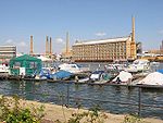
 View of the Bärenquell Brewery in Niederschöneweide | |
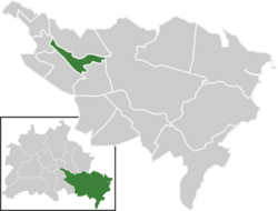
show Location of Niederschöneweide in Treptow-Köpenick and Berlin | |
 Niederschöneweide | |
| Coordinates: 52°27′22″N 13°30′47″E / 52.45611°N 13.51306°ECoordinates: 52°27′22″N 13°30′47″E / 52.45611°N 13.51306°E | |
| Country | Germany |
| State | Berlin |
| City | Berlin |
| Borough | Treptow-Köpenick |
| Founded | 1598 |
| Subdivisions | 1 zone |
| Area | |
| • Total | 3.49 km2 (1.35 sq mi) |
| Elevation | 34 m (112 ft) |
| Population (30 June 2008) | |
| • Total | 10,043 |
| • Density | 2,900/km2 (7,500/sq mi) |
| Time zone | UTC+01:00 (CET) |
| • Summer (DST) | UTC+02:00 (CEST) |
| Postal codes | (nr. 0905) 12439 |
| Vehicle registration | B |
| Website | Official website |


Niederschöneweide (German pronunciation: [ˈniːdərˈʃøːnəˈvaɪ̯də] (![]() listen), literally Lower Schöneweide) is a German locality (Ortsteil) within the Berlin borough (Bezirk) of Treptow-Köpenick. It is, with Oberschöneweide (Upper Schöneweide), part of the geographic quarter of . Until 2001 it was part of the former borough of Treptow.
listen), literally Lower Schöneweide) is a German locality (Ortsteil) within the Berlin borough (Bezirk) of Treptow-Köpenick. It is, with Oberschöneweide (Upper Schöneweide), part of the geographic quarter of . Until 2001 it was part of the former borough of Treptow.
History[]
First mentioned in 1598 as Schöne Weyde, it became an autonomous municipality in 1850, growing as an industrial town at the end of 19th century. In 1920 it merged into Berlin with the "Greater Berlin Act". Between 1949 and 1990 it was part of East Berlin, and new residential complexes were established at . All the industries on the territory were converted into Volkseigener Betrieb (VEB), the state-owned enterprises.[1] In 1994, after German reunification, it started a plan for a redevelopment of many contaminated grounds on many areas, inheritance of the heavy industrial era. They must be cleared away and detoxified with high costs.[2]
Geography[]
Overview[]
Located in the south-eastern side of the city and crossed by the river Spree, Niederschöneweide borders with the localities of Oberschöneweide, Plänterwald, Baumschulenweg, Johannisthal, Adlershof and Köpenick. A bit of the urban parks , situated in Adlershof, belongs to the quarter.
Subdivision[]
Niederschöneweide counts 1 zone (Ortslage):
Transport[]
As urban railways, Niederschöneweide is served both by S-Bahn and tramway lines. The railway stations serving the locality are Schöneweide (S45, S46, S47, S8, S85 and S9 lines+DB regional service), Johannisthal (S45, S46, S8, S85, S9) and Oberspree (S47). The tramway lines, crossing Brückenstraße and Michael-Brückner Straße, are the M17, 21, 27, 63 and 67.
Photogallery[]
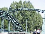
Industrial building over the Spree
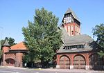
Old fire station
to Oberschöneweide

The Oberspree beach in 1970


Personalities[]
- Ernst Schneller (1890–1944)
References[]
- ^ (in German) Historical infos about Niederschöneweide
- ^ (in German) Infos about the requalification area on the official website
External links[]
![]() Media related to Niederschöneweide at Wikimedia Commons
Media related to Niederschöneweide at Wikimedia Commons
- (in German) Niederschöneweide official website
- (in German) Niederschöneweide page on www.berlin.de
| Authority control |
|---|
- Localities of Berlin
- Treptow-Köpenick