Nigaho Island
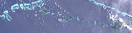 Satellite image | |
 Nigaho Island | |
| Geography | |
|---|---|
| Location | Oceania |
| Coordinates | 11°11′S 153°05′E / 11.183°S 153.083°ECoordinates: 11°11′S 153°05′E / 11.183°S 153.083°E[1] |
| Archipelago | Louisiade Archipelago |
| Adjacent bodies of water | Solomon Sea |
| Total islands | 1 |
| Major islands |
|
| Area | 0.11 km2 (0.042 sq mi) |
| Highest elevation | 20 m (70 ft) |
| Administration | |
| Province | |
| District | Samarai-Murua District |
| LLG[2] | |
| Island Group | Calvados Chain |
| Largest settlement | (pop. 226) |
| Demographics | |
| Population | 226 (2014) |
| Pop. density | 2,054/km2 (5320/sq mi) |
| Ethnic groups | Papauans, Austronesians, Melanesians. |
| Additional information | |
| Time zone | |
| ISO code | PG-MBA |
| Official website | www |

Nigaho Island is an island in Papua New Guinea, part of the Calvados Chain within the Louisiade Archipelago. Politically, it is in Pana Tinani Ward, not like the other Calvados Chain islands which all belong to the Calvados Chain Ward. It is the most densely populated island of the chain. It is the most eastern island of the chain.
References[]
This article about an island in Papua New Guinea is a stub. You can help Wikipedia by . |
Categories:
- Islands of Milne Bay Province
- Louisiade Archipelago
- Papua New Guinea island stubs