North Canton, Ohio
North Canton, Ohio | |
|---|---|
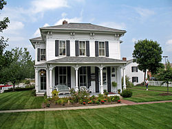 House at the | |
| Nickname(s): The Dogwood City | |
 Location of North Canton, Ohio | |
 Location of North Canton in Stark County | |
| Coordinates: 40°52′30″N 81°24′4″W / 40.87500°N 81.40111°WCoordinates: 40°52′30″N 81°24′4″W / 40.87500°N 81.40111°W | |
| Country | United States |
| State | Ohio |
| County | Stark |
| Government | |
| • Mayor | Stephan B. Wilder |
| Area | |
| • Total | 6.41 sq mi (16.60 km2) |
| • Land | 6.41 sq mi (16.60 km2) |
| • Water | 0.00 sq mi (0.00 km2) |
| Elevation | 1,161 ft (354 m) |
| Population | |
| • Total | 17,842 |
| • Density | 2,800/sq mi (1,100/km2) |
| Time zone | UTC-5 (Eastern (EST)) |
| • Summer (DST) | UTC-4 (EDT) |
| ZIP codes | 44709, 44720, 44799 |
| Area code(s) | 330 |
| FIPS code | 39-56294[4] |
| GNIS feature ID | 1065163[2] |
| Website | http://northcantonohio.gov/ |

North Canton is a city in Stark County in the U.S. state of Ohio, and is part of the Greater Cleveland area. The population was 17,842 at the 2020 United States Census. It is part of the Canton–Massillon metropolitan statistical area.
History[]
In 1831, the Community of North Canton first began as the Village of New Berlin. Residents were primarily of German descent. William H. “Boss” Hoover moved his tannery business from the family farm to the center of the North Canton village in 1873. In 1908, Hoover began manufacturing vacuum cleaners. During World War I, it became unfashionable to be associated with anything German so in 1918, the community changed the name of the village to North Canton.[5] The Hoover Company became the world's largest manufacturer of vacuum cleaners in 1933. The North Canton Jaycees were formed in 1951. In 2007, the Hoover Company officially shut down. The Hoover Company's old building was bought in 2010 for residential, educational, and recreational purposes. The old Hoover Company building was sold by sections in 2013 to be transformed into a mall and apartments.[6][7]
Geography[]
The West Branch of Nimishillen Creek flows through the city.[8]
According to the United States Census Bureau, the city has a total area of 6.40 square miles (16.58 km2), all land.[9]
Demographics[]
| Historical population | |||
|---|---|---|---|
| Census | Pop. | %± | |
| 1910 | 865 | — | |
| 1920 | 1,597 | 84.6% | |
| 1930 | 2,648 | 65.8% | |
| 1940 | 2,988 | 12.8% | |
| 1950 | 4,032 | 34.9% | |
| 1960 | 7,727 | 91.6% | |
| 1970 | 15,228 | 97.1% | |
| 1980 | 14,189 | −6.8% | |
| 1990 | 14,748 | 3.9% | |
| 2000 | 16,369 | 11.0% | |
| 2010 | 17,488 | 6.8% | |
| 2020 | 17,842 | 2.0% | |
| Sources:[10][4][11][12] | |||
2010 census[]
As of the census[3] of 2010, there were 17,488 people, 7,557 households, and 4,426 families living in the city. The population density was 2,732.5 inhabitants per square mile (1,055.0/km2). There were 8,078 housing units at an average density of 1,262.2 per square mile (487.3/km2). The racial makeup of the city was 94.8% White, 2.0% African American, 0.2% Native American, 1.1% Asian, 0.3% from other races, and 1.5% from two or more races. Hispanic or Latino of any race were 1.5% of the population.
There were 7,557 households, of which 23.9% had children under the age of 18 living with them, 46.2% were married couples living together, 9.2% had a female householder with no husband present, 3.1% had a male householder with no wife present, and 41.4% were non-families. 36.3% of all households were made up of individuals, and 17.2% had someone living alone who was 65 years of age or older. The average household size was 2.15 and the average family size was 2.82.
The median age in the city was 42.5 years. 18.6% of residents were under the age of 18; 12.2% were between the ages of 18 and 24; 21.8% were from 25 to 44; 25.8% were from 45 to 64; and 21.5% were 65 years of age or older. The gender makeup of the city was 46.3% male and 53.7% female.
Of the city's population over the age of 25, 34.3% hold a bachelor's degree or higher.[13]
2000 census[]
As of the census[4] of 2000 (jobs), there were 16,369 people, 7,114 households, and 4,382 families living in the city. The population density was 2,697.1 people per square mile (1,041.2/km2). There were 7,506 housing units at an average density of 1,236.8 per square mile (477.4/km2). The racial makeup of the city was 96.90% White, 1.12% African American, 0.07% Native American, 1.04% Asian, 0.18% from other races, and 0.69% from two or more races. Hispanic or Latino of any race were 0.82% of the population.
There were 7,114 households, out of which 23.5% had children under the age of 18 living with them, 51.7% were married couples living together, 7.5% had a female householder with no husband present, and 38.4% were non-families. 33.8% of all households were made up of individuals, and 15.2% had someone living alone who was 65 years of age or older. The average household size was 2.18 and the average family size was 2.80.
In the city, the population was spread out, with 19.3% under the age of 18, 9.5% from 18 to 24, 25.1% from 25 to 44, 23.6% from 45 to 64, and 22.6% who were 65 years of age or older. The median age was 42 years. For every 100 females, there were 87.5 males. For every 100 females age 18 and over, there were 83.1 males.
The median income for a household in the city was $42,013, and the median income for a family was $53,268. Males had a median income of $39,517 versus $29,250 for females. The per capita income for the city was $24,045. About 3.5% of families and 5.7% of the population were below the poverty line, including 7.7% of those under age 18 and 5.6% of those age 65 or over.
Education[]
Most students attend North Canton City Schools, which consists of Clearmount and Northwood elementary schools and Greentown and Orchard Hill intermediate schools, plus North Canton Middle School and North Canton Hoover High School. Students living in Jackson Township attend Jackson High School. Also in the city limits is St. Paul School,[14] that offers a private, parochial education, in the Catholic tradition, for students in grades K-8.
Walsh University is a private, Catholic university that offers undergraduate and graduate degrees. Enrollment is about 2,500. Men's and women's athletic teams are members of the NCAA Division II and Great Lakes Intercollegiate Athletic Conference.
Glenoak and Jackson Township also exist in the 44720 zip code.
Notable people[]
- Todd Blackledge, National Football League player and television sports analyst
- Joe DeRosa, an official in the National Basketball Association
- Jehu Grubb, pioneer settler and politician
- Diana Al-Hadid, Syrian-born American artist[15]
- Marty Lee Hoenes, rock musician
- Ray Kolp, Major League Baseball player
- Eddie McClintock, actor
- Tony Migliozzi, ultra-marathoner and 2015 IAU 50 km World Champion[16]
- Jeffrey Mylett, actor and songwriter
- Dick Snyder, National Basketball Association player
- Rabbit Warstler, Major League Baseball player
References[]
- ^ "2019 U.S. Gazetteer Files". United States Census Bureau. Retrieved July 28, 2020.
- ^ Jump up to: a b "US Board on Geographic Names". United States Geological Survey. 2007-10-25. Retrieved 2008-01-31.
- ^ Jump up to: a b "U.S. Census website". United States Census Bureau. Retrieved 2013-01-06.
- ^ Jump up to: a b c "U.S. Census website". United States Census Bureau. Retrieved 2008-01-31.
- ^ Ohio History Connection. (n.d.). New Berlin, Ohio. Retrieved from http://www.ohiohistorycentral.org/w/New_Berlin,_Ohio
- ^ North Canton Chamber Archived 2007-02-04 at the Wayback Machine
- ^ New Berlin, Ohio
- ^ DeLorme (1991). Ohio Atlas & Gazetteer. Yarmouth, Maine: DeLorme. ISBN 0-89933-233-1.
- ^ "US Gazetteer files 2010". United States Census Bureau. Archived from the original on 2012-07-02. Retrieved 2013-01-06.
- ^ "U.S. Census website". United States Census Bureau. Retrieved 2021-08-19.
- ^ "Number of Inhabitants: Ohio" (PDF). 18th Census of the United States. U.S. Census Bureau. 1960. Retrieved 17 May 2020.
- ^ "Ohio: Population and Housing Unit Counts" (PDF). U.S. Census Bureau. Retrieved 22 November 2013.
- ^ "Archived copy". Archived from the original on 2014-01-11. Retrieved 2014-01-11.CS1 maint: archived copy as title (link)
- ^ "St. Paul Campus". Holy Cross Academy Catholic Schools. Retrieved 30 November 2014.
- ^ The Akron Art Museum salutes Diana Al-Hadid, a Kent State grad in search of art world success - on her own terms | cleveland.com Retrieved 2018-06-08.
- ^ Strava Pro Runner Profile | Tony M. Retrieved 2018-06-08.
External links[]
| Wikivoyage has a travel guide for North Canton. |
| show Municipalities and communities of Stark County, Ohio, United States |
|---|

| show Authority control |
|---|
- Cities in Stark County, Ohio
- German-American culture in Ohio
- Cities in Ohio
- 1831 establishments in Ohio