Norwood, Louisiana
Norwood, Louisiana | |
|---|---|
Village | |
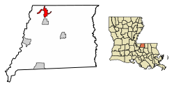 Location of Norwood in East Feliciana Parish, Louisiana. | |
 Location of Louisiana in the United States | |
| Coordinates: 30°58′10″N 91°06′20″W / 30.96944°N 91.10556°WCoordinates: 30°58′10″N 91°06′20″W / 30.96944°N 91.10556°W | |
| Country | United States |
| State | Louisiana |
| Parish | East Feliciana |
| Area | |
| • Total | 4.10 sq mi (10.62 km2) |
| • Land | 4.08 sq mi (10.58 km2) |
| • Water | 0.02 sq mi (0.04 km2) |
| Elevation | 312 ft (95 m) |
| Population (2010) | |
| • Total | 322 |
| • Estimate (2019)[2] | 291 |
| • Density | 71.27/sq mi (27.52/km2) |
| Time zone | UTC-6 (CST) |
| • Summer (DST) | UTC-5 (CDT) |
| Area code(s) | 225 |
| FIPS code | 22-56295 |

Norwood is a village in East Feliciana Parish, Louisiana, United States. The population was 322 at the 2010 census.[3] It is part of the Baton Rouge Metropolitan Statistical Area.
Geography[]
Norwood is located in northwestern East Feliciana Parish at 30°58′10″N 91°6′20″W / 30.96944°N 91.10556°W (30.969430, -91.105509).[4] Louisiana Highway 19 passes through the village, leading south 39 miles (63 km) to Baton Rouge and north 2 miles (3 km) to the Mississippi border. Centreville, Mississippi, is 9 miles (14 km) north of Norwood, and Clinton, the East Feliciana Parish seat, is 10 miles (16 km) to the southeast.
According to the United States Census Bureau, Norwood has a total area of 4.1 square miles (10.6 km2), of which 0.02 square miles (0.04 km2), or 0.40%, is water.[3]
Demographics[]
| Historical population | |||
|---|---|---|---|
| Census | Pop. | %± | |
| 1950 | 414 | — | |
| 1960 | 427 | 3.1% | |
| 1970 | 348 | −18.5% | |
| 1980 | 421 | 21.0% | |
| 1990 | 317 | −24.7% | |
| 2000 | 337 | 6.3% | |
| 2010 | 322 | −4.5% | |
| 2019 (est.) | 291 | [2] | −9.6% |
| U.S. Decennial Census[5] | |||
2020 census[]
| Race | Number | Percentage |
|---|---|---|
| White (non-Hispanic) | 217 | 77.78% |
| Black or African American (non-Hispanic) | 60 | 21.51% |
| Hispanic or Latino | 2 | 0.72% |
As of the 2020 United States census, there were 279 people, 127 households, and 71 families residing in the village.
2000 census[]
As of the census[7] of 2000, there were 337 people, 137 households, and 83 families residing in the village. The population density was 83.8 inhabitants per square mile (32.4/km2). There were 172 housing units at an average density of 42.8 per square mile (16.5/km2). The racial makeup of the village was 66.17% White, 33.23% African American, and 0.59% from two or more races. Hispanic or Latino of any race were 0.89% of the population.
There were 137 households, out of which 27.0% had children under the age of 18 living with them, 44.5% were married couples living together, 13.9% had a female householder with no husband present, and 39.4% were non-families. 37.2% of all households were made up of individuals, and 19.7% had someone living alone who was 65 years of age or older. The average household size was 2.46 and the average family size was 3.31.
In the village, the population was spread out, with 27.6% under the age of 18, 9.5% from 18 to 24, 25.2% from 25 to 44, 22.8% from 45 to 64, and 14.8% who were 65 years of age or older. The median age was 37 years. For every 100 females, there were 86.2 males. For every 100 females age 18 and over, there were 79.4 males.
The median income for a household in the village was $30,750, and the median income for a family was $45,714. Males had a median income of $30,000 versus $35,156 for females. The per capita income for the village was $16,003. About 7.6% of families and 16.4% of the population were below the poverty line, including 13.2% of those under age 18 and 17.1% of those age 65 or over.
Notable people[]
- Lawrence Brooks (1909-2022), the oldest American veteran of World War II, was born in Norwood.
Municipalities and communities of East Feliciana Parish, Louisiana, United States | ||
|---|---|---|
Parish seat: Clinton | ||
| Towns |  | |
| Villages | ||
| Unincorporated communities | ||
| ||
References[]
- ^ "2019 U.S. Gazetteer Files". United States Census Bureau. Retrieved July 25, 2020.
- ^ a b "Population and Housing Unit Estimates". United States Census Bureau. May 24, 2020. Retrieved May 27, 2020.
- ^ a b "Geographic Identifiers: 2010 Demographic Profile Data (G001): Norwood village, Louisiana". American Factfinder. U.S. Census Bureau. Archived from the original on February 13, 2020. Retrieved February 10, 2016.
- ^ "US Gazetteer files: 2010, 2000, and 1990". United States Census Bureau. 2011-02-12. Retrieved 2011-04-23.
- ^ "Census of Population and Housing". Census.gov. Retrieved June 4, 2015.
- ^ "Explore Census Data". data.census.gov. Retrieved 2021-12-28.
- ^ "U.S. Census website". United States Census Bureau. Retrieved 2008-01-31.
- Villages in Louisiana
- Villages in East Feliciana Parish, Louisiana
- Villages in Baton Rouge metropolitan area