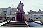
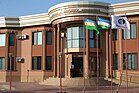
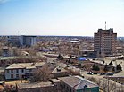
Nukus
Nukus
| |
|---|---|
      | |
 Seal | |
 Nukus Location in Uzbekistan | |
| Coordinates: 42°28′N 59°36′E / 42.467°N 59.600°ECoordinates: 42°28′N 59°36′E / 42.467°N 59.600°E | |
| Country | |
| Province | Karakalpakstan |
| Established | 1860 |
| Government | |
| • Type | City Administration |
| Area | |
| • Total | 222 km2 (86 sq mi) |
| Elevation | 76 m (249 ft) |
| Population (2021)[1] | |
| • Total | 325,100 |
| • Density | 1,500/km2 (3,800/sq mi) |
| Postal code | 2301xx |
| Area code(s) | (+998) 61 |
| Website | www |

Nukus (Uzbek: Nukus, Нукус; Karakalpak: Nókis, Нөкис; Kazakh: Núkis) is the sixth-largest city in Uzbekistan and the capital of the autonomous Republic of Karakalpakstan. The population of Nukus as of April 1, 2021 was approximately 325,100. The Amu Darya river passes west of the town.
The city is best known for its world-class Nukus Museum of Art.
History[]
The name Nukus comes from the old tribal name of the Karakalpaks, Nukus.[2] Nukus developed from a small settlement in 1932 into a large, modern Soviet city with broad avenues and big public buildings by the 1950s.
The city's isolation made it host to the Red Army's Chemical Research Institute, a major research and testing center for chemical weapons. In 2002 the United States Department of Defense dismantled the Chemical Research Institute, the major research and testing site for the Novichok agent, under a $6 million Cooperative Threat Reduction program.[3][4]
Turtkul city became the administrative center of the autonomous region of Karakalpakstan when the Soviet authorities came to power. However in the 20s, Amu Darya, which was 12 km from the River Bank, was threatened with the flush of Turtkul, which caused the core of Karakalpakstan to move towards Nukus. In 1932 the city was officially founded. It is the center of Karakalpakstan's economy, government, politics and culture.[5]
Sights[]

Nukus is host to the Nukus Museum of Art (also known as the State Art Museum of the Republic of Karakalpakstan, named after ) and State Museum. The State Museum houses the usual collection of artifacts recovered from archaeological investigations, traditional jewelry, costumes and musical instruments, displays of the area's now vanished or endangered flora and fauna, and on the Aral Sea issue. The Art Museum is noted for its collection of modern Russian and Uzbek art from 1918 to 1935. Stalin tried his best to eliminate all non Soviet art from this period, and sent most of the artists to the gulag.[citation needed] Both Savitsky himself and the collection at Nukus survived because the city's remoteness limited the influence and reach of Soviet authorities. The documentary film The Desert of Forbidden Art is all about the collection and its history.[6]
Nukus is also home to the Amet and Ayimkhan Shamuratovs house museum, a hub for Karakalpak music and oral culture. The museum's collection represents personal belongings of the Shamuratovs including stage clothes, photographs, manuscripts, books, letters.[7]
Climate[]
Nukus experiences a cold desert climate (Köppen BWk) with summers that are long, dry and very hot, and winters that are short, though quite cold and snowy, having a very dry type of a continental climate.
| hideClimate data for Nukus (1981–2010) | |||||||||||||
|---|---|---|---|---|---|---|---|---|---|---|---|---|---|
| Month | Jan | Feb | Mar | Apr | May | Jun | Jul | Aug | Sep | Oct | Nov | Dec | Year |
| Average high °C (°F) | 0.7 (33.3) |
4.0 (39.2) |
11.7 (53.1) |
21.7 (71.1) |
28.7 (83.7) |
34.5 (94.1) |
36.2 (97.2) |
34.3 (93.7) |
27.9 (82.2) |
19.4 (66.9) |
10.0 (50.0) |
3.1 (37.6) |
19.4 (66.9) |
| Average low °C (°F) | −7.5 (18.5) |
−6.0 (21.2) |
−0.1 (31.8) |
8.2 (46.8) |
14.2 (57.6) |
19.1 (66.4) |
21.3 (70.3) |
18.9 (66.0) |
12.0 (53.6) |
4.9 (40.8) |
−0.8 (30.6) |
−5.5 (22.1) |
6.6 (43.9) |
| Average precipitation mm (inches) | 10.8 (0.43) |
9.6 (0.38) |
17.1 (0.67) |
15.4 (0.61) |
12.2 (0.48) |
4.1 (0.16) |
2.7 (0.11) |
1.6 (0.06) |
2.4 (0.09) |
6.9 (0.27) |
12.5 (0.49) |
11.8 (0.46) |
107.1 (4.22) |
| Average precipitation days | 11 | 10 | 9 | 8 | 8 | 5 | 4 | 2 | 3 | 5 | 8 | 10 | 83 |
| Source: Centre of Hydrometeorological Service of Uzbekistan[8] | |||||||||||||
Economy[]
In 2019, “Nukus” free economic zone (FEZ) was established to "attract direct foreign and domestic investments for the production of import-substituting products that are in demand on foreign markets". This FEZ will be in place for 30 years.[9]
See also[]
References[]
- ^ Число постоянных жителей в Республике Каракалпакстан на 1 апреля 2021 года
- ^ Словарь современных географических названий. — Екатеринбург: У-Фактория. Под общей редакцией акад. В. М. Котлякова. 2006.
- ^ Miller, Judith (25 May 1999). "U.S. and Uzbeks Agree on Chemical Arms Plant Cleanup". New York Times. Retrieved 13 March 2018.
- ^ John S. Wolf (19 March 2003). "Hearing, First Session". Committee on Foreign Relations. United States Senate. Retrieved 13 March 2018.
Hon. John S. Wolf, Assistant Secretary of State for Nonproliferation: ... DOD completed a project to dismantle the former Soviet CW research facility at Nukus, Uzbekistan in FY 2002
- ^ "Nukus". Retrieved February 21, 2021.
- ^ Tom Bissell, Chasing the Sea, Pantheon (2003). ISBN 0-375-42130-0. p. 323–324.
- ^ "Nukus travel guide". Caravanistan. Retrieved 2019-12-02.
- ^ "Average monthly data about air temperature and precipitation in 13 regional centers of the Republic of Uzbekistan over period from 1981 to 2010". Centre of Hydrometeorological Service of the Republic of Uzbekistan (Uzhydromet). Archived from the original on 15 December 2019. Retrieved 15 December 2019.
- ^ "“Nukus” free economic zone established", Kun.uz September 5, 2019.
| Wikimedia Commons has media related to Nukus. |

| show Authority control |
|---|
- Nukus
- Populated places in Karakalpakstan
- Populated places established in 1932
- 1932 establishments in the Soviet Union