Ogawa, Nagano
Ogawa
小川村 | |
|---|---|
Village | |
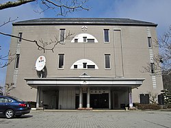 Ogawa Village Hall | |
 Flag  Seal | |
 Location of Ogawa in Nagano Prefecture | |
 Ogawa | |
| Coordinates: 36°37′2″N 137°58′29″E / 36.61722°N 137.97472°ECoordinates: 36°37′2″N 137°58′29″E / 36.61722°N 137.97472°E | |
| Country | Japan |
| Region | Chūbu (Kōshin'etsu) |
| Prefecture | Nagano |
| District | Kamiminochi |
| Area | |
| • Total | 58.11 km2 (22.44 sq mi) |
| Population (April 2019) | |
| • Total | 2,585 |
| • Density | 44/km2 (120/sq mi) |
| Time zone | UTC+9 (Japan Standard Time) |
| Symbols | |
| Phone number | 026-269-2323 |
| Address | 8800-8 Takafu, Ogawa-mura, Kamiminochi-gun, Nagano-ken 381-3302 |
| Website | Official website |


Ogawa (小川村, Ogawa-mura) is a village located in Nagano Prefecture, Japan. As of 1 April 2019, the village had an estimated population of 2,585 in 1074 households,[1] and a population density of 44 persons per km². The total area of the village is 58.11 square kilometres (22.44 sq mi). Ogawa is listed as one of The Most Beautiful Villages in Japan.[2]
Geography[]
Ogawa is located in the mountains of northwestern Nagano Prefecture.
Surrounding municipalities[]
- Nagano Prefecture
- Nagano
- Ōmachi
- Hakuba
Demographics[]
Per Japanese census data,[3] the population of Ogawa has declined over the past 60 years.
| Year | Pop. | ±% |
|---|---|---|
| 1940 | 8,846 | — |
| 1950 | 9,436 | +6.7% |
| 1960 | 8,283 | −12.2% |
| 1970 | 6,163 | −25.6% |
| 1980 | 5,132 | −16.7% |
| 1990 | 4,133 | −19.5% |
| 2000 | 3,620 | −12.4% |
| 2010 | 3,046 | −15.9% |
Climate[]
The village has a humid continental climate characterized by short, hot and humid summers, and cold winters with heavy snowfall (Köppen climate classification Cfa). The average annual temperature in Ogawa is 10.3 °C. The average annual rainfall is 1273 mm with September as the wettest month. The temperatures are highest on average in August, at around 23.8 °C, and lowest in January, at around -2.3 °C.[4]
History[]
The area of present-day Ogawa was part of ancient Shinano Province. The villages of Kita-Ogawa and Minami-Ogawa were created with the establishment of the modern municipalities system on April 1, 1889. The two villages merged to form the village of Ogawa on April 1, 1955.
Economy[]
The economy of Ogawa is agricultural, primarily rice cultivation and horticulture.
Education[]
Ogawa has one public elementary school and one public middle school operated by the village government. The village does not have a high school.
Transportation[]
Railway[]
- Ogawa does not have any passenger railway service.
Highway[]
Local attractions[]
- Furusato Land Ogawa, local history museum
References[]
- ^ Ogawa Village official statistics(in Japanese)
- ^ The Most Beautiful Villages in Japan Archived 2015-02-15 at the Wayback Machine (in Japanese)
- ^ Ogawa population statistics
- ^ Ogawa climate data
External links[]
 Media related to Ogawa, Nagano at Wikimedia Commons
- Official Website (in Japanese)
| show Authority control |
|---|
This Nagano Prefecture location article is a stub. You can help Wikipedia by . |
- Ogawa, Nagano
- Villages in Nagano Prefecture
- Nagano geography stubs