Azumino
Azumino
安曇野市 | |
|---|---|
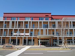 Azumino City Hall | |
 Flag  Seal | |
 Location of Azumino in Nagano Prefecture | |
 Azumino | |
| Coordinates: 36°18′14.17″N 137°54′20.81″E / 36.3039361°N 137.9057806°ECoordinates: 36°18′14.17″N 137°54′20.81″E / 36.3039361°N 137.9057806°E | |
| Country | Japan |
| Region | Chūbu (Kōshin'etsu) |
| Prefecture | Nagano |
| Government | |
| • Mayor | Munehiro Miyazawa |
| Area | |
| • Total | 331.78 km2 (128.10 sq mi) |
| Population (March 2019) | |
| • Total | 97,800 |
| • Density | 290/km2 (760/sq mi) |
| Time zone | UTC+9 (Japan Standard Time) |
| Symbols | |
| • Tree | Zelkova serrata |
| • Flower | Wasabi |
| Phone number | 0263-71-2000 |
| Address | 4932-26 Toyoshina, Azumino-shi, Nagano-ken 399-8205 |
| Website | Official website |


Azumino (安曇野市, Azumino-shi) is a city located in Nagano Prefecture, Japan. As of 1 March 2019, the city had an estimated population of 97,761 in 39744 households.[1] and a population density of 290 persons per km². Its total area is 331.78 square kilometres (128.10 sq mi).
Etymology of Azumino[]
Azumino is a combination of two words, "Azumi" and "no". "Azumi" comes from the Azumi people, who are said to have moved to the "no" (plain) in ancient times. The Azumi people originally lived in northern Kyushu, and were famed for their skills in fishing and navigation. "The Azumi people" can be translated as "the people who live on the sea." The reason why the seafaring people migrated to this mountainous region is a mystery.
Geography[]
Azumino is located in the Azumino Plateau on the northwestern end of the Matsumoto Basin, between mountain ranges to the west and east. The range of mountains on the western border is known as the Northern Alps (Hida Mountains) and is popular among hikers all over Japan. To the south is the city of Matsumoto, Nagano prefecture's second largest city. To the north lies the city of Ōmachi, and north of Ōmachi is the village of Hakuba. Hakuba was the site of many of the ski events during the 1998 Winter Olympic Games. Mount Jōnen at 2,857 metres (9,373 ft) is the highest elevation in the city.
Surrounding municipalities[]
Demographics[]
Per Japanese census data,[2] the population of Azumino has increased rapidly over the past 40 years.
| Year | Pop. | ±% |
|---|---|---|
| 1960 | 66,564 | — |
| 1970 | 65,690 | −1.3% |
| 1980 | 75,209 | +14.5% |
| 1990 | 83,154 | +10.6% |
| 2000 | 92,864 | +11.7% |
| 2010 | 96,461 | +3.9% |
Climate[]
The city has a climate characterized by characterized by hot and humid summers, and relatively mild winters (Köppen climate classification Cfa). The average annual temperature in Azumino is 11.2 °C. The average annual rainfall is 1192 mm with September as the wettest month. The temperatures are highest on average in August, at around 24.4 °C, and lowest in January, at around -1.3 °C.[3] The mountainous portions of the city are considered part of the snow country of Japan, with heavy accumulations of snow in winter.
| Azumino city min/max temperature & rainfall | ||||||||||||||||||||||||||||||||||||||||||||||||||||||||||||
|---|---|---|---|---|---|---|---|---|---|---|---|---|---|---|---|---|---|---|---|---|---|---|---|---|---|---|---|---|---|---|---|---|---|---|---|---|---|---|---|---|---|---|---|---|---|---|---|---|---|---|---|---|---|---|---|---|---|---|---|---|
| Climate chart (explanation) | ||||||||||||||||||||||||||||||||||||||||||||||||||||||||||||
| ||||||||||||||||||||||||||||||||||||||||||||||||||||||||||||
| ||||||||||||||||||||||||||||||||||||||||||||||||||||||||||||
History[]
The area of present-day Azumino was part of ancient Shinano Province. The area was part of the holdings of Matsumoto Domain during the Edo period. The modern city of Azumino was established on October 1, 2005 by the merger of the town of Akashina (from Higashichikuma District), the towns of Hotaka and Toyoshina, and the villages of Horigane and Misato (all from Minamiazumi District).
Government[]
Azumino has a mayor-council form of government with a directly elected mayor and a unicameral city legislature of 22 members.
Education[]
Azumino has ten public elementary schools and seven public middle schools. The city has four public high schools operated by the Nagano Prefectural Board of Education.
Transportation[]
Railway[]
 East Japan Railway Company - Ōito Line
- Azusabashi - Hitoichiba - Nakagaya - Minami-Toyoshina - Toyoshina - Hakuyachō - Hotaka - Ariake - Azumi-Oiwake
- East Japan Railway Company - Shinonoi Line
Highway[]
Sister cities[]
Domestic[]
- Misato, Saitama, Saitama Prefecture
- Edogawa, Tokyo
- Musashino, Tokyo
- Manazuru, Kanagawa
- Sangō, Nara
- Higashi-ku, Fukuoka
International[]
 - Kramsach, Austria, since November 25, 1993 [4]
 - Collierville, Tennessee, United states
Local attractions[]

- Azumino is home to the world's largest wasabi farm, Daio Wasabi Farm.[5]
- Jōkyō Gimin Memorial Museum
Notable people from Azumino[]
- (1835–1905), artist & educator
- (1870–1938), educator
- Kiyoshi Kiyosawa (1890–1945), journalist
- Kei Kumai (1930–2007), film director
- (1855–1887), people's rights activist
- (1890–1974), philosopher
- Rokuzan Ogiwara (1879–1910), sculptor
- Aizō Sōma (1870–1954), founded Nakamuraya
- Tada Kasuke (?–1687), executed farmer
- (1914–2007), lacquerware artist
- Etsujirō Uehara (1877–1962), political scientist & politician
- Yoshimi Usui (1905–1987), editor & writer
- Masaaki Iinuma (1912–1941), pilot & aviation pioneer
References[]
- ^ Azuminio city official statistics(in Japanese)
- ^ Azumino population statistics
- ^ Azumino climate data
- ^ Azumino city official hoe page Archived 2017-03-08 at the Wayback Machine(in Japanese)
- ^ "Archived copy". Archived from the original on 2016-04-08. Retrieved 2014-02-21.CS1 maint: archived copy as title (link)
External links[]
| Wikivoyage has a travel guide for Azumino. |
![]() Media related to Azumino, Nagano at Wikimedia Commons
Media related to Azumino, Nagano at Wikimedia Commons
- Official Website (in Japanese)
| show Authority control |
|---|
- Azumino, Nagano
- Cities in Nagano Prefecture