Ogden, Kansas
Ogden, Kansas | |
|---|---|
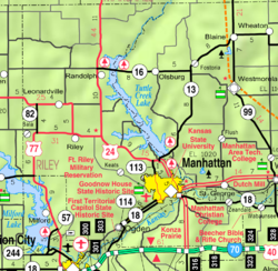
 Location of Ogden, Kansas | |
 | |
| Coordinates: 39°6′47″N 96°42′34″W / 39.11306°N 96.70944°WCoordinates: 39°6′47″N 96°42′34″W / 39.11306°N 96.70944°W | |
| Country | United States |
| State | Kansas |
| County | Riley |
| Area | |
| • Total | 1.73 sq mi (4.48 km2) |
| • Land | 1.67 sq mi (4.33 km2) |
| • Water | 0.06 sq mi (0.15 km2) |
| Elevation | 1,043 ft (318 m) |
| Population | |
| • Total | 2,087 |
| • Estimate (2019)[3] | 1,958 |
| • Density | 1,170.35/sq mi (451.78/km2) |
| Time zone | UTC-6 (CST) |
| • Summer (DST) | UTC-5 (CDT) |
| ZIP code | 66517 |
| Area code | 785 |
| FIPS code | 20-52275 [4] |
| GNIS ID | 476571 [5] |
| Website | ogden-ks.gov |

Ogden is a city in Riley County, Kansas, United States. As of the 2010 census, the city population was 2,087.[6]
History[]
Ogden was founded about 1857.[7] It was named for Major E. A. Ogden of the Army Corps of Engineers, a leader in building Fort Riley nearby.[8][9][10] Ogden was incorporated as a city in 1870.[7]
Geography[]
Ogden is located at 39°6′47″N 96°42′34″W / 39.11306°N 96.70944°W (39.113103, -96.709359).[11] According to the United States Census Bureau, the city has a total area of 1.66 square miles (4.30 km2), of which, 1.61 square miles (4.17 km2) is land and 0.05 square miles (0.13 km2) is water.[12]
Climate[]
The climate in this area is characterized by hot, humid summers and generally mild to cool winters. According to the Köppen Climate Classification system, Ogden has a humid subtropical climate, abbreviated "Cfa" on climate maps.[13]
Demographics[]
| Historical population | |||
|---|---|---|---|
| Census | Pop. | %± | |
| 1890 | 173 | — | |
| 1900 | 232 | 34.1% | |
| 1910 | 230 | −0.9% | |
| 1920 | 596 | 159.1% | |
| 1930 | 418 | −29.9% | |
| 1940 | 494 | 18.2% | |
| 1950 | 845 | 71.1% | |
| 1960 | 1,780 | 110.7% | |
| 1970 | 1,491 | −16.2% | |
| 1980 | 1,804 | 21.0% | |
| 1990 | 1,494 | −17.2% | |
| 2000 | 1,762 | 17.9% | |
| 2010 | 2,087 | 18.4% | |
| 2019 (est.) | 1,958 | [3] | −6.2% |
| U.S. Decennial Census[14] | |||
Ogden is part of the Manhattan, Kansas Metropolitan Statistical Area.
2010 census[]
As of the census[2] of 2010, there were 2,087 people, 823 households, and 551 families living in the city. The population density was 1,296.3 inhabitants per square mile (500.5/km2). There were 992 housing units at an average density of 616.1 per square mile (237.9/km2). The racial makeup of the city was 76.8% White, 11.2% African American, 1.2% Native American, 1.7% Asian, 0.2% Pacific Islander, 2.6% from other races, and 6.2% from two or more races. Hispanic or Latino of any race were 9.4% of the population.
There were 823 households, of which 43.3% had children under the age of 18 living with them, 48.4% were married couples living together, 13.4% had a female householder with no husband present, 5.2% had a male householder with no wife present, and 33.0% were non-families. 27.0% of all households were made up of individuals, and 3.6% had someone living alone who was 65 years of age or older. The average household size was 2.54 and the average family size was 3.08.
The median age in the city was 26.5 years. 30.6% of residents were under the age of 18; 14.2% were between the ages of 18 and 24; 35.1% were from 25 to 44; 15.7% were from 45 to 64; and 4.3% were 65 years of age or older. The gender makeup of the city was 50.7% male and 49.3% female.
2000 census[]
As of the census[4] of 2000, there were 1,762 people, 690 households, and 462 families living in the city. The population density was 2,337.8 people per square mile (907.1/km2). There were 851 housing units at an average density of 1,129.1 per square mile (438.1/km2). The racial makeup of the city was 76.16% White, 12.26% African American, 0.68% Native American, 2.10% Asian, 0.17% Pacific Islander, 3.01% from other races, and 5.62% from two or more races. Hispanic or Latino of any race were 7.89% of the population.
There were 690 households, out of which 41.3% had children under the age of 18 living with them, 52.3% were married couples living together, 12.0% had a female householder with no husband present, and 32.9% were non-families. 27.0% of all households were made up of individuals, and 5.1% had someone living alone who was 65 years of age or older. The average household size was 2.55 and the average family size was 3.12.
In the city, the population was spread out, with 32.0% under the age of 18, 14.4% from 18 to 24, 34.7% from 25 to 44, 13.1% from 45 to 64, and 5.9% who were 65 years of age or older. The median age was 27 years. For every 100 females, there were 102.8 males. For every 100 females age 18 and over, there were 95.6 males.
The median income for a household in the city was $26,750, and the median income for a family was $31,375. Males had a median income of $25,463 versus $19,471 for females. The per capita income for the city was $12,287. About 17.5% of families and 17.6% of the population were below the poverty line, including 17.1% of those under age 18 and 9.2% of those age 65 or over.
Education[]
The community is served by Manhattan-Ogden USD 383 public school district. A fraction of northeast Ogden is served by Geary County USD 475.
See also[]
References[]
- ^ "2019 U.S. Gazetteer Files". United States Census Bureau. Retrieved July 24, 2020.
- ^ Jump up to: a b "U.S. Census website". United States Census Bureau. Retrieved 2012-07-06.
- ^ Jump up to: a b "Population and Housing Unit Estimates". United States Census Bureau. May 24, 2020. Retrieved May 27, 2020.
- ^ Jump up to: a b "U.S. Census website". United States Census Bureau. Retrieved 2008-01-31.
- ^ "US Board on Geographic Names". United States Geological Survey. 2007-10-25. Retrieved 2008-01-31.
- ^ "2010 City Population and Housing Occupancy Status". U.S. Census Bureau. Retrieved March 6, 2011.[dead link]
- ^ Jump up to: a b Blackmar, Frank Wilson (1912). Kansas: A Cyclopedia of State History, Volume 2. Standard Publishing Company. pp. 384.
- ^ "Profile for Ogden, Kansas". ePodunk. Archived from the original on 14 May 2019. Retrieved 22 June 2014.
- ^ Heim, Michael (2007). Exploring Kansas Highways. p. 41.
- ^ Kansas State Historical Society (1916). Biennial Report of the Board of Directors of the Kansas State Historical Society. Kansas State Printing Plant. pp. 275.
- ^ "US Gazetteer files: 2010, 2000, and 1990". United States Census Bureau. 2011-02-12. Retrieved 2011-04-23.
- ^ "US Gazetteer files 2010". United States Census Bureau. Archived from the original on January 12, 2012. Retrieved 2012-07-06.
- ^ Climate Summary for Ogden, Kansas
- ^ United States Census Bureau. "Census of Population and Housing". Retrieved August 21, 2014.
External links[]
| hide Municipalities and communities of Riley County, Kansas, United States | ||
|---|---|---|
| Cities |  | |
| Unincorporated communities | ||
| Footnotes | †This populated place is designated a Census-Designated Place (CDP) by the United States Census Bureau. ‡This populated place also has portions in an adjacent county or counties. | |
| ||
| Authority control |
|---|
- Cities in Kansas
- Cities in Riley County, Kansas
- Manhattan, Kansas metropolitan area