Omlenice
Omlenice | |
|---|---|
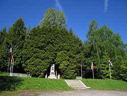 Death Transport Memorial | |
 Flag  Coat of arms | |
 Omlenice Location in the Czech Republic | |
| Coordinates: 48°43′33″N 14°26′37″E / 48.72583°N 14.44361°ECoordinates: 48°43′33″N 14°26′37″E / 48.72583°N 14.44361°E | |
| Country | |
| Region | South Bohemian |
| District | Český Krumlov |
| First mentioned | 1358 |
| Area | |
| • Total | 13.82 km2 (5.34 sq mi) |
| Elevation | 675 m (2,215 ft) |
| Population (2021-01-01)[1] | |
| • Total | 568 |
| • Density | 41/km2 (110/sq mi) |
| Time zone | UTC+1 (CET) |
| • Summer (DST) | UTC+2 (CEST) |
| Postal code | 382 41 |
| Website | www |

Omlenice is a municipality and village in Český Krumlov District in the South Bohemian Region of the Czech Republic. It has about 600 inhabitants.
Administrative parts[]
Villages of Blažkov, Omlenička, Stradov and Výnězda are administrative parts of Omlenice.
References[]
External links[]
| Wikimedia Commons has media related to Omlenice. |
- Official website (in Czech)
| Authority control: National libraries |
|---|
This South Bohemian Region location article is a stub. You can help Wikipedia by . |
Categories:
- Villages in Český Krumlov District
- South Bohemian Region geography stubs