Orange, Connecticut
Orange, Connecticut | |
|---|---|
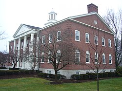 Orange Town Hall | |
 Flag  Seal | |
 Location in New Haven County, Connecticut | |
| Coordinates: 41°16′46″N 73°01′31″W / 41.27944°N 73.02528°WCoordinates: 41°16′46″N 73°01′31″W / 41.27944°N 73.02528°W | |
| Country | |
| U.S. state | |
| County | New Haven |
| Metropolitan area | New Haven |
| Incorporated | 1822 |
| Government | |
| • Type | Selectman-town meeting |
| • First selectman | James M. Zeoli (R) |
| • Selectmen | Ralph Okenquist (R) John Carangelo (R) Judy W. Williams (R) Paul Davis (D) Mitchell R. Goldblatt (D) |
| Area | |
| • Total | 17.4 sq mi (45.1 km2) |
| • Land | 17.2 sq mi (44.5 km2) |
| • Water | 0.2 sq mi (0.6 km2) |
| Elevation | 213 ft (65 m) |
| Population (2010) | |
| ��� Total | 13,956 |
| • Density | 800/sq mi (310/km2) |
| Time zone | UTC-5 (Eastern) |
| • Summer (DST) | UTC-4 (Eastern) |
| ZIP code | 06477 |
| Area code(s) | 203/475 |
| FIPS code | 09-57600 |
| GNIS feature ID | 0213485 |
| Website | www |

Orange is a town in New Haven County, Connecticut, United States. The population was 13,956 at the 2010 census.[1] The town is governed by a Board of Selectmen.
History[]
The Paugusset, an Algonquian people, once lived in the area that is now Orange. In 1639, the Rev. Peter Prudden purchased the land from the Native Americans for six coats, ten blankets, one kettle, twelve hatchets, twelve hoes, two dozen knives and a dozen small mirrors.[2] When originally settled by English colonists, Orange was the northern and eastern district of the now neighboring city of Milford; however, by 1822, the population of the area had grown to the point where residents desired to form their own separate community, thus forming the town of Orange.
The town is named after William III of England, who was Prince of Orange from birth.[3] William is remembered for succeeding James II, deposed in the Glorious Revolution of 1688. James II had been considered a despot in Connecticut; he had famously and unsuccessfully commissioned Edmund Andros to seize Connecticut's Charter.[4]
The town continued to grow throughout the 19th century. As early as 1848, a separation of Orange and West Haven was considered. It was not until 1921 that the two were officially separated by act of the Connecticut General Assembly and the new city of West Haven was formed out of the southeastern portion of Orange.[4] This gave the remnant town of Orange a very rural feel, as the bulk of the urbanized population was ceded to West Haven. In the post-war years, however, Orange began suburbanizing at a rapid pace.
Early roads through the area included the Boston Post Road (now U.S. Route 1) and the Derby Turnpike (now Connecticut Route 34). The turnpike was originally an Indian path. A toll road through Orange, from New Haven to Derby, was built starting in 1800. The toll house was located in Orange; tolls ended in 1887.[5] The New Haven and Derby Railroad ran through Orange starting in 1871, with a station in Orange. At its peak, there were eleven trains per day in each direction along with one freight train. The advent of a trolley from New Haven to Derby (starting in 1904 and running until 1937) hastened the end to rail service (in 1925).[5] Later, the construction of the Wilbur Cross Parkway and Interstate 95 brought highways through the area.
On the National Register of Historic Places[]

- Col. Asa Platt House — 2 Tyler City Road (added 2002). Federal style. Built in 1810, it is thought to have been built by David Hoadley, who built the Orange Congregational Church. The nomination to the register, by Jan Cunningham, refers to "the elegant refinement of the interior", repeated elliptical forms in "the sunbursts of the mantelpieces; in the recessed panels below the parlor windows; in the capitals of the arches; and, in a wholly unexpected manner, in the high relief of the egg form that embellishes the simple mantel frieze in a second-floor chamber."[6]
- Henry F. Miller House — 30 Derby Ave. (added May 25, 2001). This international style house was completed in 1949 and featured at the time in the New Haven Register as "The House of Tomorrow".
- Orange Center Historic District — Roughly Orange Center Road from Orange Cemetery to Nan Drive (added August 10, 1989). The district was originally established by the town January 13, 1978.[7] The Orange Congregational Church, designed by David Hoadley and built in 1810 on the town green, is a centerpiece of the district. This Federal style church features a Palladian window, domed belfry and a painted black oval "window" on the front tower.[8] The district also includes the Stone-Otis House (Federal with Greek revival portico), built circa 1830 (now a museum) and The Academy, a schoolhouse built in 1878 with Stick style elements, including an elaborate gable screen, also now a museum.[8]
- William Andrew House (also known as Bryan-Andrew House) — 131 Old Tavern Road (added 2002). Built about 1750 for the Bryan family, early settlers in North Milford. This area was known as "Bryan's Farms". The house includes a finely detailed front cornice, feather-edged sheathing and hand-split lath laboriously installed without nails. The house later served as housing for dairy farm employees and was ultimately bought by the Town of Orange in 2000 to be restored for use as a museum.[6]
Demographics[]
| Year | Pop. | ±% |
|---|---|---|
| 1830 | 1,341 | — |
| 1840 | 1,329 | −0.9% |
| 1850 | 1,476 | +11.1% |
| 1860 | 1,974 | +33.7% |
| 1870 | 2,634 | +33.4% |
| 1880 | 3,341 | +26.8% |
| 1890 | 4,537 | +35.8% |
| 1900 | 6,995 | +54.2% |
| 1910 | 11,272 | +61.1% |
| 1920 | 16,614 | +47.4% |
| 1930[9] | 1,530 | −90.8% |
| 1940 | 2,009 | +31.3% |
| 1950 | 3,032 | +50.9% |
| 1960 | 8,547 | +181.9% |
| 1970 | 13,524 | +58.2% |
| 1980 | 13,237 | −2.1% |
| 1990 | 12,830 | −3.1% |
| 2000 | 13,233 | +3.1% |
| 2010 | 13,956 | +5.5% |
As of the census of 2000,[11] there were 13,233 people, 4,739 households, and 3,895 families residing in the town. The population density was 770.0 people per square mile (297.2/km2). There were 4,870 housing units at an average density of 283.4 per square mile (109.4/km2). The racial makeup of the town was 94.08% White, 0.79% Black or African American, 0.08% Native American, 3.84% Asian, 0.01% Pacific Islander, 0.32% from other races, and 0.88% from two or more races. Hispanic or Latino of any race were 1.44% of the population.
There were 4,739 households, out of which 35.1% had children under the age of 18 living with them, 73.1% were married couples living together, 6.7% had a female householder with no husband present, and 17.8% were non-families. 15.7% of all households were made up of individuals, and 10.0% had someone living alone who was 65 years of age or older. The average household size was 2.77 and the average family size was 3.09.
In the town, the population was spread out, with 24.6% under the age of 18, 4.3% from 18 to 24, 24.5% from 25 to 44, 26.7% from 45 to 64, and 19.9% who were 65 years of age or older. The median age was 43 years. For every 100 females, there were 94.5 males. For every 100 females age 18 and over, there were 91.1 males.
The median income for a household in the town was $79,365, and the median income for a family was $88,583. Males had a median income of $58,946 versus $41,563 for females. The per capita income for the town was $36,471. About 2.1% of families and 2.5% of the population were below the poverty line, including 1.4% of those under age 18 and 4.3% of those age 65 or over.[12]
| Registration and party enrollment statistics as of October 26, 2010[13] | |||||
|---|---|---|---|---|---|
| Party | Active voters | Inactive voters | Total voters | ||
| Republican | 2,455 | 21 | 2,476 | ||
| Democratic | 2,502 | 22 | 2,524 | ||
| Unaffiliated | 5,172 | 44 | 5,216 | ||
| Minor Parties | 23 | 1 | 24 | ||
| Total | 10,152 | 88 | 10,240 | ||

Education[]
Schools[]
- Mary L. Tracy, for kindergarten and pre-school
- Peck Place, first to sixth grades
- Turkey Hill, first to sixth grades
- Racebrook, first to sixth grades
- Amity Middle School, seven to eighth grades (Orange campus)
- Southern Connecticut Hebrew Academy (formerly New Haven Hebrew Day School)
Orange is served by the regional Amity Regional High School in Woodbridge.[14]
Library[]
- Case Memorial Library[citation needed]
Town tradition[]

Orange exhibits its rural roots at the annual Orange Country Fair. This event originally ran from 1898 to 1912 and was revived in 1975. It has continued since then featuring horse, oxen and tractor pulls as well as exhibits of animals, flowers, fruits, vegetables and baked goods.[15] In early August, the town also promotes the Orange Volunteer Fireman's Carnival, which raises funds to support the volunteer fire department. Both events are held at the fairgrounds at High Plains Community Center near the center of town.
Orange was the home of the first computer camp,[16][17] held at the local Amity Jr. High School in 1977.
During the Cold War, Orange was a location for the permanent deployment of Nike missiles for the defense of Greater New Haven. The former site of the Nike missiles has since (from the late 1950s onward) been the home of the 103rd Air Control and Warning Squadron, later to become the 103rd Tactical Control Squadron and as it remains today the 103rd Air Control Squadron, a part of the Connecticut Air National Guard.[18][19]
In the early nineteenth century, settlers from Orange founded Orange, Ohio, then part of Connecticut's Western Reserve.
On August 18, 2005 the Orange Little League Girls softball team lost the championship game of the Little League Softball World Series to a team from McLean, Virginia.[20][21]
On March 15–17, 2009, Orange hosted the 2009 ConnJam, a Boy Scout event in which over 3,000 Boy Scouts from the Connecticut Yankee Council attended events and camped over the weekend.[22][23]
Business and industry[]
Orange is the home of the North American headquarters of Pez candies.[24][25] It is also the home of the headquarters of Avangrid and its subsidiaries Southern Connecticut Gas[26] and The United Illuminating Company.[27]
Tangoe, Inc., a provider of telecommunications management software, was formerly headquartered in Orange.[28] Orange was the home of the US headquarters of Saab-Scania from 1972 until 1992 when the company relocated to Norcross, Georgia.[29] From 1973-2010, Hubbell, a manufacturer of electrical products, was headquartered in Orange.[30] In 2013, the University of New Haven purchased the former Hubbell headquarters buildings to redevelop as a graduate school campus.[31] Yale's West Campus is located on the Orange-West Haven town line, on a 136-acre property that was formerly occupied by Bayer. In 2013, the Yale School of Nursing relocated to a building on the Yale West Campus that is mostly on the Orange side of the town border.[32]
About three percent of the 17 square miles in the town is farmed.[33] One such farm, Field View Farm, has been operated by the Hine family since 1639.[34][35]
The town has extensive retail development along the Boston Post Road corridor.[33]
Notable people[]
- Josef (1888-1976) and Anni Albers (1899-1994), noted artists
- William Atherton (1947-), character actor, born and raised in Orange
- Art Ceccarelli (1930-2012), baseball player
- Christopher Collier (1930-2020), historian, professor and winner of the Newbery Medal
- John J. DeGioia (1957-), president of Georgetown University, raised in Orange
- Kristen Griest (1989-), Army Captain and one of the first two female graduates of the United States Army Ranger School
- Henry Lee (1938-), former resident, forensic scientist notable for his investigations of famous crimes
- Patrick B. O'Sullivan (1887-1978), U.S. Congressman and judge
- Timothy Sykes (1981-), penny stock trader and trainer.[36]
- Stephen Valiquette (1977-), ice hockey goaltender.
- Lev Nussberg (1937-), is a Russian avant garde painter. He is the founder of Russian Kinetic Art
Geography[]
According to the United States Census Bureau, the town has a total area of 17.4 square miles (45.1 km2), of which 17.2 square miles (44.5 km2) is land and 0.2 square miles (0.6 km2), or 1.38%, is water. The town limits include Wooster Island in the Housatonic River. The Wepawaug, Oyster and Indian Rivers flow through the town.
References[]
- ^ "Profile of General Population and Housing Characteristics: 2010 Demographic Profile Data (DP-1): Orange town, New Haven County, Connecticut". United States Census Bureau. Retrieved September 27, 2012.
- ^ http://www.orange-ct.gov/index.htm
- ^ The Connecticut Magazine: An Illustrated Monthly. Connecticut Magazine Company. 1903. p. 334.
- ^ Jump up to: a b History of Orange Archived September 26, 2006, at the Wayback Machine
- ^ Jump up to: a b "The Derby Turnpike, Priscilla Searles, Business New Haven, Jan 27, 1997". Conntact.com. 1997-01-27. Archived from the original on January 19, 2013. Retrieved 2013-01-09.
- ^ Jump up to: a b "CT Trust for Historic Preservation". Cttrust.org. Retrieved 2013-01-09.
- ^ Orange Connecticut Historic District
- ^ Jump up to: a b Liz Deluca, "The Historic District, A Walking Tour", Our Town Newspaper, June 10, 1997, pages 9-11.
- ^ The more densely settled eastern part of Orange was split off as the town of West Haven in 1921, leading to the drop in population.
- ^ Enter your Company or Top-Level Office. "Connecticut State Register and Manual". Ct.gov. Retrieved 2013-01-09.
- ^ United States Census Data: General
- ^ United States Census Data: Economic
- ^ "Registration and Party Enrollment Statistics as of October 26, 2010" (PDF). Connecticut Secretary of State. Archived from the original (PDF) on February 1, 2015. Retrieved 2006-10-02.
- ^ "Amity High School". Archived from the original on 2013-01-27. Retrieved 2013-02-26.
- ^ "Orange Country Fair, Library of Congress Local Legacies". Lcweb2.loc.gov. Retrieved 2013-01-09.
- ^ Harvey, Helen (9 June 2002). "Computer pioneer made a lot of campers happy". The New Haven Register. Retrieved 11 December 2012.
- ^ Humphrey, Mary (June 1982). "Learning With Computers". Compute! Magazine. Retrieved 11 December 2012.
- ^ "103rd Airlift Wing, Connecticut Air National Guard - Proud Heritage". The Official Web Site of 103rd Airlift Wing. Retrieved 2010-10-24.
- ^ "103rd Air Control Squadron". Archived from the original on 2012-06-17. Retrieved 2010-10-24.
- ^ "SOUR ENDING Orange's bid for crown, perfection denied". New Haven Register. Journal Register Company. 19 August 2005. Retrieved 2010-10-24.
- ^ "Virginia beats Connecticut to win title". Associated Press. August 19, 2005. Retrieved 2010-10-24.
- ^ "Scout Jamboree in Orange". WTNH. LIN Television Corporation. 16 May 2009. Retrieved 2010-10-24.
- ^ "Connecticut Yankee Council, BSA". Connecticut Yankee Council. Retrieved 2010-10-24.
- ^ About us, Pez Candy, Inc.
- ^ Albert, Bridget (2 March 2012). "Candy Land: PEZ draws fans to Orange headquarters for tours". The New Haven Register. Retrieved 11 December 2012.
- ^ "Southern Connecticut Gas - Contact Us". Retrieved 24 June 2013.
- ^ Albert, Bridget (27 April 2012). "Orange businesses happy with UI move". The New Haven Register. Retrieved 11 December 2012.
- ^ "Tangoe, Inc. - Orange, CT - Corporate Headquarters". Archived from the original on 1 May 2013. Retrieved 24 June 2013.
- ^ "SAAB-SCANIA of America – 60 Marsh Hill Rd, Orange, CT". Saab History. 24 October 2007. Retrieved 2010-10-24.
- ^ Prevost, Lisa (May 7, 2010). "Hubbell Plans Housing for Its Orange Site". The New York Times. Retrieved 24 June 2013.
- ^ Misur, Susan (February 7, 2013). "University of New Haven looking to buy Hubbell property in Orange". The New Haven Register. Retrieved 26 June 2013.
- ^ Shelton, Jim (June 22, 2013). "Move-in day nears for Yale's new nursing school, campus on Orange-West Haven line bustling". The New Haven Register. Retrieved 24 June 2013.
- ^ Jump up to: a b Hughes, C.J. (September 30, 2011). "For Nature Lovers Who Also Shop-Hop". The New York Times. Retrieved 24 June 2013.
- ^ "350-Year-Old Farm Survives the Odds". New York Times. March 13, 1989. Retrieved March 28, 2012.
- ^ "7 Companies Older Than America". Inc. July 3, 2012. Retrieved September 26, 2012.
- ^ "Tim Grittani Day Trading". FastSwings. Retrieved April 20, 2020.
External links[]
- Town of Orange official website
- Orange Historical Society
- Case Memorial Library
- Orange Local History Collection at Case Memorial Library
- History of Orange, North Milford, Connecticut, 1639-1949, compiled by Mary R. Woodruff
- Orange 150, Sesquicentennial 1822-1972
- The Amity Star, a newspaper of the early 1950s
- Orange School District
- Orange Chamber of Commerce
- Orange Country Fair
- Orange Town News
| show Places adjacent to Orange, Connecticut |
|---|
| show Municipalities and communities of New Haven County, Connecticut, United States |
|---|


| show New York metropolitan area |
|---|

| show Authority control |
|---|
- Orange, Connecticut
- Towns in New Haven County, Connecticut
- Towns in the New York metropolitan area
- Towns in Connecticut