Orrville, Ohio
Orrville, Ohio | |
|---|---|
City | |
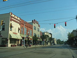 Central Orrville | |
| Motto(s): A City of Diversified Industry | |
 Location of Orrville, Ohio | |
 Location of Orrville in Wayne County | |
| Coordinates: 40°50′N 81°46′W / 40.833°N 81.767°WCoordinates: 40°50′N 81°46′W / 40.833°N 81.767°W | |
| Country | United States |
| State | Ohio |
| County | Wayne |
| Government | |
| • Mayor | Dave Handwerk |
| Area | |
| • Total | 5.62 sq mi (14.55 km2) |
| • Land | 5.61 sq mi (14.53 km2) |
| • Water | 0.01 sq mi (0.03 km2) |
| Elevation | 1,060 ft (323 m) |
| Population | |
| • Total | 8,380 |
| • Estimate (2019)[5] | 8,419 |
| • Density | 1,500.98/sq mi (579.55/km2) |
| Time zone | UTC-5 (Eastern (EST)) |
| • Summer (DST) | UTC-4 (EDT) |
| ZIP code | 44667 |
| Area code(s) | 330 |
| FIPS code | 39-58828[4] |
| GNIS feature ID | 1065216[3] |
| Website | orrville.com |

Orrville is a city in Wayne County, Ohio, United States. It is about 9 miles east of Wooster and 20 miles southwest of Akron. The population was 8,380 at the 2010 census.
The J.M. Smucker Co., owner of the Smucker's brand, is headquartered in Orrville.
History[]
Orrville was laid out in 1852, and named after Judge Smith Orr, proprietor.[6] A post office called Orrville has been in operation since 1852.[7]
Geography[]
Orrville is located at 40°50′N 81°46′W / 40.833°N 81.767°W (40.8414, −81.7715).[8]
According to the United States Census Bureau, the city has a total area of 5.75 square miles (14.89 km2), of which 5.74 square miles (14.87 km2) is land and 0.01 square miles (0.03 km2) is water.[9]
Demographics[]
| Historical population | |||
|---|---|---|---|
| Census | Pop. | %± | |
| 1870 | 745 | — | |
| 1880 | 1,441 | 93.4% | |
| 1890 | 1,765 | 22.5% | |
| 1900 | 1,901 | 7.7% | |
| 1910 | 3,101 | 63.1% | |
| 1920 | 4,107 | 32.4% | |
| 1930 | 4,427 | 7.8% | |
| 1940 | 4,484 | 1.3% | |
| 1950 | 5,153 | 14.9% | |
| 1960 | 6,511 | 26.4% | |
| 1970 | 7,408 | 13.8% | |
| 1980 | 7,511 | 1.4% | |
| 1990 | 7,712 | 2.7% | |
| 2000 | 8,551 | 10.9% | |
| 2010 | 8,380 | −2.0% | |
| 2019 (est.) | 8,419 | [5] | 0.5% |
| Sources:[4][10][11][12][13][14][15] | |||
2010 census[]
At the 2010 census there were 8,380 people, 3,337 households, and 2,273 families living in the city. The population density was 1,459.9 inhabitants per square mile (563.7/km2). There were 3,690 housing units at an average density of 642.9 per square mile (248.2/km2). The racial makeup of the city was 89.7% White, 4.9% African American, 0.1% Native American, 1.3% Asian, 1.3% from other races, and 2.6% from two or more races. Hispanic or Latino of any race were 3.5%.[2]
Of the 3,337 households 32.5% had children under the age of 18 living with them, 49.9% were married couples living together, 13.8% had a female householder with no husband present, 4.5% had a male householder with no wife present, and 31.9% were non-families. 26.5% of households were one person and 11.9% were one person aged 65 or older. The average household size was 2.48 and the average family size was 2.96.
The median age was 39 years. 24.3% of residents were under the age of 18; 8.7% were between the ages of 18 and 24; 23.8% were from 25 to 44; 26.9% were from 45 to 64; and 16.1% were 65 or older. The gender makeup of the city was 48.7% male and 51.3% female.
2000 census[]
At the 2000 census there were 8,551 people, 3,305 households, and 2,343 families living in the city. The population density was 1,600.8 people per square mile (618.3/km2). There were 3,489 housing units at an average density of 653.2 per square mile (252.3/km2). The racial makeup of the city was 90.89% White, 5.93% African American, 0.16% Native American, 1.15% Asian, 0.01% Pacific Islander, 0.51% from other races, and 1.34% from two or more races. Hispanic or Latino of any race were 1.29%.[4] Of the 3,305 households 35.2% had children under the age of 18 living with them, 54.4% were married couples living together, 12.2% had a female householder with no husband present, and 29.1% were non-families. 24.8% of households were one person and 10.0% were one person aged 65 or older. The average household size was 7.55 and the average family size was 3.04.
The age distribution was 27.6% under the age of 18, 8.4% from 18 to 24, 29.7% from 25 to 44, 21.2% from 45 to 64, and 13.1% 65 or older. The median age was 36 years. For every 100 females, there were 94.0 males. For every 100 females age 18 and over, there were 87.6 males.
The median household income was $36,500 and the median family income was $46,728. Males had a median income of $32,565 versus $25,252 for females. The per capita income for the city was $17,419. About 5.7% of families and 7.7% of the population were below the poverty line, including 7.3% of those under age 18 and 8.2% of those age 65 or over.
Economy[]
Orrville is the corporate headquarters for The J.M. Smucker Company and its fruit spread producing facility, which Smucker's asserts is the largest in the world.[16] Other firms based in the city include Smith Dairy Products Company, Schantz Organ Company, and The Will-Burt Company.
Education[]
Orrville City Schools, and Wayne College, which is a branch campus of The University of Akron, are both located in Orrville.
Notable people[]
- Mike Birkbeck – Major League Baseball player for the Milwaukee Brewers and New York Mets
- Heber Blankenhorn – journalist and labor activist
- Tim Hiller – former standout quarterback at Western Michigan
- Bob Knight – former American college basketball head coach
- Mark Smucker – CEO of The J.M. Smucker Company
References[]
- ^ "2019 U.S. Gazetteer Files". United States Census Bureau. Retrieved July 28, 2020.
- ^ Jump up to: a b "U.S. Census website". United States Census Bureau. Retrieved 2013-01-06.
- ^ Jump up to: a b "US Board on Geographic Names". United States Geological Survey. 2007-10-25. Retrieved 2008-01-31.
- ^ Jump up to: a b c "U.S. Census website". United States Census Bureau. Retrieved 2008-01-31.
- ^ Jump up to: a b "Population and Housing Unit Estimates". Retrieved May 21, 2020.
- ^ Overman, William Daniel (1958). Ohio Town Names. Akron, OH: Atlantic Press. p. 105.
- ^ "Post offices". Jim Forte Postal History. Retrieved 18 June 2016.
- ^ "US Gazetteer files: 2010, 2000, and 1990". United States Census Bureau. 2011-02-12. Retrieved 2011-04-23.
- ^ "US Gazetteer files 2010". United States Census Bureau. Archived from the original on 2012-01-25. Retrieved 2013-01-06.
- ^ "Population of Civil Divisions Less than Counties" (PDF). Statistics of the Population of the United States at the Ninth Census. U.S. Census Bureau. 1870. Retrieved 17 May 2020.
- ^ "Population of Civil Divisions Less than Counties" (PDF). Statistics of the Population of the United States at the Tenth Census. U.S. Census Bureau. 1880. Retrieved 28 November 2013.
- ^ "Population: Ohio" (PDF). 1910 U.S. Census. U.S. Census Bureau. Retrieved 28 November 2013.
- ^ "Population: Ohio" (PDF). 1930 US Census. U.S. Census Bureau. Retrieved 28 November 2013.
- ^ "Number of Inhabitants: Ohio" (PDF). 18th Census of the United States. U.S. Census Bureau. 1960. Retrieved 17 May 2020.
- ^ "Ohio: Population and Housing Unit Counts" (PDF). U.S. Census Bureau. Retrieved 22 November 2013.
- ^ "Smucker products have a new home at state-of-the-art facility in Orrville". Akron Beacon Journal. Retrieved 2019-05-22.
External links[]
| show Municipalities and communities of Wayne County, Ohio, United States |
|---|

| show Authority control |
|---|
- Cities in Wayne County, Ohio
- Cities in Ohio