Pamekasan Regency
Pamekasan Regency
Kabupaten Pamekasan | |
|---|---|
 Aerial photo of Sendang near Pamekasan | |
 Seal | |
| Motto(s): Madu Ganda Mangesti Tunggal (Fragrant island, goes along with the unitary state) Mekkas Jatna Paksa Jenneng Dibi' (Governed by self-ability and people's support) | |
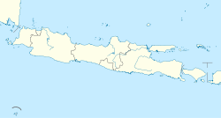
 Location within East Java | |
| Coordinates: 7°10′S 113°28′E / 7.167°S 113.467°ECoordinates: 7°10′S 113°28′E / 7.167°S 113.467°E | |
| Country | |
| Province | East Java |
| Capital | Pamekasan |
| Government | |
| • Regent | Khalil Asy'ari[1] |
| • Vice Regent | vacant |
| Area | |
| • Total | 792.30 km2 (305.91 sq mi) |
| Population (2020 Census)[2] | |
| • Total | 850,057 |
| • Density | 1,100/km2 (2,800/sq mi) |
| Area code | (+62) 324 |
| Website | pamekasankab.go.id |
Pamekasan Regency is a regency (kabupaten) of the province of East Java, Indonesia. It is located on Madura Island approximately 120 km east of Surabaya, the provincial capital.
The regency covers an area of 792.30 km2, and at the 2010 Census it had a population of 795,918 (an increase from 689,225 at the previous Census in 2000); at the 2020 Census the total was 850,057.[3]
Neighbouring Regencies[]
Pamekasan Regency is bordered on the east by Sumenep Regency, on the north by the Java Sea, on the west by Sampang Regency, and on the south by the Madura Strait (separating Madura from the island of Java).
Administrative Districts[]
Pamekasan Regency consists of thirteen districts (kecamatan), tabulated below with their areas and their populations at the 2010 Census[4] and the 2020 Census.[5] The table also includes the location of the district administrative centres, the number of administrative villages (rural desa and ur||align="right"| 59,156ban kelurahan) in each district, and its post code.
| District | Area in Sq.km |
Population 2010 Census |
Population 2010 Census |
Admin centre |
Number of villages |
Post code |
|---|---|---|---|---|---|---|
| Tlanakanan | 48.10 | 59,156 | 64,172 | Branta Tinggi | 17 | 69371 |
| Pademawu | 71.90 | 76,713 | 84,803 | Bunder | 22 | 69321 -60323 |
| Galis | 31.86 | 28,235 | 29,770 | Galis | 10 | 69382 |
| Larangan | 40.86 | 53,174 | 56,553 | Larangan Luar | 14 | 69383 |
| Pamekasan (district) |
26.47 | 89,103 | 89,017 | Patemon | 18 | 69311 -69317 |
| Proppo | 71.49 | 75,079 | 84,864 | Proppo | 27 | 69363 |
| Palengaan | 88.48 | 85,246 | 82,600 | Palengaan Laok | 12 | 69362 |
| Pegantenan | 86.04 | 63,014 | 73,686 | Pegantenan | 13 | 69361 |
| Kadur | 52.43 | 44,622 | 47,959 | Kadur | 10 | 69355 |
| Pakong | 30.71 | 34,429 | 36,817 | Pakong | 12 | 69352 |
| Waru | 70.03 | 59,346 | 64,394 | Waru Barat | 12 | 69353 |
| Batumarmar | 97.05 | 77,653 | 79,519 | Tamberu | 13 | 69354 |
| Pasean | 76.88 | 50,148 | 55,953 | Tlontoraja | 9 | 69356 |
| Totals | 792.30 | 795,918 | 850,057 | 189 |
Demographics[]
The population comprises Madurese, Javanese, and Chinese Indonesians.
Economy[]
One of the famous produces from this region is Batik Pamekasan.
References[]
- Madura Island
- Regencies of East Java
- East Java geography stubs


