Parish Grove Township, Benton County, Indiana
Parish Grove Township | |
|---|---|
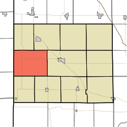 Location of Parish Grove Township in Benton County | |
| Coordinates: 40°36′28″N 87°27′25″W / 40.60778°N 87.45694°WCoordinates: 40°36′28″N 87°27′25″W / 40.60778°N 87.45694°W | |
| Country | United States |
| State | Indiana |
| County | Benton |
| Organized | July 1840 |
| Government | |
| • Type | Indiana township |
| Area | |
| • Total | 45.44 sq mi (117.7 km2) |
| • Land | 45.42 sq mi (117.6 km2) |
| • Water | 0.01 sq mi (0.03 km2) |
| Elevation | 745 ft (227 m) |
| Population (2010) | |
| • Total | 241 |
| • Density | 5.3/sq mi (2.0/km2) |
| Time zone | UTC-5 (EST) |
| • Summer (DST) | UTC-4 (EDT) |
| FIPS code | 18-57942[2] |
| GNIS feature ID | 453706 |

Parish Grove Township is one of eleven townships in Benton County, Indiana. As of the 2010 census, its population was 241 and it contained 101 housing units.[3] It contains the unincorporated town of Freeland Park.
History[]
Parish Grove Township was one of the county's original three created in 1840.[4] The grove for which it is named grew close to the township's southeastern corner, near what is now the intersection of county roads 400 West and 300 South.[5] It originally covered about 1,000 acres (4.0 km2) and contained an abundant variety of trees, including oaks, walnuts, hickory, dogwood, haw, paw paw, sycamore, quaking ash, ironwood, water beach, elm, linn, poplar, ash, sassafras, locust, etc. As late as 1924 there were 37 varieties growing in the grove.
Parish Grove was home to a group of local Pottawatomie Indians led by Chief Parish (real name Pierre Moran), the son of French trader Constant Moran and a Kickapoo woman. Parish died circa 1826 and is buried in the grove, though the grave is unmarked.[6]
Geography[]
According to the 2010 census, the township has a total area of 45.44 square miles (117.7 km2), of which 45.42 square miles (117.6 km2) (or 99.96%) is land and 0.01 square miles (0.026 km2) (or 0.02%) is water.[3] Almost all of Parish Grove Township is open farmland, divided into roughly square mile blocks by regularly spaced county roads. Its highest point, located in the extreme southeastern corner of the township, is 915 feet (279 m); the land slopes away and flattens to the northwest down to about 700 feet (210 m). Several small streams flow north and west toward Sugar Creek, including Mud Creek, Gretencord Ditch, Salmon Ditch, Finigan Ditch and Kult Ditch.
Unincorporated towns[]
Adjacent townships[]
- Center (east)
- Grant (southeast)
- Hickory Grove (south)
- Richland (northeast)
- York (north)
Major highways[]
 U.S. Route 41
 State Road 18
 State Road 71
References[]
- ^ "US Board on Geographic Names". United States Geological Survey. 2007-10-25. Retrieved 2008-01-31.
- ^ "U.S. Census website". United States Census Bureau. Retrieved 2008-01-31.
- ^ a b "Population, Housing Units, Area, and Density: 2010 - County -- County Subdivision and Place -- 2010 Census Summary File 1". United States Census. Archived from the original on 2020-02-12. Retrieved 2013-05-10.
- ^ Birch, Jesse Setlington (1942) [1928]. History of Benton County and Historic Oxford. Oxford, Indiana: Craw & Craw, Inc. p. 40.
- ^ Andreas, Alfred Theodore (1876). "Benton County". Illustrated Historical Atlas of the State of Indiana. Chicago: Baskin, Forster & Company.
- ^ Birch, Jesse Setlington (1942) [1928]. History of Benton County and Historic Oxford. Oxford, Indiana: Craw & Craw, Inc. p. 20.
External links[]
Municipalities and communities of Benton County, Indiana, United States | ||
|---|---|---|
| Towns | ||
| Townships | ||
| CDPs | ||
| Other communities | ||
| Ghost towns | ||
| Footnotes | ‡This populated place also has portions in an adjacent county or counties | |
| ||
- Townships in Benton County, Indiana
- Lafayette metropolitan area, Indiana
- Townships in Indiana