Swanington, Indiana
Swanington, Indiana | |
|---|---|
 Benton County's location in Indiana | |
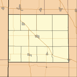 Swanington Freeland Park's location in Benton County | |
| Coordinates: 40°35′00″N 87°16′38″W / 40.58333°N 87.27722°WCoordinates: 40°35′00″N 87°16′38″W / 40.58333°N 87.27722°W | |
| Country | United States |
| State | Indiana |
| County | Benton |
| Township | Center |
| Elevation | 804 ft (245 m) |
| ZIP code | 47944 |
| Area code(s) | 765 |
| FIPS code | 18-74492[2] |
| GNIS feature ID | 444465 |

Swanington is an unincorporated community in Center Township, Benton County, in the U.S. state of Indiana.[3] It is part of the Lafayette, Indiana Metropolitan Statistical Area.
History[]
Swanington was platted by William Swan at the intersection of the existing Cleveland, Cincinnati, Chicago and St. Louis Railway (the "Big Four") which ran southeast from nearby Fowler and the new Chicago, Attica and Southern Railroad. Before its platting, the site was known as Wyndham, the name possibly coming from the town of Windham, Connecticut. In the 1920s the town supported a general store, grain elevator, grade school, United Brethren church and about 100 people.[4]
A post office was established at Swanington in 1886, and remained in operation until it was discontinued in 1937.[5]
Geography[]
Swanington is located at 40°35′00″N 87°16′38″W / 40.58333°N 87.27722°W in Center Township, on U.S. Route 52 southeast of Fowler.
References[]
- ^ "US Board on Geographic Names". United States Geological Survey. 2007-10-25. Retrieved 2008-01-31.
- ^ "U.S. Census website". United States Census Bureau. Retrieved 2008-01-31.
- ^ "Swanington, Indiana". Geographic Names Information System. United States Geological Survey. Retrieved February 29, 2020.
- ^ Birch, Jesse Setlington (1942) [1928]. "Unincorporated community s of the County". History of Benton County and Historic Oxford. Oxford, Indiana: Craw & Craw. p. 206.
- ^ "Benton County". Jim Forte Postal History. Retrieved 26 August 2014.
Municipalities and communities of Benton County, Indiana, United States | ||
|---|---|---|
| Towns | ||
| Townships | ||
| CDPs | ||
| Other communities | ||
| Ghost towns | ||
| Footnotes | ‡This populated place also has portions in an adjacent county or counties | |
| ||
This Benton County, Indiana location article is a stub. You can help Wikipedia by . |
- Unincorporated communities in Benton County, Indiana
- Lafayette metropolitan area, Indiana
- Unincorporated communities in Indiana
- Northern Indiana geography stubs