Raub, Indiana
Raub, Indiana | |
|---|---|
 Benton County's location in Indiana | |
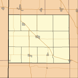 Raub Raub's location in Benton County | |
| Coordinates: 40°43′48″N 87°29′30″W / 40.73000°N 87.49167°WCoordinates: 40°43′48″N 87°29′30″W / 40.73000°N 87.49167°W | |
| Country | United States |
| State | Indiana |
| County | Benton |
| Township | York |
| Elevation | 732 ft (223 m) |
| Time zone | UTC-5 (Eastern (EST)) |
| • Summer (DST) | UTC-4 (EDT) |
| ZIP code | 47942 |
| Area code(s) | 219 |
| FIPS code | 18-63072[2] |
| GNIS feature ID | 441790 |

Raub is an unincorporated community in York Township, Benton County, in the U.S. state of Indiana.[3] It is part of the Lafayette, Indiana Metropolitan Statistical Area.
History[]
Raub was laid out by merchant and livestock-dealer Adams D. Raub on April 8, 1872[4] near the railroad which had been completed through the area the previous year. Originally consisting of 71 lots, its first house was that of Ira Perkins (which predated the railroad), followed by that of A. Houser in the fall of 1871. At about the same time, Raub gained its first store, a business selling groceries and notions, and in 1873 got a general store operated by Samuel White. A hardware store, drug store, saloon, doctor's office, grain elevator, blacksmith, and various other establishments followed over the next decade.
A post office was established at Raub in 1872, and remained in operation until it was discontinued in 1967.[5]
The first organized religious service started about the same time as the laid out, in 1872. The first minister was a Circuit Rider named W.H. Hickman. In 1875, the group that Rev. Hickman, ministered to formed the Raub Evangelical United Brethren Church and commissioned contractor J.H. Bradshaw or Lafayette, IN to build the structure that is still in use today by the Raub United Methodist Church. The Evangelical United Brethren Church joined with the Methodist Church in 1968 and with that merger, the people of the church remained while the name changed slightly
Geography[]
Raub is located at 40°43′48″N 87°29′30″W / 40.73000°N 87.49167°W in York Township, at the intersection of Indiana State Road 71 and the Kankakee, Beaverville and Southern Railroad. The site is half a mile from the border with Newton County and is surrounded by relatively flat, open farmland.
References[]
- ^ "US Board on Geographic Names". United States Geological Survey. 2007-10-25. Retrieved 2008-01-31.
- ^ "U.S. Census website". United States Census Bureau. Retrieved 2008-01-31.
- ^ "Raub, Indiana". Geographic Names Information System. United States Geological Survey. Retrieved February 29, 2020.
- ^ Baker, Ronald L. (October 1995). From Needmore to Prosperity: Hoosier Place Names in Folklore and History. Indiana University Press. p. 276. ISBN 978-0-253-32866-3.
...laid out on April 8, 1872 by A. D. Raub...
- ^ "Benton County". Jim Forte Postal History. Retrieved 26 August 2014.
- Mossman, Ed (1883), "History of Benton County: Past Events -- Present Condition" in Counties of Warren, Benton, Jasper and Newton, Indiana: Historical and Biographical, Chicago: F. A. Battey & Co.
| Wikimedia Commons has media related to Raub, Indiana. |
Municipalities and communities of Benton County, Indiana, United States | ||
|---|---|---|
| Towns | ||
| Townships | ||
| CDPs | ||
| Other communities | ||
| Ghost towns | ||
| Footnotes | ‡This populated place also has portions in an adjacent county or counties | |
| ||
This Benton County, Indiana location article is a stub. You can help Wikipedia by . |
- Unincorporated communities in Benton County, Indiana
- Lafayette metropolitan area, Indiana
- Unincorporated communities in Indiana
- Northern Indiana geography stubs