Placer, Surigao del Norte
Placer | |
|---|---|
| Municipality of Placer | |
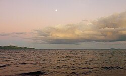 Cagbantoy Beach | |
 Map of Surigao del Norte with Placer highlighted | |
OpenStreetMap  | |
 Placer Location within the Philippines | |
| Coordinates: 9°39′25″N 125°36′06″E / 9.65703°N 125.60161°ECoordinates: 9°39′25″N 125°36′06″E / 9.65703°N 125.60161°E | |
| Country | Philippines |
| Region | Caraga |
| Province | Surigao del Norte |
| District | 2nd district |
| Founded | 1850 |
| Barangays | 20 (see Barangays) |
| Government | |
| • Type | Sangguniang Bayan |
| • Mayor | Jovymarie C. Villazon |
| • Vice Mayor | Ryan Fel B. Napuli |
| • Representative | Robert Ace S. Barbers |
| • Electorate | 21,235 voters (2019) |
| Area | |
| • Total | 61.29 km2 (23.66 sq mi) |
| Elevation | 42 m (138 ft) |
| Highest elevation | 315 m (1,033 ft) |
| Lowest elevation | 0 m (0 ft) |
| Population (2020 census) [3] | |
| • Total | 29,616 |
| • Density | 480/km2 (1,300/sq mi) |
| • Households | 5,854 |
| Economy | |
| • Income class | 4th municipal income class |
| • Poverty incidence | 34.40% (2015)[4] |
| • Revenue | ₱115,182,654.07 (2020) |
| • Assets | ₱443,263,847.36 (2020) |
| • Expenditure | ₱90,429,125.61 (2020) |
| • Liabilities | ₱181,588,686.44 (2020) |
| Service provider | |
| • Electricity | Surigao del Norte Electric Cooperative (SURNECO) |
| Time zone | UTC+8 (PST) |
| ZIP code | 8405 |
| PSGC | |
| IDD : area code | +63 (0)86 |
| Native languages | Surigaonon Agusan Cebuano Tagalog |

Placer, officially the Municipality of Placer (Surigaonon: Lungsod nan Placer; Tagalog: Bayan ng Placer), is a 4th class municipality in the province of Surigao del Norte, Philippines. According to the 2020 census, it has a population of 29,616 people. [3]
History[]
In 1850, the town was founded by Captain Felipe Custodio and Capitan Luis Patino. It was named "Placer" (Spanish for "pleasure" or "delight") by Custodio in reference to the happiness derived from local gold mining, as well as the abundant fish and rice harvests. In 1860, this name was officially approved.[5]
In 1930, the municipality lost some of its territory when the Municipality of Mainit was formed, and again in 1947, when the Municipality of Tagana-an was established.[5]
World War II[]
After the Japanese obtained the surrender of American and Filipino troops on Mindanao in May and June 1942, Placer, along with much of Mindanao, remained free of Japanese occupation. In late September 1943, Japanese troops landed and occupied Placer. Their goals seemed to be to fill drums with oil from a storage tank there for their use and to search for lumber. About 300 to 400 Japanese troops were in town. Some began moving south toward Claver. On October 10, guerrillas under American leadership attacked with 135 men from both the north and south to dislodge the Japanese from Placer. This attack failed, leaving the town in Japanese hands.[6]
Geography[]
Placer is in the northeast of Mindanao Island, facing the Hinatuan Passage to the east. Its territory includes the small islands of Tinago, Banga, and Mahaba, as well as half of Masapelid Island where barangays Ellaperal, Lakandula, and Sani-sani are located.[5]
Its topography consists of low rising hills that are interspersed by plains.[5]
Barangays[]
Placer is politically subdivided into 20 barangays. In 1956, the sitios of Santa Cruz, Anislagan, Alangalang, Soyoc, and Pananay-an were converted into barrios, while barrio Macalaya was divided into Upper and Lower Macalaya.[7]
- Amoslog
- Anislagan
- Bad-as (contains the intersection of the Pan-Philippine Highway (or National Highway) & the Surigao-Davao Coastal Road)
- Boyongan
- Bugas-bugas
- Central (Poblacion)
- Ellaperal (Nonok)
- Ipil (Poblacion)
- Lakandula
- Mabini
- Macalaya
- Magsaysay (Poblacion)
- Magupange
- Pananay-an
- Panhutongan
- San Isidro
- Sani-sani
- Santa Cruz
- Suyoc
- Tagbongabong
Climate[]
| Climate data for Placer, Surigao del Norte | |||||||||||||
|---|---|---|---|---|---|---|---|---|---|---|---|---|---|
| Month | Jan | Feb | Mar | Apr | May | Jun | Jul | Aug | Sep | Oct | Nov | Dec | Year |
| Average high °C (°F) | 27 (81) |
27 (81) |
28 (82) |
29 (84) |
30 (86) |
29 (84) |
29 (84) |
29 (84) |
29 (84) |
29 (84) |
29 (84) |
28 (82) |
29 (83) |
| Average low °C (°F) | 23 (73) |
23 (73) |
23 (73) |
23 (73) |
25 (77) |
25 (77) |
25 (77) |
25 (77) |
25 (77) |
25 (77) |
24 (75) |
24 (75) |
24 (75) |
| Average precipitation mm (inches) | 210 (8.3) |
161 (6.3) |
123 (4.8) |
85 (3.3) |
148 (5.8) |
186 (7.3) |
164 (6.5) |
157 (6.2) |
141 (5.6) |
190 (7.5) |
223 (8.8) |
200 (7.9) |
1,988 (78.3) |
| Average rainy days | 21.0 | 16.8 | 18.5 | 18.2 | 24.9 | 27.7 | 28.4 | 27.0 | 26.1 | 27.6 | 24.6 | 22.0 | 282.8 |
| Source: Meteoblue (modeled/calculated data, not measured locally)[8] | |||||||||||||
Demographics[]
|
| |||||||||||||||||||||||||||||||||||||||||||||||||||
| Source: Philippine Statistics Authority [9] [10] [11] | ||||||||||||||||||||||||||||||||||||||||||||||||||||
Economy[]
| Poverty Incidence of Placer | |
| Source: Philippine Statistics Authority[12][13][14][15][16][17] | |
References[]
- ^ Municipality of Placer | (DILG)
- ^ "2015 Census of Population, Report No. 3 – Population, Land Area, and Population Density" (PDF). Philippine Statistics Authority. Quezon City, Philippines. August 2016. ISSN 0117-1453. Archived (PDF) from the original on May 25, 2021. Retrieved July 16, 2021.
- ^ a b Census of Population (2020). "Caraga". Total Population by Province, City, Municipality and Barangay. PSA. Retrieved 8 July 2021.
- ^ https://psa.gov.ph/sites/default/files/City%20and%20Municipal-level%20Small%20Area%20Poverty%20Estimates_%202009%2C%202012%20and%202015_0.xlsx; publication date: 10 July 2019; publisher: Philippine Statistics Authority.
- ^ a b c d "History of Placer". WOWSURIGAO.com. Retrieved 15 September 2021.
- ^ Virginia Hansen Holmes, Guerrilla Daughter (Kent, Ohio: Kent State U. Press, 2009), pp. 108-9.
- ^ "An Act Converting into Barrios Certain Sitios in the Province of Surigao, and Dividing the Barrio of Macalaya into Two Barrios, Municipality of Placer, in the Same Province". LawPH.com. Archived from the original on 2012-07-11. Retrieved 2011-04-12.
- ^ "Placer: Average Temperatures and Rainfall". Meteoblue. Retrieved 20 November 2019.
- ^ Census of Population (2015). "Caraga". Total Population by Province, City, Municipality and Barangay. PSA. Retrieved 20 June 2016.
- ^ Census of Population and Housing (2010). "Caraga". Total Population by Province, City, Municipality and Barangay. NSO. Retrieved 29 June 2016.
- ^ Censuses of Population (1903–2007). "Caraga". Table 1. Population Enumerated in Various Censuses by Province/Highly Urbanized City: 1903 to 2007. NSO.
- ^ "Poverty incidence (PI):". Philippine Statistics Authority. Retrieved 28 December 2020.
- ^ https://psa.gov.ph/sites/default/files/NSCB_LocalPovertyPhilippines_0.pdf; publication date: 29 November 2005; publisher: Philippine Statistics Authority.
- ^ https://psa.gov.ph/sites/default/files/2003%20SAE%20of%20poverty%20%28Full%20Report%29_1.pdf; publication date: 23 March 2009; publisher: Philippine Statistics Authority.
- ^ https://psa.gov.ph/sites/default/files/2006%20and%202009%20City%20and%20Municipal%20Level%20Poverty%20Estimates_0_1.pdf; publication date: 3 August 2012; publisher: Philippine Statistics Authority.
- ^ https://psa.gov.ph/sites/default/files/2012%20Municipal%20and%20City%20Level%20Poverty%20Estima7tes%20Publication%20%281%29.pdf; publication date: 31 May 2016; publisher: Philippine Statistics Authority.
- ^ https://psa.gov.ph/sites/default/files/City%20and%20Municipal-level%20Small%20Area%20Poverty%20Estimates_%202009%2C%202012%20and%202015_0.xlsx; publication date: 10 July 2019; publisher: Philippine Statistics Authority.
External links[]
| Wikimedia Commons has media related to Placer, Surigao del Norte. |
- Philippine Standard Geographic Code
- Philippine Census Information
- Local Governance Performance Management System
Places adjacent to Placer, Surigao del Norte | |
|---|---|
Surigao City (capital) | |
| Municipalities | |
| Component city | |
- Municipalities of Surigao del Norte