Plain Township, Kosciusko County, Indiana
Plain Township | |
|---|---|
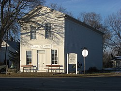 The John Pound Store in Oswego | |
 | |
| Coordinates: 41°17′59″N 85°49′38″W / 41.29972°N 85.82722°WCoordinates: 41°17′59″N 85°49′38″W / 41.29972°N 85.82722°W | |
| Country | United States |
| State | Indiana |
| County | Kosciusko |
| Government | |
| • Type | Indiana township |
| Area | |
| • Total | 35.9 sq mi (93 km2) |
| • Land | 33.93 sq mi (87.9 km2) |
| • Water | 1.97 sq mi (5.1 km2) |
| Elevation | 840 ft (256 m) |
| Population (2010) | |
| • Total | 7,698 |
| • Density | 226.9/sq mi (87.6/km2) |
| Time zone | UTC-5 (Eastern (EST)) |
| • Summer (DST) | UTC-4 (EDT) |
| FIPS code | 18-60228[2] |
| GNIS feature ID | 453743 |

Plain Township is one of seventeen townships in Kosciusko County, Indiana. As of the 2010 census, its population was 7,698 and it contained 3,679 housing units.[3]
History[]
The Robert Orr Polygonal Barn was listed on the National Register of Historic Places in 1992.[4]
Geography[]
According to the 2010 census, the township has a total area of 35.9 square miles (93 km2), of which 33.93 square miles (87.9 km2) (or 94.51%) is land and 1.97 square miles (5.1 km2) (or 5.49%) is water.[3]
Cities and towns[]
Unincorporated towns[]
- Arrowhead Park at 41°16′44″N 85°47′24″W / 41.2789341°N 85.7899895°W
- Bell Rohr Park at 41°19′54″N 85°46′52″W / 41.3317128°N 85.7811007°W
- Highlands Park at 41°16′24″N 85°47′09″W / 41.2733784°N 85.7858226°W
- Island Park at 41°17′13″N 85°48′01″W / 41.2869897°N 85.8002677°W
- Monoquet at 41°17′22″N 85°51′42″W / 41.2894896°N 85.8616588°W
- Osborn Landing at 41°16′52″N 85°47′49″W / 41.2811563°N 85.7969341°W
- Oswego at 41°19′13″N 85°47′14″W / 41.3203237°N 85.7872119°W
- Stoneburner Landing at 41°17′06″N 85°46′36″W / 41.2850453°N 85.7766558°W
- Stony Ridge at 41°19′38″N 85°46′37″W / 41.3272683°N 85.7769338°W
- Wa-Will-Away Park at 41°17′24″N 85°46′41″W / 41.2900454°N 85.7780448°W
(This list is based on USGS data and may include former settlements.)
Notable residents[]
- Chris Schenkel, former Sportscaster for ABC Sports. Resided in Leesburg.[5]
References[]
- ^ "US Board on Geographic Names". United States Geological Survey. 2007-10-25. Retrieved 2008-01-31.
- ^ "U.S. Census website". United States Census Bureau. Retrieved 2008-01-31.
- ^ a b "Population, Housing Units, Area, and Density: 2010 - County -- County Subdivision and Place -- 2010 Census Summary File 1". United States Census. Archived from the original on 2020-02-12. Retrieved 2013-05-10.
- ^ "National Register Information System". National Register of Historic Places. National Park Service. July 9, 2010.
- ^ "Chris Schenkel".
External links[]
Municipalities and communities of Kosciusko County, Indiana, United States | ||
|---|---|---|
| Cities | ||
| Towns | ||
| Townships | ||
| Unincorporated communities |
| |
| Footnotes | ‡This populated place also has portions in an adjacent county or counties | |
| ||
This Kosciusko County, Indiana location article is a stub. You can help Wikipedia by . |
Categories:
- Townships in Kosciusko County, Indiana
- Townships in Indiana
- Kosciusko County, Indiana geography stubs