Ponce de Leon, Florida
Ponce de Leon, Florida | |
|---|---|
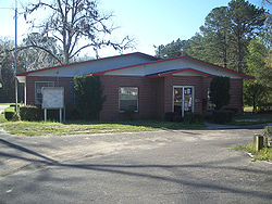 Town hall | |
 Location in Holmes County and the state of Florida | |
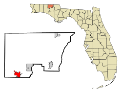
 Ponce de Leon Location in the United States | |
| Coordinates: 30°43′33″N 85°56′16″W / 30.72583°N 85.93778°WCoordinates: 30°43′33″N 85°56′16″W / 30.72583°N 85.93778°W | |
| Country | |
| State | |
| County | Holmes |
| Area | |
| • Total | 5.00 sq mi (12.95 km2) |
| • Land | 4.96 sq mi (12.85 km2) |
| • Water | 0.04 sq mi (0.10 km2) |
| Elevation | 62 ft (19 m) |
| Population (2010) | |
| • Total | 598 |
| • Estimate (2019)[4] | 567 |
| • Density | 114.29/sq mi (44.13/km2) |
| Time zone | UTC-6 (Central (CST)) |
| • Summer (DST) | UTC-5 (CDT) |
| ZIP code | 32455 |
| Area code(s) | 850 |
| FIPS code | 12-58175[2] |
| GNIS feature ID | 0289171[3] |
| Website | www |


Ponce de Leon (/ˌpɒns də ˈliːən/ PONSS də LEE-ən) is a town in Holmes County, Florida, United States. The population was 598 at the 2010 census,[5] up from 457 at the 2000 census. From 2000 to 2010, the Ponce de Leon town population growth percentage was 30.9%.
Geography[]

Ponce de Leon is located in southwestern Holmes County at 30°43′33″N 85°56′16″W / 30.72583°N 85.93778°W (30.725783, -85.937783).[6] U.S. Route 90 runs through the center of town, leading northeast 17 miles (27 km) to Bonifay, the Holmes County seat, and west 11 miles (18 km) to DeFuniak Springs. Florida State Road 81 crosses US 90 near the center of town, leading north 20 miles (32 km) to the Alabama border and south 19 miles (31 km) to Florida State Road 20 at . Interstate 10 passes through the southern part of Ponce de Leon, with access from Exit 96 (SR 81). I-10 leads east 107 miles (172 km) to Tallahassee and west 88 miles (142 km) to Pensacola.
According to the United States Census Bureau, the town has a total area of 5.0 square miles (12.9 km2), of which 4.9 square miles (12.8 km2) are land and 0.26 square kilometres (0.1 sq mi), or 0.78%, are water.[5] The town is in the valley of Sandy Creek, a south-flowing tributary of the Choctawhatchee River. Ponce de Leon Springs State Park is in the southern part of the town, north of I-10, along both sides of Sandy Creek. The entrance is on the eastern side of the park off Ponce de Leon Springs Road.
Demographics[]
| Historical population | |||
|---|---|---|---|
| Census | Pop. | %± | |
| 1970 | 288 | — | |
| 1980 | 454 | 57.6% | |
| 1990 | 406 | −10.6% | |
| 2000 | 457 | 12.6% | |
| 2010 | 598 | 30.9% | |
| 2019 (est.) | 567 | [4] | −5.2% |
| U.S. Decennial Census[7] | |||
As of the census[2] of 2010, there were 598 people, 246 households, and 131 families residing in the town. The population density was 92.3 people per square mile (35.6/km2). There were 290 housing units at n average density of 47.0 per square mile (18.2/km2). The racial makeup of the town was 91.60% White, 1.80% African American, 2.41% Native American, 1.00% from other races, and 2.00% from two or more races. Hispanic or Latino of any race were 3.00% of the population.
There were 200 households, out of which 30.0% had children under the age of 18 living with them, 48.5% were married couples living together, 11.5% had a female householder with no husband present, and 34.5% were non-families. 29.5% of all households were made up of individuals, and 14.5% had someone living alone who was 65 years of age or older. The average household size was 2.29 and the average family size was 2.82.
In the town, the population was spread out, with 24.9% under the age of 18, 6.3% from 18 to 24, 24.9% from 25 to 44, 28.0% from 45 to 64, and 15.8% who were 65 years of age or older. The median age was 40 years. For every 100 females, there were 94.5 males. For every 100 females age 18 and over, there were 92.7 males.
The median income for a household in the town was $25,521, and the median income for a family was $33,250. Males had a median income of $26,339 versus $13,750 for females. The per capita income for the town was $14,673. About 16.9% of families and 19.3% of the population were below the poverty line, including 22.2% of those under age 18 and 19.4% of those age 65 or over.
See also[]
| Wikimedia Commons has media related to Ponce de Leon, Florida. |
References[]
- ^ "2019 U.S. Gazetteer Files". United States Census Bureau. Retrieved July 2, 2020.
- ^ Jump up to: a b "U.S. Census website". United States Census Bureau. Retrieved 2008-01-31.
- ^ "US Board on Geographic Names". United States Geological Survey. 2007-10-25. Retrieved 2008-01-31.
- ^ Jump up to: a b "Population and Housing Unit Estimates". United States Census Bureau. May 24, 2020. Retrieved May 27, 2020.
- ^ Jump up to: a b "Geographic Identifiers: 2010 Demographic Profile Data (G001): Esto town, Florida". American Factfinder. U.S. Census Bureau. Retrieved May 15, 2017.[dead link]
- ^ "US Gazetteer files: 2010, 2000, and 1990". United States Census Bureau. 2011-02-12. Retrieved 2011-04-23.
- ^ "Census of Population and Housing". Census.gov. Retrieved June 4, 2015.
| show Municipalities and communities of Holmes County, Florida, United States |
|---|

| show Authority control |
|---|
- Towns in Holmes County, Florida
- Towns in Florida
- Former census-designated places in Florida