President Quirino, Sultan Kudarat
This article needs additional citations for verification. (May 2014) |
President Quirino | |
|---|---|
| Municipality of President Quirino | |
 Seal | |
Nickname(s):
| |
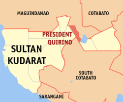 Map of Sultan Kudarat with President Quirino highlighted | |
OpenStreetMap  | |
 President Quirino Location within the Philippines | |
| Coordinates: 6°42′N 124°44′E / 6.7°N 124.73°ECoordinates: 6°42′N 124°44′E / 6.7°N 124.73°E | |
| Country | Philippines |
| Region | Soccsksargen |
| Province | Sultan Kudarat |
| District | 1st district |
| Founded | November 22, 1973 |
| Named for | Elpidio Quirino |
| Barangays | 19 (see Barangays) |
| Government | |
| • Type | Sangguniang Bayan |
| • Mayor | Azel V. Mangudadatu |
| • Vice Mayor | Ma. Katrina Buena F. Sandigan |
| • Representative | Bai Rihan M. Sakaluran |
| • Municipal Council | Members |
| • Electorate | 24,263 voters (2019) |
| Area | |
| • Total | 208.40 km2 (80.46 sq mi) |
| Elevation | 29 m (95 ft) |
| Highest elevation | 69 m (226 ft) |
| Lowest elevation | 13 m (43 ft) |
| Population (2020 census) [3] | |
| • Total | 42,244 |
| • Density | 200/km2 (530/sq mi) |
| • Households | 9,663 |
| Economy | |
| • Income class | 3rd municipal income class |
| • Poverty incidence | 30.11% (2015)[4] |
| • Revenue | ₱157,703,836.07 (2020) |
| • Assets | ₱185,959,160.64 (2020) |
| • Expenditure | ₱115,530,163.17 (2020) |
| • Liabilities | ₱85,191,635.35 (2020) |
| Service provider | |
| • Electricity | Sultan Kudarat Electric Cooperative (SUKELCO) |
| Time zone | UTC+8 (PST) |
| ZIP code | 9804 |
| PSGC | |
| IDD : area code | +63 (0)64 |
| Native languages | Hiligaynon Maguindanao Tagalog |

President Quirino, officially the Municipality of President Quirino (Filipino: Bayan ng President Quirino; Hiligaynon: Banwa sang President Quirino; Ilocano: Ili ti President Quirino), is a 3rd class municipality in the province of Sultan Kudarat, Philippines. According to the 2020 census, it has a population of 42,244 people. [3]
History[]
President Quirino was formerly called as Sambulawan and it is actually the portion of the Municipality of Buluan, Maguindanao and Tacurong City. Pres. Quirino was created into a separate municipality on November 22, 1973, at the same time when the Province of Cotabato was divided into the provinces of North Cotabato, Maguindanao, and Sultan Kudarat, by presidential decree 341 of President Ferdinand Marcos.[5]
Geography[]
President Quirino is located at the center of Central Mindanao. It is 110 kilometres (68 mi) from General Santos City, 108 kilometres (67 mi) from Cotabato City, and 248 kilometres (154 mi) from Davao City. It is situated at the crossroads of the Davao-Gen. Santos-Cotabato highways.
In the northern part is the municipality of General Salipada K. Pendatun, Maguindanao, in the eastern part is municipality of Buluan, Maguindanao, in the western part is the city of Tacurong and the southern part is the municipality of Tantangan, South Cotabato, in south-eastern part is municipality of Lutayan and Mangudadatu.
President Quirino is a vast plain municipality having one barangay (Estrella) extending to the lakeside of the famous Buluan Lake. It has four existing types of soil namely; tinambulan peat, Banga sandy loam, Lutayan clay, and hydrosol.
Barangays[]
President Quirino is politically subdivided into 19 barangays.
- Bagumbayan
- Bannawag
- Bayawa
- Central Mangilala
- Estrella
- Kalanawi I
- Kalanawi II
- Katico
- Malingon
- Mangelen
- Pedtubo
- Poblacion (Sambulawan)
- Romualdez
- San Jose
- Sinakulay
- Suben
- Tinaungan
- Tual (Liguasan)
- Tuato (San Pedro)
Climate[]
| Climate data for President Quirino, Sultan Kudarat | |||||||||||||
|---|---|---|---|---|---|---|---|---|---|---|---|---|---|
| Month | Jan | Feb | Mar | Apr | May | Jun | Jul | Aug | Sep | Oct | Nov | Dec | Year |
| Average high °C (°F) | 31 (88) |
31 (88) |
32 (90) |
32 (90) |
31 (88) |
30 (86) |
30 (86) |
30 (86) |
30 (86) |
30 (86) |
30 (86) |
31 (88) |
31 (87) |
| Average low °C (°F) | 23 (73) |
23 (73) |
23 (73) |
24 (75) |
24 (75) |
24 (75) |
24 (75) |
24 (75) |
24 (75) |
24 (75) |
24 (75) |
23 (73) |
24 (74) |
| Average precipitation mm (inches) | 64 (2.5) |
45 (1.8) |
59 (2.3) |
71 (2.8) |
140 (5.5) |
179 (7.0) |
192 (7.6) |
198 (7.8) |
163 (6.4) |
147 (5.8) |
113 (4.4) |
66 (2.6) |
1,437 (56.5) |
| Average rainy days | 12.2 | 10.3 | 12.7 | 15.7 | 26.0 | 27.4 | 28.1 | 28.2 | 26.0 | 26.7 | 22.9 | 16.6 | 252.8 |
| Source: Meteoblue[6] | |||||||||||||
Demographics[]
| Year | Pop. | ±% p.a. |
|---|---|---|
| 1975 | 19,029 | — |
| 1980 | 20,601 | +1.60% |
| 1990 | 23,591 | +1.36% |
| 1995 | 28,206 | +3.40% |
| 2000 | 32,721 | +3.23% |
| 2007 | 33,595 | +0.36% |
| 2010 | 38,753 | +5.34% |
| 2015 | 41,408 | +1.27% |
| 2020 | 42,244 | +0.39% |
| Source: Philippine Statistics Authority [7] [8] [9][10] | ||
Language[]
People speak Maguindanao, Tagalog, Cebuano, Ilocano and Hiligaynon. Most of the residents came from Pangasinan, Ilocos Sur and National Capital Region, with significant settlers from Iloilo and Negros. Indigenous people such as Blaan, Manobo and T'boli can be founded in Barangay Bagumbayan, Manobo can be found on Barangay Kalanawe I and Barangay Tinaungan, Blaan from Barangay San Jose and Islam or Muslim on Barangay Bayawa as the barangay is near to the Municipality of Buluan which is from the province of Maguindanao.
Economy[]
| Poverty Incidence of President Quirino | |
| Source: Philippine Statistics Authority[11][12][13][14][15][16][17] | |
President Quirino is the one of the economic and agricultural town in the Philippines, some of this is selling "sukang tuba at tubo" or vinegar of the coconut/sugarcane. And one of this is the finest "muscovado", is a type of partially refined to unrefined brown sugar with a strong molasses content and flavour.
Small-scale industries include electronics and repair shop, car/motor vehicle body builder/repair shop, vulcanizing and machine shop, shoe and appliance repair shops hollow blocks/culvert making basket/mat weaving, dressmaking/tailoring, balut making, bakery. Other major industries is the rattan making, Banana, Coconut, Palay, Corn and African Palm Oils. People doing an corn -drying process, rice milling and other milling process, are found in the poblacion or in central town.
Sambuyawan Festival and Tagapulot Festival[]
Sambuyawan Festival
Sambuyawan is celebrated every third week of November on giving way on its foundation in 1973. Cultures, local products, and tradition are shown in the festival such as Street dancing, drum & lyre, singing, dancing and other activities. Festival's name was derived from the former town named Sambulawan.
Muscovado / Tagapulot Festival
The Muscovado Festival is celebrated every December 12, In which people must be recognized the town's own economic product which is Tagapulot or sweet Sugarcane candy from the sugarcane plantations.
Transportation and Communications[]
Transportation[]
President Quirino has no any public transport terminal, but there has habal-habal, jeepney, multicab, and bus transportation where you can hop in around the Kidapawan-Junction highway.
Communications[]
President Quirino has an official lane of Smart Communication tower substation and Globe Telecom substation in Barangay Poblacion.
References[]
- ^ Municipality of President Quirino | (DILG)
- ^ "2015 Census of Population, Report No. 3 – Population, Land Area, and Population Density" (PDF). Philippine Statistics Authority. Quezon City, Philippines. August 2016. ISSN 0117-1453. Archived (PDF) from the original on May 25, 2021. Retrieved July 16, 2021.
- ^ a b Census of Population (2020). "Region XII (Soccsksargen)". Total Population by Province, City, Municipality and Barangay. PSA. Retrieved 8 July 2021.
- ^ https://psa.gov.ph/sites/default/files/City%20and%20Municipal-level%20Small%20Area%20Poverty%20Estimates_%202009%2C%202012%20and%202015_0.xlsx; publication date: 10 July 2019; publisher: Philippine Statistics Authority.
- ^ "Presidential Decree No. 341, s. 1973". Official Gazette of the Republic of the Philippines. Retrieved 9 September 2017.
- ^ "President Quirino: Average Temperatures and Rainfall". Meteoblue. Retrieved 15 May 2020.
- ^ Census of Population (2015). "Region XII (Soccsksargen)". Total Population by Province, City, Municipality and Barangay. PSA. Retrieved 20 June 2016.
- ^ Census of Population and Housing (2010). "Region XII (Soccsksargen)". Total Population by Province, City, Municipality and Barangay. NSO. Retrieved 29 June 2016.
- ^
Censuses of Population (1903–2007). "Region XII (Soccsksargen)". Table 1. Population Enumerated in Various Censuses by Province/Highly Urbanized City: 1903 to 2007. NSO.
{{cite encyclopedia}}: CS1 maint: url-status (link) - ^ "Province of Sultan Kudarat". Municipality Population Data. Local Water Utilities Administration Research Division. Retrieved 17 December 2016.
- ^ "Poverty incidence (PI):". Philippine Statistics Authority. Retrieved 28 December 2020.
- ^ https://psa.gov.ph/sites/default/files/NSCB_LocalPovertyPhilippines_0.pdf; publication date: 29 November 2005; publisher: Philippine Statistics Authority.
- ^ https://psa.gov.ph/sites/default/files/2003%20SAE%20of%20poverty%20%28Full%20Report%29_1.pdf; publication date: 23 March 2009; publisher: Philippine Statistics Authority.
- ^ https://psa.gov.ph/sites/default/files/2006%20and%202009%20City%20and%20Municipal%20Level%20Poverty%20Estimates_0_1.pdf; publication date: 3 August 2012; publisher: Philippine Statistics Authority.
- ^ https://psa.gov.ph/sites/default/files/2012%20Municipal%20and%20City%20Level%20Poverty%20Estima7tes%20Publication%20%281%29.pdf; publication date: 31 May 2016; publisher: Philippine Statistics Authority.
- ^ https://psa.gov.ph/sites/default/files/City%20and%20Municipal-level%20Small%20Area%20Poverty%20Estimates_%202009%2C%202012%20and%202015_0.xlsx; publication date: 10 July 2019; publisher: Philippine Statistics Authority.
- ^ "PSA Releases the 2018 Municipal and City Level Poverty Estimates". Philippine Statistics Authority. 15 December 2021. Retrieved 22 January 2022.
External links[]
- President Quirino Profile at PhilAtlas.com
- Philippine Standard Geographic Code
- Philippine Census Information
- Local Governance Performance Management System
Places adjacent to President Quirino, Sultan Kudarat | ||||||||||||||||
|---|---|---|---|---|---|---|---|---|---|---|---|---|---|---|---|---|
| ||||||||||||||||
Isulan (capital) | |
| Municipalities | |
| Component city | |
- Municipalities of Sultan Kudarat