Pandag, Maguindanao
Pandag | |
|---|---|
| Municipality of Pandag | |
 Seal | |
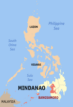
 Map of Maguindanao with Pandag highlighted | |
 | |
 Pandag Location within the Philippines | |
| Coordinates: 6°44′28″N 124°46′58″E / 6.741053°N 124.782714°ECoordinates: 6°44′28″N 124°46′58″E / 6.741053°N 124.782714°E | |
| Country | Philippines |
| Region | Bangsamoro Autonomous Region in Muslim Mindanao |
| Province | Maguindanao |
| District | 2nd district |
| Founded | December 30, 2006 |
| Barangays | 8 (see Barangays) |
| Government | |
| • Type | Sangguniang Bayan |
| • Mayor | Zihan M. Mangudadatu |
| • Vice Mayor | Dante P. Mamalinta |
| • Representative | Esmael G. Mangudadatu |
| • Municipal Council | Members |
| • Electorate | 12,330 voters (2019) |
| Area | |
| • Total | 85.31 km2 (32.94 sq mi) |
| Elevation | 18 m (59 ft) |
| Highest elevation | 38 m (125 ft) |
| Lowest elevation | 7 m (23 ft) |
| Population (2020 census) [3] | |
| • Total | 26,356 |
| • Density | 310/km2 (800/sq mi) |
| • Households | 3,906 |
| Economy | |
| • Poverty incidence | 61.14% (2015)[4] |
| • Revenue | ₱92,276,000.00 (2020) |
| • Assets | ₱29,344,000.00 (2020) |
| • Expenditure | ₱90,097,000.00 (2020) |
| • Liabilities | ₱11,324,000.00 (2020) |
| Service provider | |
| • Electricity | Maguindanao Electric Cooperative (MAGELCO) |
| Time zone | UTC+8 (PST) |
| ZIP code | 9616 |
| PSGC | |
| IDD : area code | +63 (0)64 |
| Native languages | Maguindanao Tagalog |

Pandag, officially the Municipality of Pandag (Maguindanaon: Ingud nu Pandag; Iranun: Inged a Pandag; Tagalog: Bayan ng Pandag), is a municipality in the province of Maguindanao, Philippines. According to the 2020 census, it has a population of 26,356 people. [3]
It was created out of 8 barangays of Buluan, Maguindanao, by virtue of Muslim Mindanao Autonomy Act No. 203,[5] which was subsequently ratified in a plebiscite held on December 30, 2006.
Geography[]
Barangays[]
Pandag is politically subdivided into 8 barangays.
- Kabuling
- Kayaga
- Kayupo (Cuyapo)
- Lepak
- Lower Dilag
- Malangit
- Pandag
Climate[]
| Climate data for Pandag, Maguindanao | |||||||||||||
|---|---|---|---|---|---|---|---|---|---|---|---|---|---|
| Month | Jan | Feb | Mar | Apr | May | Jun | Jul | Aug | Sep | Oct | Nov | Dec | Year |
| Average high °C (°F) | 31 (88) |
31 (88) |
32 (90) |
32 (90) |
31 (88) |
30 (86) |
30 (86) |
30 (86) |
30 (86) |
30 (86) |
30 (86) |
31 (88) |
31 (87) |
| Average low °C (°F) | 23 (73) |
23 (73) |
23 (73) |
24 (75) |
24 (75) |
24 (75) |
24 (75) |
24 (75) |
24 (75) |
24 (75) |
24 (75) |
24 (75) |
24 (75) |
| Average precipitation mm (inches) | 64 (2.5) |
45 (1.8) |
59 (2.3) |
71 (2.8) |
140 (5.5) |
179 (7.0) |
192 (7.6) |
198 (7.8) |
163 (6.4) |
147 (5.8) |
113 (4.4) |
66 (2.6) |
1,437 (56.5) |
| Average rainy days | 12.2 | 10.3 | 12.7 | 15.7 | 26.0 | 27.4 | 28.1 | 28.2 | 26.0 | 26.7 | 22.9 | 16.6 | 252.8 |
| Source: Meteoblue (modeled/calculated data, not measured locally)[6] | |||||||||||||
Demographics[]
| Year | Pop. | ±% p.a. |
|---|---|---|
| 2007 | 20,557 | — |
| 2010 | 13,795 | −13.51% |
| 2015 | 25,057 | +12.04% |
| 2020 | 26,356 | +1.00% |
| Source: Philippine Statistics Authority [7] [8] [9][10] | ||
Economy[]
| Poverty Incidence of Pandag | |
| Source: Philippine Statistics Authority[11][12][13][14] | |
References[]
- ^ Municipality of Pandag | (DILG)
- ^ "2015 Census of Population, Report No. 3 – Population, Land Area, and Population Density" (PDF). Philippine Statistics Authority. Quezon City, Philippines. August 2016. ISSN 0117-1453. Archived (PDF) from the original on May 25, 2021. Retrieved July 16, 2021.
- ^ a b Census of Population (2020). "BARMM". Total Population by Province, City, Municipality and Barangay. PSA. Retrieved 8 July 2021.
- ^ https://psa.gov.ph/sites/default/files/City%20and%20Municipal-level%20Small%20Area%20Poverty%20Estimates_%202009%2C%202012%20and%202015_0.xlsx; publication date: 10 July 2019; publisher: Philippine Statistics Authority.
- ^ "Muslim Mindanao Autonomy Act No. 203; An Act Creating Municipality of Pandag in the Province of Maguindanao, Providing Funds Therefor, and for Other Purposes" (PDF). Regional Legislative Assembly, Autonomous Region in Muslim Mindanao. Retrieved 27 January 2016.
- ^ "Pandag, Maguindanao : Average Temperatures and Rainfall". Meteoblue. Retrieved 19 January 2019.
- ^ Census of Population (2015). "ARMM – Autonomous Region in Muslim Mindanao". Total Population by Province, City, Municipality and Barangay. PSA. Retrieved 20 June 2016.
- ^ Census of Population and Housing (2010). "ARMM – Autonomous Region in Muslim Mindanao". Total Population by Province, City, Municipality and Barangay. NSO. Retrieved 29 June 2016.
- ^ Censuses of Population (1903–2007). "ARMM – Autonomous Region in Muslim Mindanao". Table 1. Population Enumerated in Various Censuses by Province/Highly Urbanized City: 1903 to 2007. NSO.
- ^ "Province of Maguindanao". Municipality Population Data. Local Water Utilities Administration Research Division. Retrieved 17 December 2016.
- ^ "Poverty incidence (PI):". Philippine Statistics Authority. Retrieved 28 December 2020.
- ^ https://psa.gov.ph/sites/default/files/2006%20and%202009%20City%20and%20Municipal%20Level%20Poverty%20Estimates_0_1.pdf; publication date: 3 August 2012; publisher: Philippine Statistics Authority.
- ^ https://psa.gov.ph/sites/default/files/2012%20Municipal%20and%20City%20Level%20Poverty%20Estima7tes%20Publication%20%281%29.pdf; publication date: 31 May 2016; publisher: Philippine Statistics Authority.
- ^ https://psa.gov.ph/sites/default/files/City%20and%20Municipal-level%20Small%20Area%20Poverty%20Estimates_%202009%2C%202012%20and%202015_0.xlsx; publication date: 10 July 2019; publisher: Philippine Statistics Authority.
External links[]
- Pandag Profile at PhilAtlas.com
- MMA Act No. 203 : An Act Creating Municipality of Pandag in the Province of Maguindanao
- Newly created provinces, municipalities, barangays, converted city Accessed on March 9, 2006.
- Philippine Standard Geographic Code
- Philippine Census Information
- Local Governance Performance Management System
Places adjacent to Pandag, Maguindanao | ||||||||||||||||
|---|---|---|---|---|---|---|---|---|---|---|---|---|---|---|---|---|
| ||||||||||||||||
Buluan (capital) | ||
| Municipalities |
|  |
| Independent component city |
| |
This article about a location in the Bangsamoro Autonomous Region in Muslim Mindanao is a stub. You can help Wikipedia by . |
Categories:
- Municipalities of Maguindanao
- Bangsamoro geography stubs