Tagoloan, Lanao del Sur
Tagoloan | |
|---|---|
| Municipality of Tagoloan | |
 Seal | |
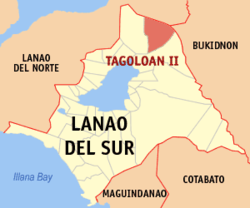 Map of Lanao del Sur with Tagoloan highlighted | |
OpenStreetMap  | |
 Tagoloan Location within the Philippines | |
| Coordinates: 8°06′33″N 124°26′21″E / 8.10917°N 124.43917°ECoordinates: 8°06′33″N 124°26′21″E / 8.10917°N 124.43917°E | |
| Country | Philippines |
| Region | Bangsamoro Autonomous Region in Muslim Mindanao |
| Province | Lanao del Sur |
| District | 1st district |
| Barangays | 19 (see Barangays) |
| Government | |
| • Type | Sangguniang Bayan |
| • Mayor | Cosain L. Capal |
| • Vice Mayor | Mangondaya L. Capal |
| • Representative | Ansaruddin Abdul Malik A. Adiong |
| • Municipal Council | Members |
| • Electorate | 11,320 voters (2019) |
| Area | |
| • Total | 362.35 km2 (139.90 sq mi) |
| Elevation | 800 m (2,600 ft) |
| Highest elevation | 1,304 m (4,278 ft) |
| Lowest elevation | 560 m (1,840 ft) |
| Population (2020 census) [3] | |
| • Total | 12,602 |
| • Density | 35/km2 (90/sq mi) |
| • Households | 1,283 |
| Economy | |
| • Income class | 4th municipal income class |
| • Poverty incidence | 78.23% (2015)[4] |
| • Revenue | ₱124,891,908.50 (2020) |
| • Assets | ₱34,979,093.86 (2020) |
| • Expenditure | ₱128,174,021.14 (2020) |
| • Liabilities | ₱232,323.32 (2020) |
| Service provider | |
| • Electricity | Lanao del Sur Electric Cooperative (LASURECO) |
| Time zone | UTC+8 (PST) |
| ZIP code | 9321 |
| PSGC | |
| IDD : area code | +63 (0)63 |
| Native languages | Maranao Tagalog |
| Website | www |

Tagoloan, officially the Municipality of Tagoloan (Maranao: Inged a Tagoloan; Tagalog: Bayan ng Tagoloan) and also known as Tagoloan II, is a 4th class municipality in the province of Lanao del Sur, Philippines. According to the 2020 census, it has a population of 12,602 people. [3]
Etymology[]
Tagoloan is a compound word composed of Maranao terms tago, referring to something inside i.e. inhabitants, and oloan, "leader", referring to Sultan .
Sharif Alawi established the Sultanate of Tagoloan in 1500. Some local historians say it was in the year 1515[5] while his younger brother Sultan was enthroned as the First Sultan of Maguindanao in the year 1520 (see Confederation of sultanates in Lanao).
Sharif Alawi and Sharif Kabunsuan came from Johore, a state in Malaysia and first landed in Mindanao in the year 1475 at an islet (now Agutayan reef, in Jasaan, Misamis Oriental,[6] visible from the seaport of the Municipality of Tagoloan in the Province of Misamis Oriental, Northern Mindanao. Other local Moro historian mentioned that these brothers arrived in Mindanao in the year 1464[5]
Sultan Sharif Alawi spread Islam (prior to the arrival of Christianity in Philippine in 1521), in this town towards Surigao, Butuan, Bukidnon, Davao, Lanao del Sur and Norte, stretching towards Misamis Occidental in western Mindanao. Sultan Sharif Kabunsuan only preached Islam in Maguindanao.
Geography[]
It is situated in the northern part of the Province of Lanao del Sur, containing a total land area of 60,214 hectares, more or less. This area is based on the territorial jurisdiction covered by those barangays (39 Barangays) named in the Presidential Decree 1548 dated June 11, 1978,[7] otherwise known as the "charter creation of the Municipality of Tagoloan II in the Province of Lanao del Sur" which hereby described as follows;
Bounded on the east by Cagayan river (Municipality of Talakag, Province of Bukidnon); on the south by Municipality of Bubong, Province of Lanao del Sur; on the south-west by Municipality of Kapai, Province of Lanao del Sur and Municipality of Tagoloan, Province of Lanao del Norte; on the west by City of Iligan; on the north by Cagayan de Oro City, Province of Misamis Oriental.
Barangays[]
Municipality of Tagoloan II is politically subdivided into thirty-nine (39) barangays under the P.D. 1548 dated June 11, 1978[7] and was then reduced into nineteen (19) barangays, as affected by E.O. No. 108, Series of 1986[8] namely, are;
- Bantalan
- Bayog
- Cadayonan
- Dagonalan
- Domalama
- Gayakay
- Inudaran
- Kalilangan
- Kianibong
- Kinggan
- Kita-o-an
- Bago-ah Ingud
- Malinao
- Malingun
- Mama-an Pagalongan
- Marawi
- Mimbaguiang
- Sigayan
- Tagoloan Poblacion
Climate[]
| Climate data for Tagoloan II, Lanao de Sur | |||||||||||||
|---|---|---|---|---|---|---|---|---|---|---|---|---|---|
| Month | Jan | Feb | Mar | Apr | May | Jun | Jul | Aug | Sep | Oct | Nov | Dec | Year |
| Average high °C (°F) | 22 (72) |
23 (73) |
24 (75) |
24 (75) |
24 (75) |
23 (73) |
23 (73) |
24 (75) |
24 (75) |
24 (75) |
23 (73) |
23 (73) |
23 (74) |
| Average low °C (°F) | 18 (64) |
18 (64) |
18 (64) |
19 (66) |
20 (68) |
19 (66) |
19 (66) |
19 (66) |
19 (66) |
19 (66) |
19 (66) |
18 (64) |
19 (66) |
| Average precipitation mm (inches) | 159 (6.3) |
143 (5.6) |
166 (6.5) |
183 (7.2) |
357 (14.1) |
414 (16.3) |
333 (13.1) |
309 (12.2) |
289 (11.4) |
285 (11.2) |
253 (10.0) |
166 (6.5) |
3,057 (120.4) |
| Average rainy days | 18.4 | 17.2 | 20.6 | 23.4 | 29.3 | 29.2 | 29.9 | 29.4 | 27.7 | 28.7 | 25.5 | 19.9 | 299.2 |
| Source: Meteoblue (modeled/calculated data, not measured locally)[9] | |||||||||||||
Demographics[]
| Year | Pop. | ±% p.a. |
|---|---|---|
| 1970 | 1,853 | — |
| 1975 | 2,305 | +4.47% |
| 1980 | 4,876 | +16.16% |
| 1990 | 7,414 | +4.28% |
| 1995 | 7,760 | +0.86% |
| 2000 | 8,714 | +2.52% |
| 2007 | 11,144 | +3.45% |
| 2010 | 9,843 | −4.42% |
| 2015 | 11,169 | +2.44% |
| 2020 | 12,602 | +2.40% |
| Source: Philippine Statistics Authority [10] [11] [12][13] | ||
Economy[]
| Poverty Incidence of Tagoloan | |
| Source: Philippine Statistics Authority[14][15][16][17][18][19] | |
References[]
- ^ Municipality of Tagoloan | (DILG)
- ^ "2015 Census of Population, Report No. 3 – Population, Land Area, and Population Density" (PDF). Philippine Statistics Authority. Quezon City, Philippines. August 2016. ISSN 0117-1453. Archived (PDF) from the original on May 25, 2021. Retrieved July 16, 2021.
- ^ a b Census of Population (2020). "BARMM". Total Population by Province, City, Municipality and Barangay. PSA. Retrieved 8 July 2021.
- ^ https://psa.gov.ph/sites/default/files/City%20and%20Municipal-level%20Small%20Area%20Poverty%20Estimates_%202009%2C%202012%20and%202015_0.xlsx; publication date: 10 July 2019; publisher: Philippine Statistics Authority.
- ^ a b "Ontay & Marogong.Net - TAGOLOAN SULTANATE".
- ^ "Wikimapia - Let's describe the whole world!".
- ^ a b "P.D. No. 1548".
- ^ gov.ph
- ^ "Tagoloan II, Lanao del Sur : Average Temperatures and Rainfall". Meteoblue. Retrieved 27 January 2019.
- ^ Census of Population (2015). "ARMM – Autonomous Region in Muslim Mindanao". Total Population by Province, City, Municipality and Barangay. PSA. Retrieved 20 June 2016.
- ^ Census of Population and Housing (2010). "ARMM – Autonomous Region in Muslim Mindanao". Total Population by Province, City, Municipality and Barangay. NSO. Retrieved 29 June 2016.
- ^ Censuses of Population (1903–2007). "ARMM – Autonomous Region in Muslim Mindanao". Table 1. Population Enumerated in Various Censuses by Province/Highly Urbanized City: 1903 to 2007. NSO.
- ^ "Province of Lanao del Sur". Municipality Population Data. Local Water Utilities Administration Research Division. Retrieved 17 December 2016.
- ^ "Poverty incidence (PI):". Philippine Statistics Authority. Retrieved 28 December 2020.
- ^ https://psa.gov.ph/sites/default/files/NSCB_LocalPovertyPhilippines_0.pdf; publication date: 29 November 2005; publisher: Philippine Statistics Authority.
- ^ https://psa.gov.ph/sites/default/files/2003%20SAE%20of%20poverty%20%28Full%20Report%29_1.pdf; publication date: 23 March 2009; publisher: Philippine Statistics Authority.
- ^ https://psa.gov.ph/sites/default/files/2006%20and%202009%20City%20and%20Municipal%20Level%20Poverty%20Estimates_0_1.pdf; publication date: 3 August 2012; publisher: Philippine Statistics Authority.
- ^ https://psa.gov.ph/sites/default/files/2012%20Municipal%20and%20City%20Level%20Poverty%20Estima7tes%20Publication%20%281%29.pdf; publication date: 31 May 2016; publisher: Philippine Statistics Authority.
- ^ https://psa.gov.ph/sites/default/files/City%20and%20Municipal-level%20Small%20Area%20Poverty%20Estimates_%202009%2C%202012%20and%202015_0.xlsx; publication date: 10 July 2019; publisher: Philippine Statistics Authority.
External links[]
- Tagoloan II Profile at PhilAtlas.com
- Philippine Standard Geographic Code
- Philippine Census Information
- Local Governance Performance Management System
Places adjacent to Tagoloan, Lanao del Sur | ||||||||||||||||
|---|---|---|---|---|---|---|---|---|---|---|---|---|---|---|---|---|
| ||||||||||||||||

- Municipalities of Lanao del Sur