Datu Hoffer Ampatuan
Datu Hoffer Ampatuan | |
|---|---|
| Municipality of Datu Hoffer Ampatuan | |
 Flag  Seal | |
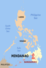
 Map of Maguindanao with Datu Hoffer Ampatuan highlighted | |
 | |
 Datu Hoffer Ampatuan Location within the Philippines | |
| Coordinates: 6°51′29″N 124°25′31″E / 6.858003°N 124.425244°ECoordinates: 6°51′29″N 124°25′31″E / 6.858003°N 124.425244°E | |
| Country | Philippines |
| Region | Bangsamoro Autonomous Region in Muslim Mindanao |
| Province | Maguindanao |
| District | 2nd district |
| Founded | July 30, 2009 |
| Barangays | 11 (see Barangays) |
| Government | |
| • Type | Sangguniang Bayan |
| • Mayor | Bongbong M. Ampatuan |
| • Vice Mayor | Bai Noraila Kristina M. Ampatuan |
| • Representative | Esmael "Toto" Gaguil Mangudadatu |
| • Municipal Council | Members |
| • Electorate | 7,453 voters (2019) |
| Area | |
| • Total | 461.10 km2 (178.03 sq mi) |
| Elevation | 132 m (433 ft) |
| Highest elevation | 751 m (2,464 ft) |
| Lowest elevation | 15 m (49 ft) |
| Population (2020 census) [3] | |
| • Total | 26,660 |
| • Density | 58/km2 (150/sq mi) |
| • Households | 4,308 |
| Economy | |
| • Poverty incidence | 61.68% (2015)[4] |
| • Revenue | ₱97,229,000.00 (2020) |
| • Assets | ₱79,446,000.00 (2020) |
| • Expenditure | ₱90,674,000.00 (2020) |
| • Liabilities | ₱1,147,000.00 (2020) |
| Service provider | |
| • Electricity | Maguindanao Electric Cooperative (MAGELCO) |
| Time zone | UTC+8 (PST) |
| ZIP code | 9608 |
| PSGC | |
| IDD : area code | +63 (0)64 |
| Native languages | Maguindanao Tagalog |

Datu Hoffer Ampatuan, officially the Municipality of Datu Hoffer Ampatuan (Maguindanaon: Ingud nu Datu Hoffer Ampatuan; Iranun: Inged a Datu Hoffer Ampatuan; Tagalog: Bayan ng Datu Hoffer Ampatuan), is a municipality in the province of Maguindanao, Philippines. According to the 2020 census, it has a population of 26,660 people. [3]
It was created out of 9 barangays from the municipality of Shariff Aguak, and portions of 2 barangays from Datu Unsay, by virtue of Muslim Mindanao Autonomy Act No. 220,[5] which was subsequently ratified in a plebiscite held on July 30, 2009.
Geography[]
Barangays[]
Datu Hoffer Ampatuan is politically subdivided into 11 barangays.
- Kubentong
- Labu-labu I
- Labu-labu II
- Limpongo
- Macalag
- Sayap
- Taib
- Talibadok
- Tuayan
- Tuayan I
Climate[]
| Climate data for Datu Hoffer Ampatuan, Maguindanao | |||||||||||||
|---|---|---|---|---|---|---|---|---|---|---|---|---|---|
| Month | Jan | Feb | Mar | Apr | May | Jun | Jul | Aug | Sep | Oct | Nov | Dec | Year |
| Average high °C (°F) | 31 (88) |
31 (88) |
32 (90) |
31 (88) |
30 (86) |
29 (84) |
29 (84) |
29 (84) |
29 (84) |
29 (84) |
30 (86) |
30 (86) |
30 (86) |
| Average low °C (°F) | 20 (68) |
21 (70) |
21 (70) |
22 (72) |
23 (73) |
23 (73) |
22 (72) |
23 (73) |
23 (73) |
23 (73) |
22 (72) |
21 (70) |
22 (72) |
| Average precipitation mm (inches) | 30 (1.2) |
19 (0.7) |
25 (1.0) |
24 (0.9) |
64 (2.5) |
88 (3.5) |
102 (4.0) |
105 (4.1) |
76 (3.0) |
82 (3.2) |
60 (2.4) |
26 (1.0) |
701 (27.5) |
| Average rainy days | 9.8 | 8.5 | 11.3 | 11.9 | 21.6 | 23.9 | 24.1 | 24.5 | 20.9 | 21.8 | 16.8 | 11.8 | 206.9 |
| Source: Meteoblue (modeled/calculated data, not measured locally) [6] | |||||||||||||
Demographics[]
| Year | Pop. | ±% p.a. |
|---|---|---|
| 2010 | 16,295 | — |
| 2015 | 25,012 | +8.50% |
| 2020 | 26,660 | +1.26% |
| Source: Philippine Statistics Authority [7] [8] [9][10] | ||
Economy[]
| Poverty Incidence of Datu Hoffer Ampatuan | |
| Source: Philippine Statistics Authority[11][12][13] | |
References[]
- ^ Municipality of Datu Hoffer Ampatuan | (DILG)
- ^ "2015 Census of Population, Report No. 3 – Population, Land Area, and Population Density" (PDF). Philippine Statistics Authority. Quezon City, Philippines. August 2016. ISSN 0117-1453. Archived (PDF) from the original on May 25, 2021. Retrieved July 16, 2021.
- ^ a b Census of Population (2020). "BARMM". Total Population by Province, City, Municipality and Barangay. PSA. Retrieved 8 July 2021.
- ^ https://psa.gov.ph/sites/default/files/City%20and%20Municipal-level%20Small%20Area%20Poverty%20Estimates_%202009%2C%202012%20and%202015_0.xlsx; publication date: 10 July 2019; publisher: Philippine Statistics Authority.
- ^ "Muslim Mindanao Autonomy Act No. xxx; An Act Creating the Municipality of Datu Hoffer in the Province of Maguindanao, Providing Funds therefor, and for Other Purposes" (PDF). Regional Legislative Assembly, Autonomous Region in Muslim Mindanao. Retrieved 27 January 2016.
- ^ "Datu Hoffer Ampatuan, Maguindanao : Average Temperatures and Rainfall". Meteoblue. Retrieved 19 January 2019.
- ^ Census of Population (2015). "ARMM – Autonomous Region in Muslim Mindanao". Total Population by Province, City, Municipality and Barangay. PSA. Retrieved 20 June 2016.
- ^ Census of Population and Housing (2010). "ARMM – Autonomous Region in Muslim Mindanao". Total Population by Province, City, Municipality and Barangay. NSO. Retrieved 29 June 2016.
- ^ Censuses of Population (1903–2007). "ARMM – Autonomous Region in Muslim Mindanao". Table 1. Population Enumerated in Various Censuses by Province/Highly Urbanized City: 1903 to 2007. NSO.
- ^ "Province of Maguindanao". Municipality Population Data. Local Water Utilities Administration Research Division. Retrieved 17 December 2016.
- ^ "Poverty incidence (PI):". Philippine Statistics Authority. Retrieved 28 December 2020.
- ^ https://psa.gov.ph/sites/default/files/2012%20Municipal%20and%20City%20Level%20Poverty%20Estima7tes%20Publication%20%281%29.pdf; publication date: 31 May 2016; publisher: Philippine Statistics Authority.
- ^ https://psa.gov.ph/sites/default/files/City%20and%20Municipal-level%20Small%20Area%20Poverty%20Estimates_%202009%2C%202012%20and%202015_0.xlsx; publication date: 10 July 2019; publisher: Philippine Statistics Authority.
External links[]
- Datu Hoffer Ampatuan Profile at PhilAtlas.com
- MMA Act No. 220 : An Act Creating the Municipality of Datu Hoffer Ampatuan in the Province of Maguindanao
- Philippine Standard Geographic Code
- 2007 Census Population Figures for Maguindanao
- COMELEC - Plebiscite results for 3 new Maguindanao towns
- COMELEC Resolution No. 8169
Buluan (capital) | ||
| Municipalities |
|  |
| Independent component city |
| |
Categories:
- Municipalities of Maguindanao