Puerto Rico Highway 125
  | ||||
|---|---|---|---|---|
| Ruta 125 | ||||
| Route information | ||||
| Maintained by Puerto Rico DTPW | ||||
| Length | 21.1 km[1] (13.1 mi) | |||
| Major junctions | ||||
| West end | ||||
| ||||
| East end | ||||
| Location | ||||
| Municipalities | Aguadilla, Moca, San Sebastián | |||
| Highway system | ||||
| ||||
| ||||
Puerto Rico Highway 125 (PR-125) is a road that travels from Aguadilla, Puerto Rico to San Sebastián, passing through Moca.[2] This highway begins at PR-111 in Palmar and ends at the same highway in Piedras Blancas.[3]
Major intersections[]
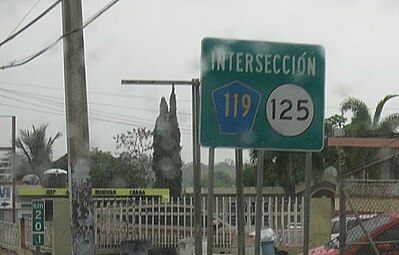
Sign for intersection of Puerto Rico Highways 119 and 125 in San Sebastián

| Municipality | Location | km[1] | mi | Destinations | Notes |
|---|---|---|---|---|---|
| Aguadilla | Palmar | 0.0 | 0.0 | Western terminus of PR-125 | |
| Moca | Pueblo | 1.2 | 0.75 | ||
| Moca barrio-pueblo | 2.3 | 1.4 | |||
| –Moca barrio-pueblo line | 2.8 | 1.7 | |||
| 3.2 | 2.0 | ||||
| Voladoras | 4.7 | 2.9 | |||
| 6.1 | 3.8 | ||||
| 7.4 | 4.6 | ||||
| 8.1 | 5.0 | ||||
| Capá | 11.1 | 6.9 | |||
| 11.6 | 7.2 | ||||
| 11.9 | 7.4 | ||||
| San Sebastián | Hato Arriba | 13.7 | 8.5 | ||
| –Guatemala line | 15.2 | 9.4 | |||
| Guatemala | 17.1 | 10.6 | |||
| 17.9 | 11.1 | ||||
| Bahomamey | 18.4 | 11.4 | |||
| 19.0 | 11.8 | ||||
| Bahomamey– line | 19.7 | 12.2 | Western terminus of PR-119 concurrency; one-way street; northbound access via Calle Severo Arana | ||
| Piedras Blancas | 19.9 | 12.4 | Eastern terminus of PR-119 concurrency | ||
| 21.1 | 13.1 | Eastern terminus of PR-125 | |||
1.000 mi = 1.609 km; 1.000 km = 0.621 mi
| |||||
Related route[]
Highway 125 Spur | |
|---|---|
| Location | San Sebastián |
| Length | 0.95 km[4] (0.59 mi; 3,100 ft) |
Highway 125 Spur (Spanish: Carretera Ramal 125, abbreviated Ramal PR-125 or PR-125R) is a road that branches off from PR-125 to PR-109 in downtown San Sebastián.[5] The entire route is located in San Sebastián.
| Location | km[4] | mi | Destinations | Notes | |
|---|---|---|---|---|---|
| Bahomamey | 0.00 | 0.00 | Western terminus of PR-125R | ||
| San Sebastián barrio-pueblo | 0.95 | 0.59 | Eastern terminus of PR-125R; one-way street; westbound access via Calle Luis Muñoz Rivera (to Añasco) | ||
| 1.000 mi = 1.609 km; 1.000 km = 0.621 mi | |||||
See also[]
References[]
- ^ a b Google (6 March 2020). "PR-125" (Map). Google Maps. Google. Retrieved 6 March 2020.
- ^ National Geographic Maps (2011). Puerto Rico (Map). 1:125,000. Adventure Map (Book 3107). Evergreen, Colorado: National Geographic Maps. ISBN 978-1566955188. OCLC 756511572.
- ^ "Tránsito Promedio Diario (AADT)". Puerto Rico Department of Transportation and Public Works (in Spanish). pp. 72–73. Retrieved 19 June 2019.
- ^ a b Google (1 March 2020). "PR-125R" (Map). Google Maps. Google. Retrieved 1 March 2020.
- ^ "Calle Pavía Fernández, San Sebastián, Puerto Rico" (Map). geoview.info. Retrieved 19 June 2019.
External links[]
| Wikimedia Commons has media related to |
This Puerto Rico road-related article is a stub. You can help Wikipedia by . |
Categories:
- Highways in Puerto Rico
- Puerto Rico road stubs