Puerto Rico Highway 111
 | ||||||||||||||
|---|---|---|---|---|---|---|---|---|---|---|---|---|---|---|
| Ruta 111 | ||||||||||||||
| Carretera Enrique Laguerre[1] | ||||||||||||||
| Route information | ||||||||||||||
| Maintained by Puerto Rico DTPW | ||||||||||||||
| Length | 67.4 km[2] (41.9 mi) | |||||||||||||
| Existed | 1953[3]–present | |||||||||||||
| Major junctions | ||||||||||||||
| West end | ||||||||||||||
| ||||||||||||||
| East end | ||||||||||||||
| Location | ||||||||||||||
| Municipalities | Aguadilla, Moca, San Sebastián, Lares, Utuado | |||||||||||||
| Highway system | ||||||||||||||
| ||||||||||||||
| ||||||||||||||
Puerto Rico Highway 111 (PR-111) is a highway connecting Aguadilla, Puerto Rico at Puerto Rico Highway 2 and Puerto Rico Highway 115 to Utuado, Puerto Rico at Puerto Rico Highway 140.[4]
Route description[]
It is the main highway to Moca and San Sebastián, being a two-lane highway before turning rural on its way to Lares, where it meets PR-129, which taking north goes to Arecibo and meets PR-2 and PR-22. In Lares, it becomes a divided avenue, replacing an old, narrow segment, but then becomes rural again. It continues to Utuado, crossing PR-10, and merging shortly with PR-123. It ends at PR-140 east of Utuado, near Jayuya. It is one of two long highways going west–east through the center of Puerto Rico (the other being PR-156). It is named the Carretera Enrique Laguerre through all its length.[5]

PR-111 on the Aguadilla pueblo coast

Electric plant on PR-111 in Bahomamey
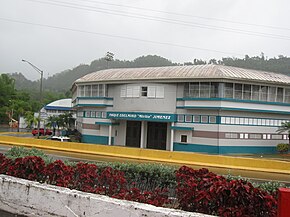
Ball park on PR-111 in Lares barrio

PR-111 East near 129 junction in Lares


Major intersections[]
| Municipality | Location | km[2] | mi | Destinations | Notes |
|---|---|---|---|---|---|
| Aguadilla | Victoria | 0.0 | 0.0 | Western terminus of PR-111; partial cloverleaf interchange | |
| 0.3 | 0.19 | ||||
| Palmar | 1.2 | 0.75 | Seagull intersection | ||
| 1.7 | 1.1 | ||||
| 2.1 | 1.3 | ||||
| Moca | Pueblo | 3.3 | 2.1 | ||
| Moca barrio-pueblo | 4.8 | 3.0 | |||
| Moca barrio-pueblo– line | 5.4– 5.5 | 3.4– 3.4 | |||
| Voladoras | 7.6 | 4.7 | |||
| 9.4 | 5.8 | ||||
| Capá | 11.9 | 7.4 | |||
| 12.7 | 7.9 | ||||
| San Sebastián | Hato Arriba | 14.1 | 8.8 | ||
| –Guatemala line | 15.7 | 9.8 | |||
| Guatemala | 17.4– 17.5 | 10.8– 10.9 | |||
| 18.2– 18.3 | 11.3– 11.4 | ||||
| Bahomamey– line | 19.4– 19.5 | 12.1– 12.1 | |||
| Piedras Blancas | 20.9 | 13.0 | |||
| 21.3– 21.4 | 13.2– 13.3 | ||||
| 21.5– 21.6 | 13.4– 13.4 | ||||
| 22.3 | 13.9 | ||||
| Eneas–Cidral line | 24.0 | 14.9 | |||
| 25.1– 25.2 | 15.6– 15.7 | ||||
| 25.3– 25.4 | 15.7– 15.8 | ||||
| Eneas–Cidral– Magos tripoint | 26.0– 26.1 | 16.2– 16.2 | |||
| Lares | Pueblo | 30.3 | 18.8 | ||
| 31.9 | 19.8 | ||||
| 32.4 | 20.1 | ||||
| 32.7 | 20.3 | ||||
| Lares barrio-pueblo | 33.2 | 20.6 | |||
| 33.5 | 20.8 | ||||
| 34.6– 34.7 | 21.5– 21.6 | ||||
| 35.0 | 21.7 | ||||
| Lares | 35.2 | 21.9 | Western terminus of PR-129 concurrency; diamond interchange | ||
| 38.2 | 23.7 | Eastern terminus of PR-129 concurrency | |||
| 38.8 | 24.1 | ||||
| 40.2 | 25.0 | ||||
| Utuado | Angeles | 42.2 | 26.2 | ||
| 45.2 | 28.1 | ||||
| Caguana | 52.4 | 32.6 | |||
| 52.6 | 32.7 | ||||
| Salto Arriba–Salto Abajo– Caguana tripoint | 55.6 | 34.5 | |||
| Salto Abajo | 59.7 | 37.1 | |||
| Utuado barrio-pueblo | 60.3 | 37.5 | Western terminus of PR-123 concurrency | ||
| 60.6 | 37.7 | Eastern terminus of PR-123 concurrency | |||
| Utuado barrio-pueblo–Viví Abajo– Salto Abajo tripoint | 62.0 | 38.5 | |||
| Utuado barrio-pueblo–Viví Abajo line | 63.8 | 39.6 | |||
| Viví Abajo | 65.1 | 40.5 | |||
| Las Palmas | 67.4 | 41.9 | Eastern terminus of PR-111 | ||
1.000 mi = 1.609 km; 1.000 km = 0.621 mi
| |||||
Related routes[]
Currently, PR-111 has three branches in its old segments in San Sebastián, Lares and Utuado, and previously had another in Aguadilla. Originally they were identified as PR-111R.[4] There are projects for Highway 111 listed on the Transportation Improvement Program for fiscal years 2017–2020, involving reconstructing, relocating and widening parts of the highway.[6]
Puerto Rico Highway 1111[]
Highway 1111 | |
|---|---|
| Location | Lares |
| Length | 4.5 km[7] (2.8 mi) |
Puerto Rico Highway 1111 (PR-1111) is the old section of PR-111 through downtown Lares. This road can be seen as Puerto Rico 111 Business.[4] The entire route is located in Lares.
| Location | km[7] | mi | Destinations | Notes | |
|---|---|---|---|---|---|
| Pueblo | 0.0 | 0.0 | Western terminus of PR-1111 | ||
| –Lares barrio-pueblo line | 0.7 | 0.43 | |||
| Lares barrio-pueblo | 1.6 | 0.99 | |||
| 3.0 | 1.9 | ||||
| 3.7 | 2.3 | ||||
| Lares barrio-pueblo– line | 4.0– 4.1 | 2.5– 2.5 | |||
| Lares | 4.1 | 2.5 | |||
| 4.5 | 2.8 | Eastern terminus of PR-1111; dead end road | |||
| 1.000 mi = 1.609 km; 1.000 km = 0.621 mi | |||||
Puerto Rico Highway 4111[]
Highway 4111 | |
|---|---|
| Location | San Sebastián |
| Length | 0.90 km[8] (0.56 mi; 3,000 ft) |
Puerto Rico Highway 4111 (PR-4111) is an old segment of PR-111 that provides access to a small residential area in Piedras Blancas, San Sebastián, Puerto Rico.[4]

The entire route is located in Piedras Blancas, San Sebastián.
| km[8] | mi | Destinations | Notes | ||
|---|---|---|---|---|---|
| 0.00 | 0.00 | Western terminus of PR-4111 | |||
| 0.90 | 0.56 | Eastern terminus of PR-4111 | |||
| 1.000 mi = 1.609 km; 1.000 km = 0.621 mi | |||||
Puerto Rico Highway 6111[]
Highway 6111 | |
|---|---|
| Location | Utuado |
| Length | 2.8 km[9] (1.7 mi) |
Puerto Rico Highway 6111 (PR-6111) is the original route of PR-111 through downtown Utuado. Like PR-1111, this road can be seen as Puerto Rico 111 Business.[4] The entire route is located in Utuado.
| Location | km[9] | mi | Destinations | Notes | |
|---|---|---|---|---|---|
| Utuado barrio-pueblo | 0.0 | 0.0 | Western terminus of PR-6111 | ||
| 0.8 | 0.50 | ||||
| Viví Abajo–Utuado barrio-pueblo line | 2.8 | 1.7 | Eastern terminus of PR-6111 | ||
| 1.000 mi = 1.609 km; 1.000 km = 0.621 mi | |||||
See also[]
References[]
- ^ "ps0996-18.pdf" (PDF). Cámara de Representantes de Puerto Rico (in Spanish). Retrieved 4 April 2019.
- ^ a b Google (26 March 2020). "PR-111" (Map). Google Maps. Google. Retrieved 26 March 2020.
- ^ "Lares, Memoria Núm. 60" (PDF). Puerto Rico Planning Board (in Spanish). 1955. Retrieved 4 August 2020.
- ^ a b c d e National Geographic Maps (2011). Puerto Rico (Map). 1:125,000. Adventure Map (Book 3107). Evergreen, Colorado: National Geographic Maps. ISBN 978-1566955188. OCLC 756511572.
- ^ "Tránsito Promedio Diario (AADT)". Transit Data (Datos de Transito) (in Spanish). DTOP PR. p. 90.
- ^ "Transportation Improvement Program (TIP) Fiscal Year 2017-2020" (PDF). DTOP GOV.
- ^ a b Google (1 March 2020). "PR-1111" (Map). Google Maps. Google. Retrieved 1 March 2020.
- ^ a b Google (1 March 2020). "PR-4111" (Map). Google Maps. Google. Retrieved 1 March 2020.
- ^ a b Google (1 March 2020). "PR-6111" (Map). Google Maps. Google. Retrieved 1 March 2020.
External links[]
| Wikimedia Commons has media related to |
- Highways in Puerto Rico